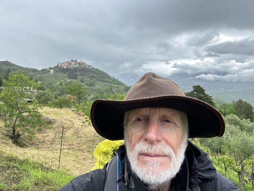
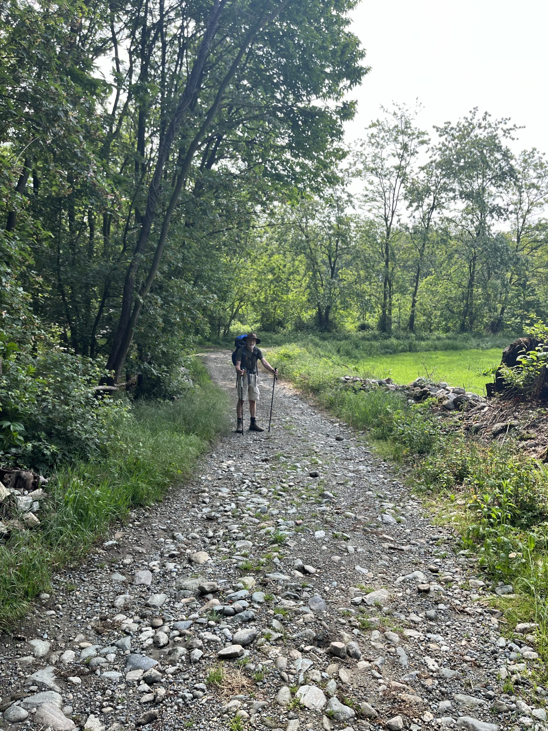
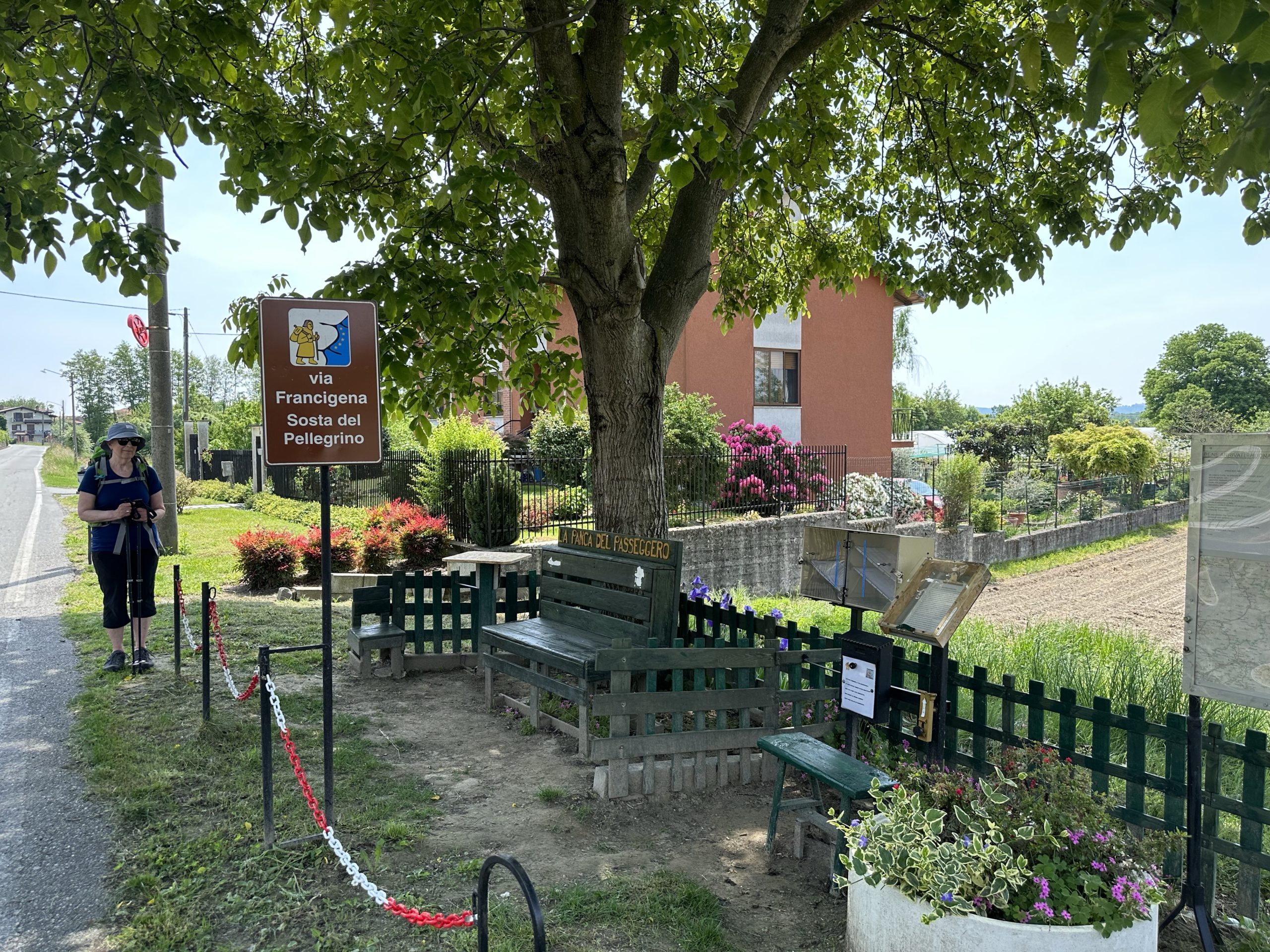
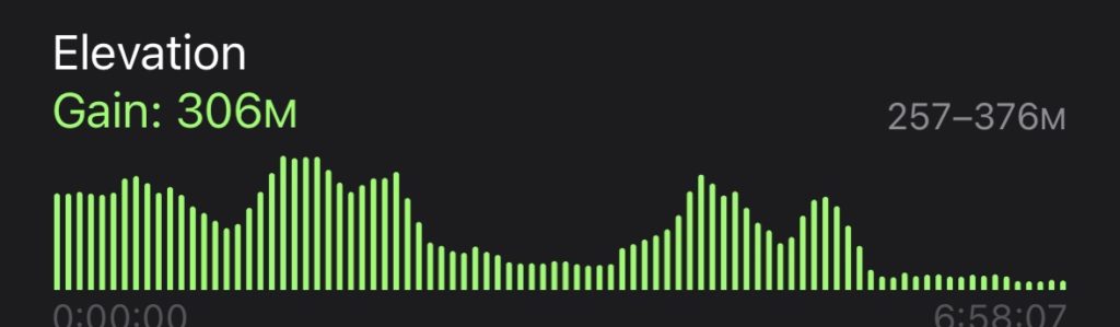
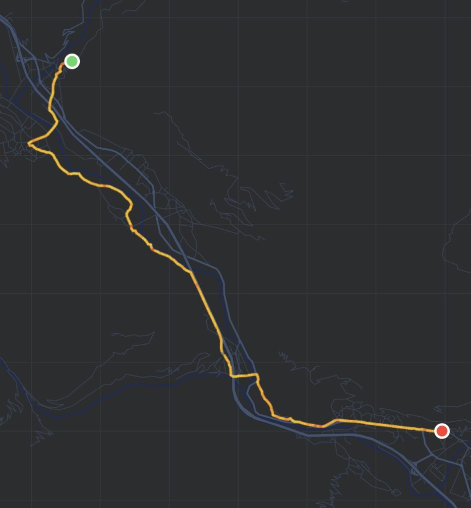
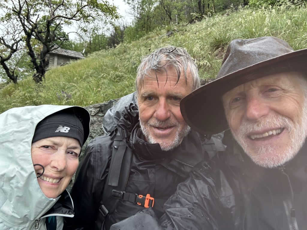
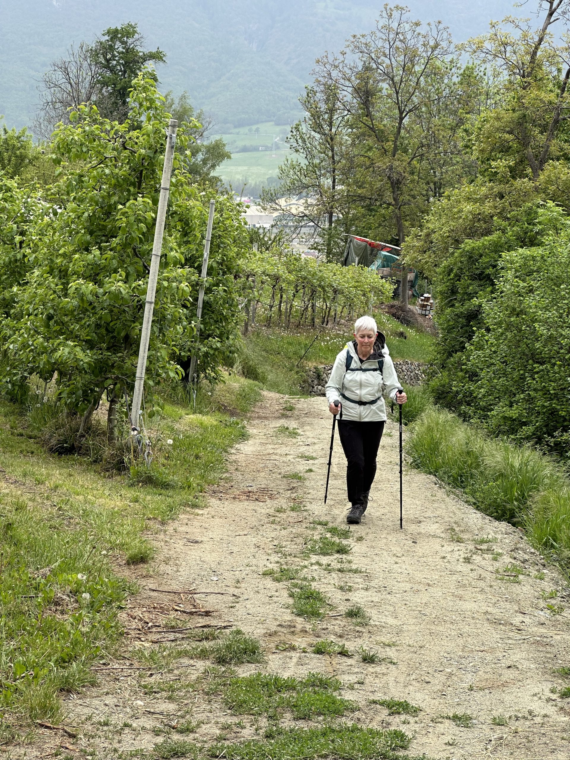
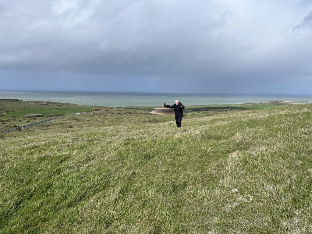
Paul walked alone today as Lois decided to rest her hip, going instead by taxi with the bags to Sarzana.
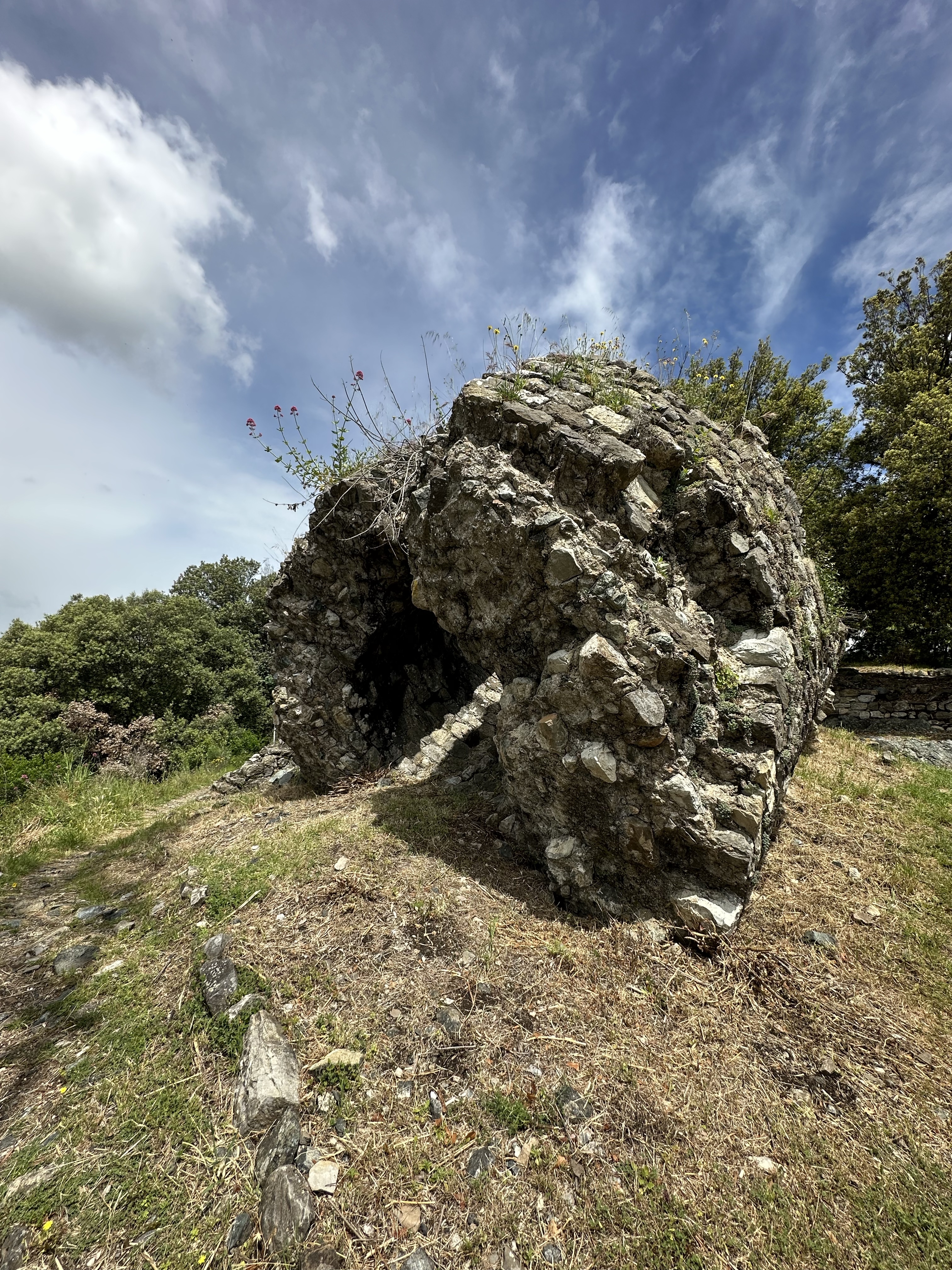
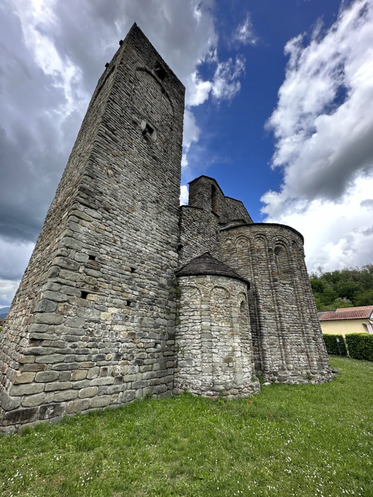
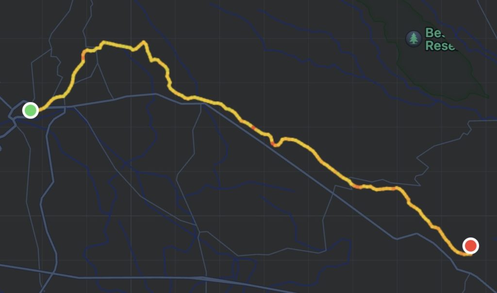
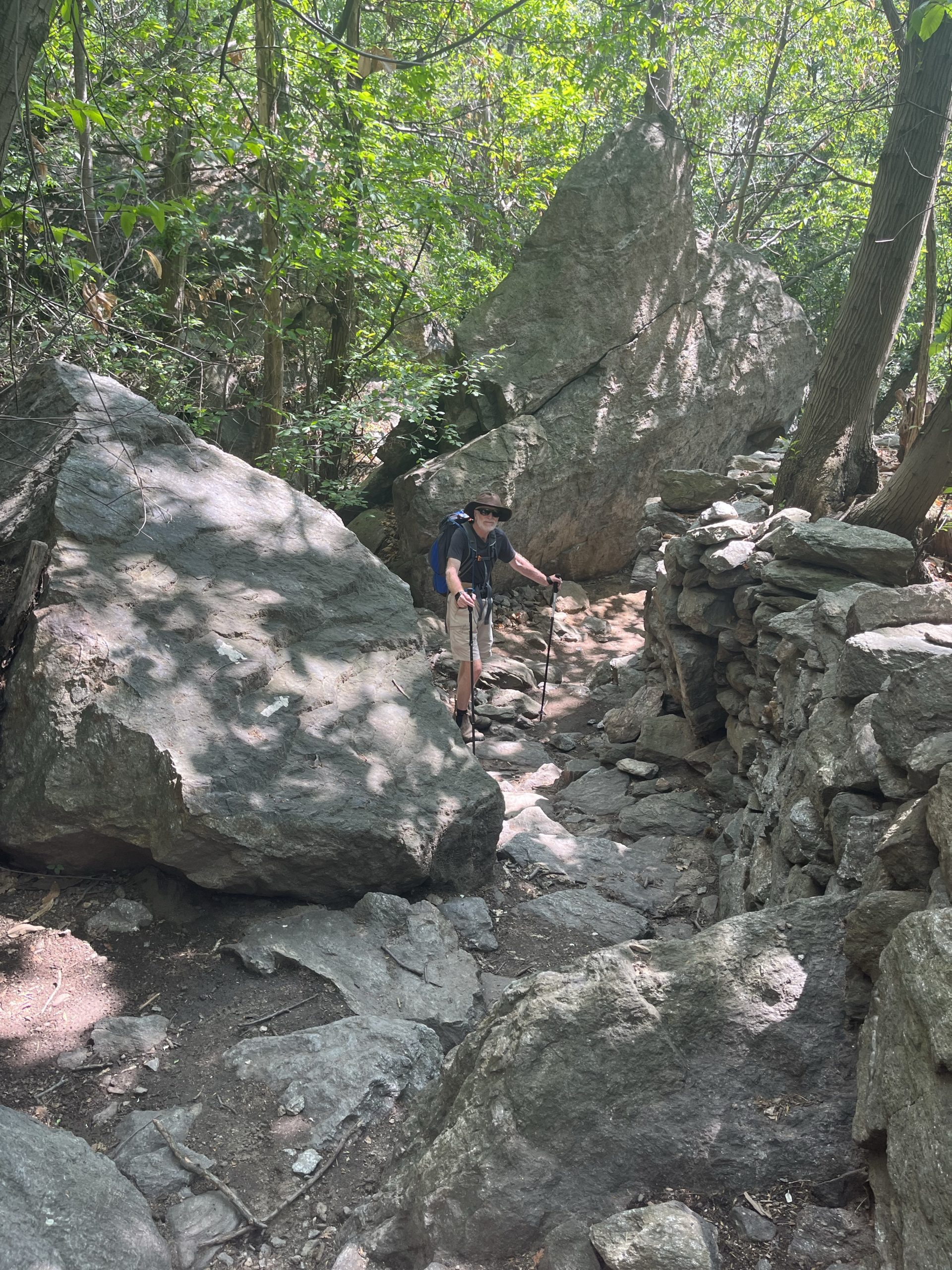
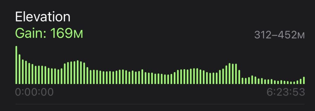
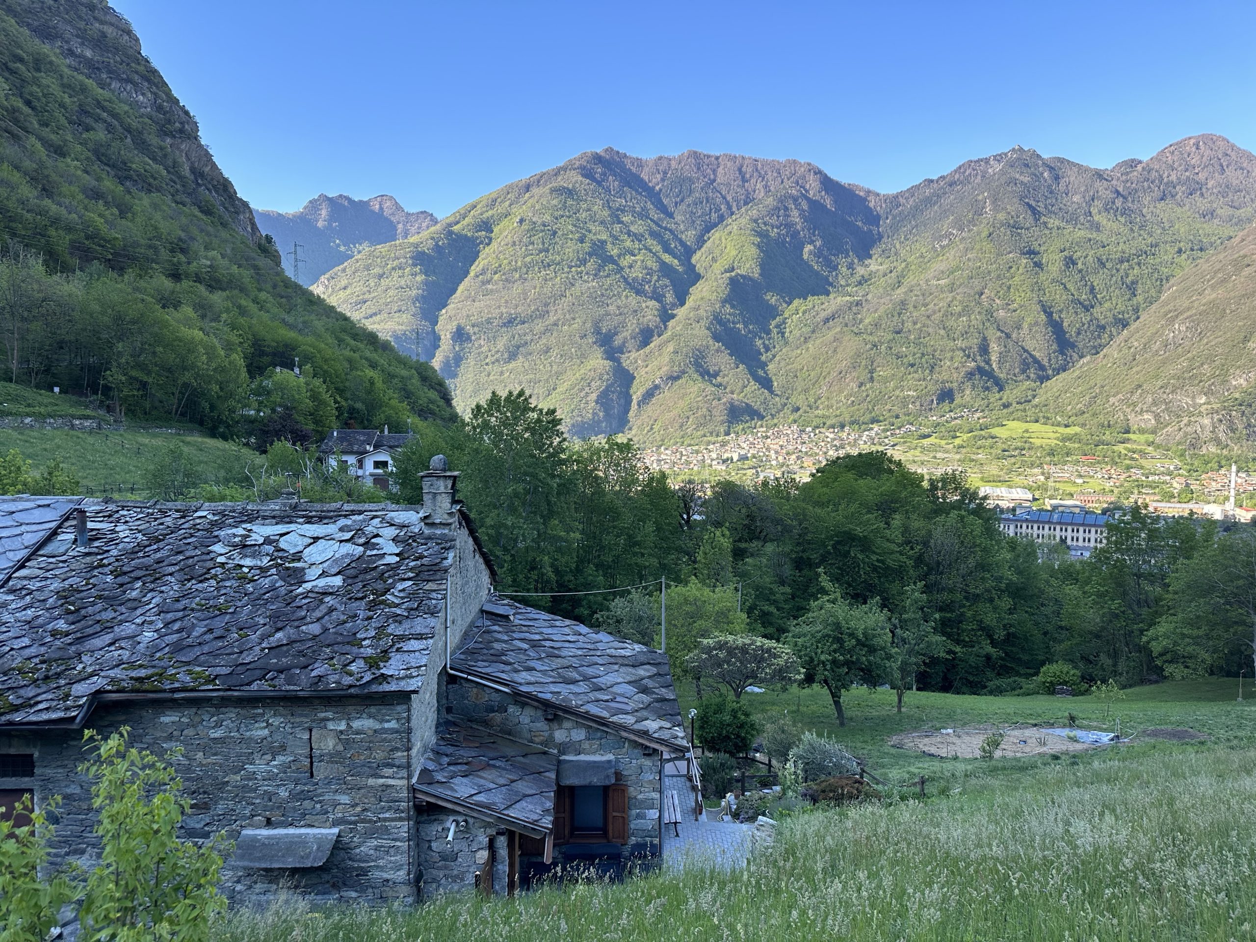
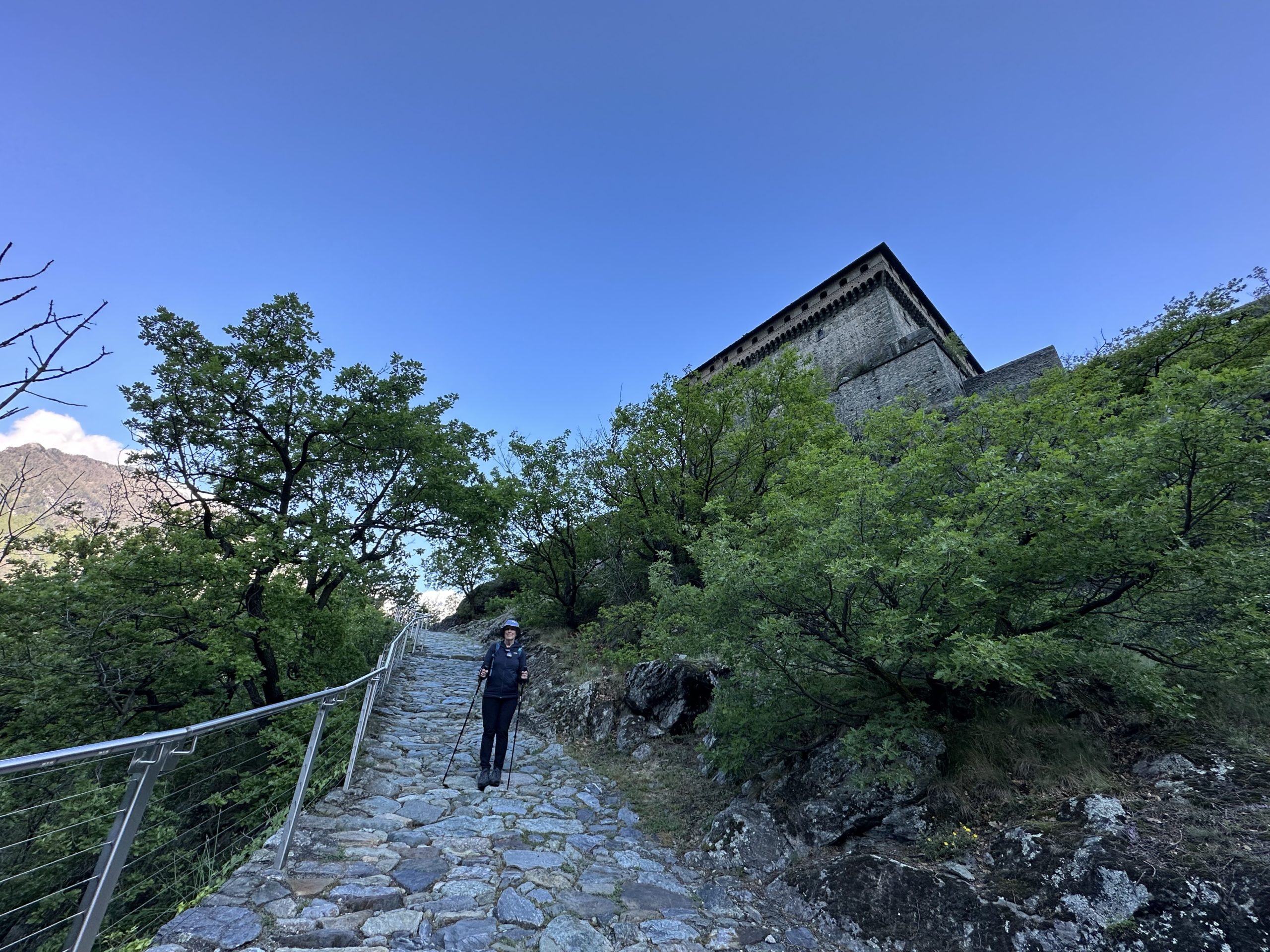
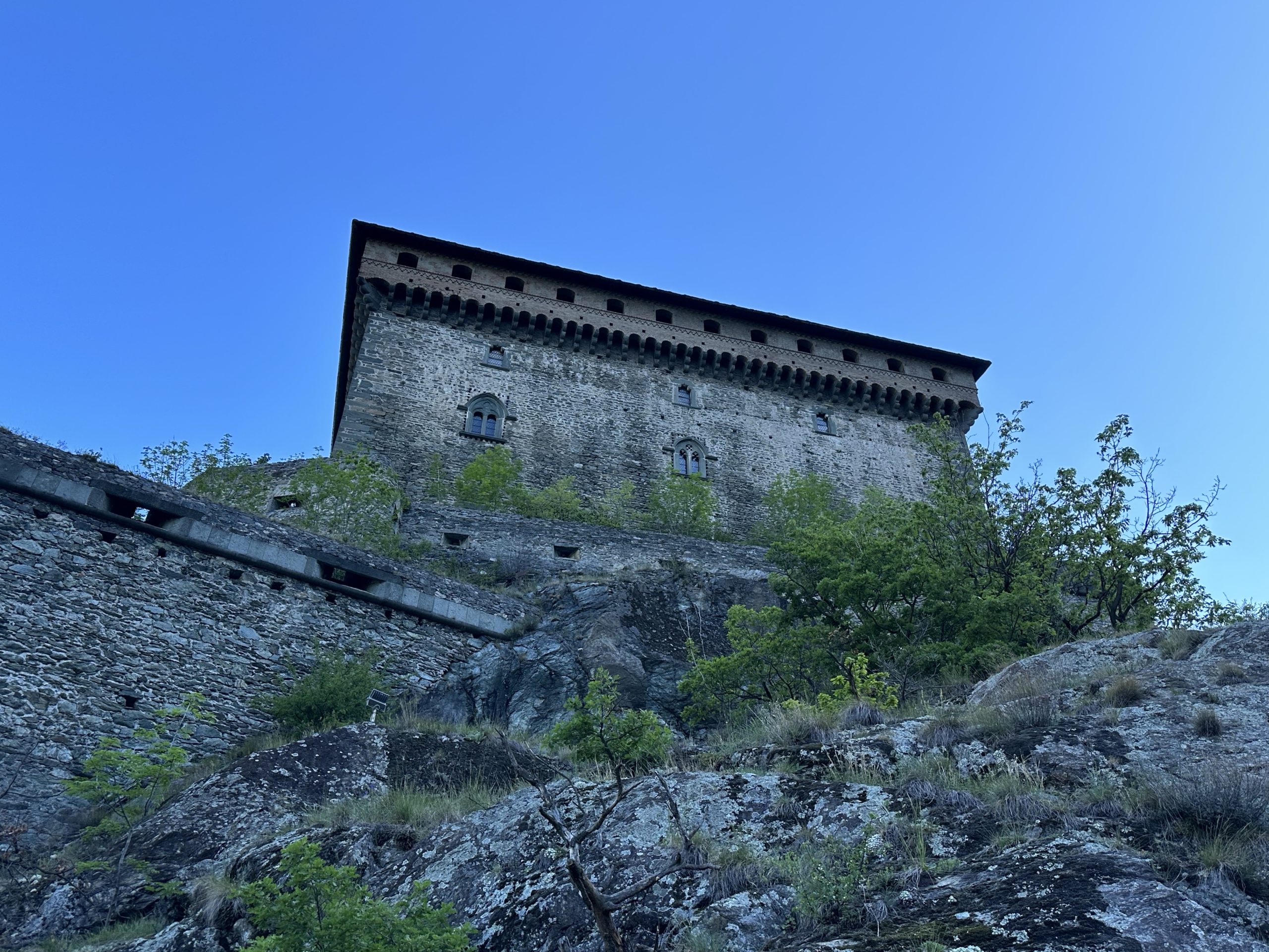
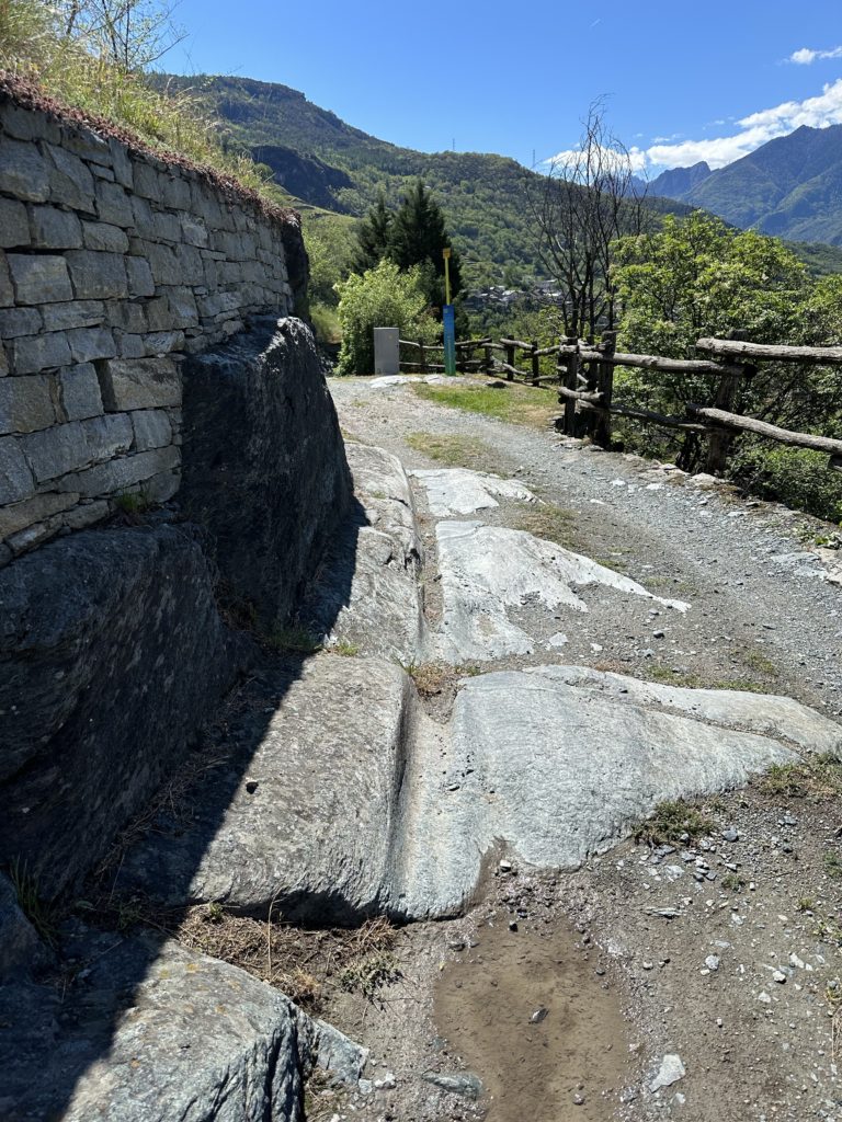
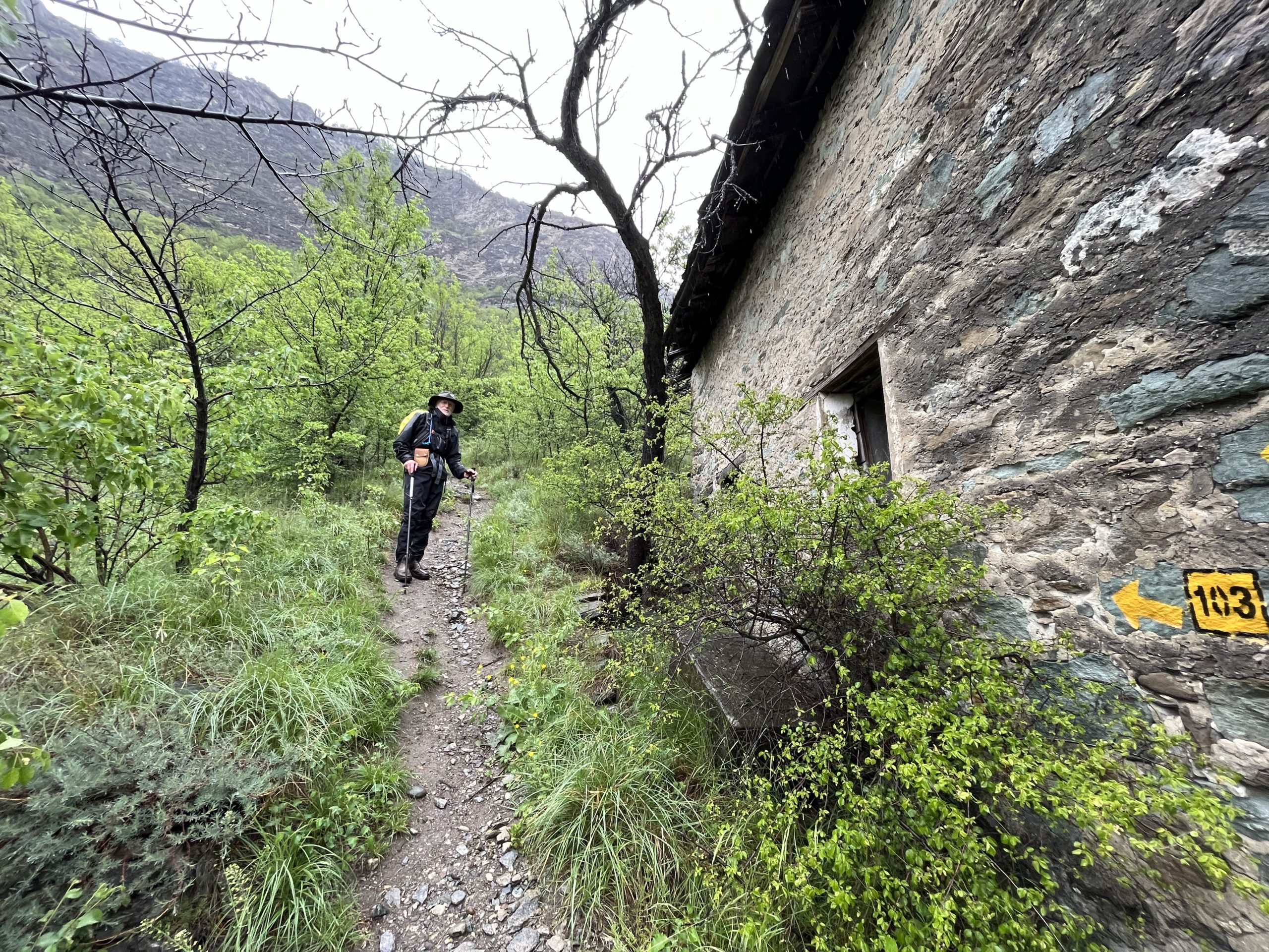
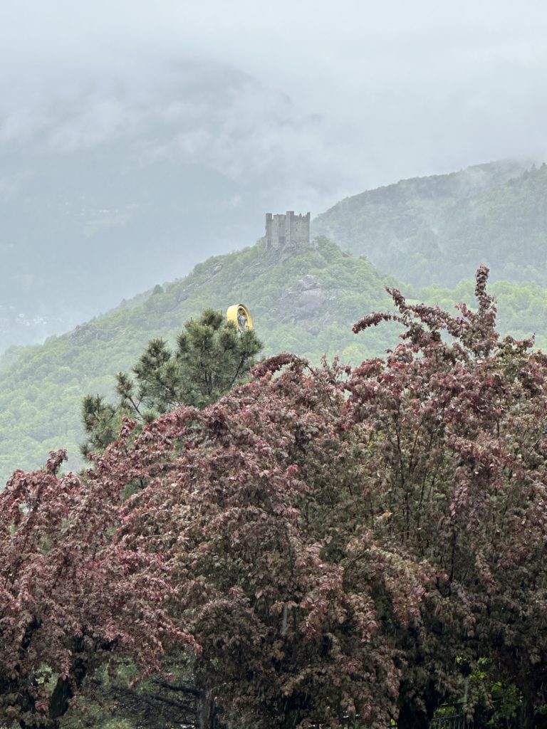
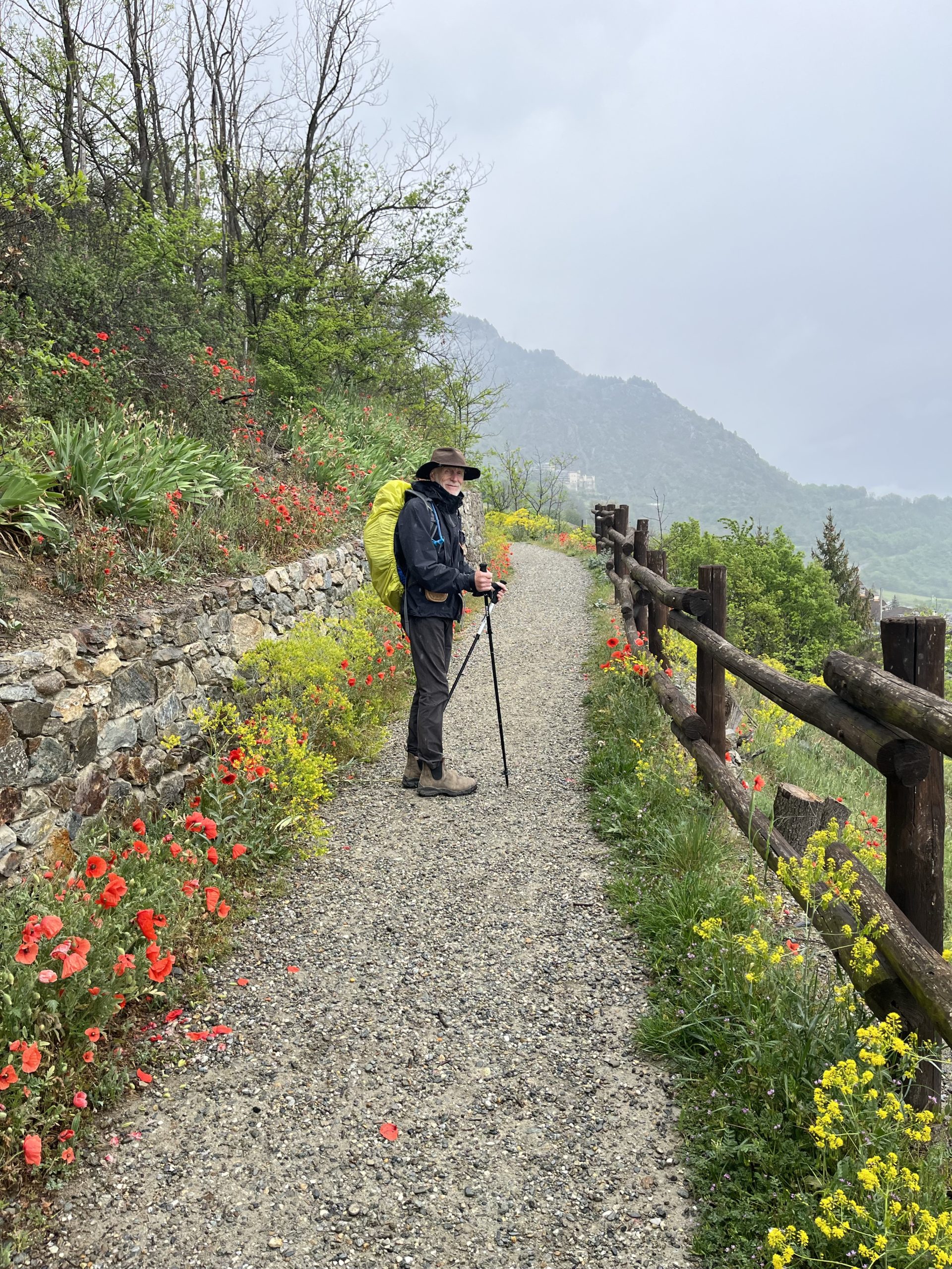
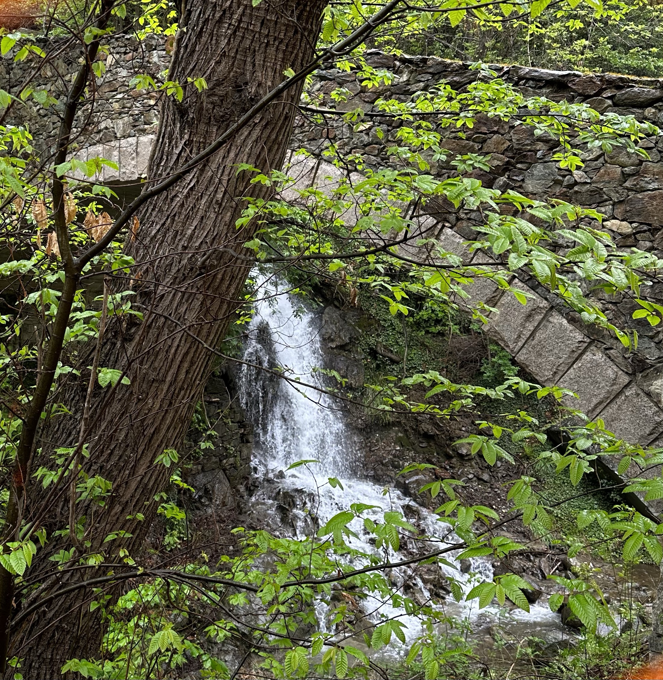
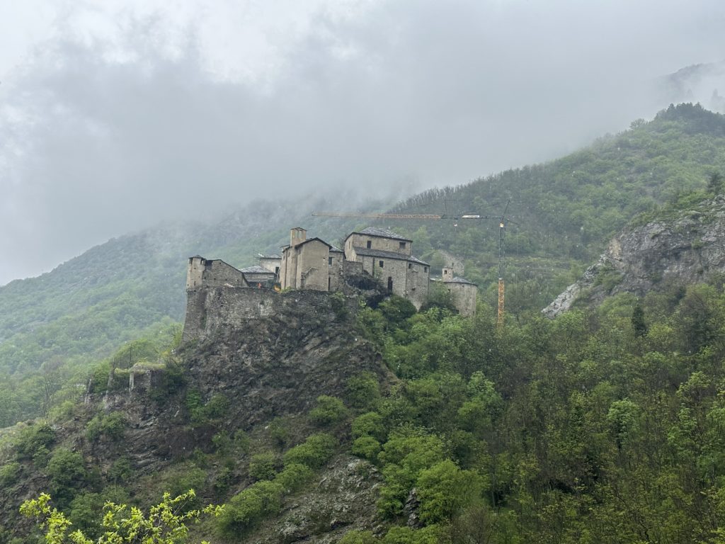
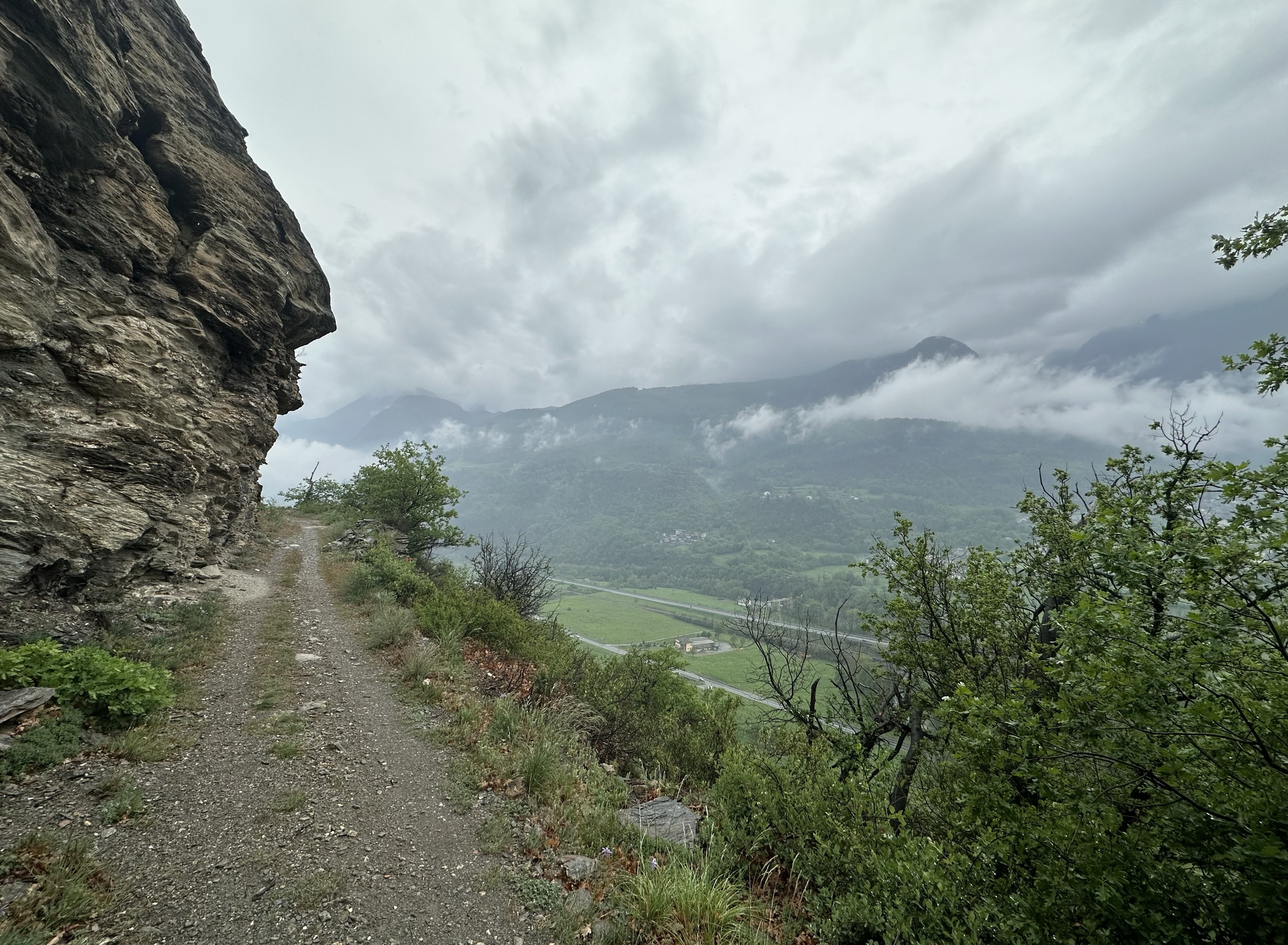
The Cicerone Guide says that todays route is short, but not easy. In Paul’s view, it was neither short, nor easy. At times, the terrain brought to mind a certain volcano in Nicaragua which Lois and Maritia will remember very well! The initial steep, rocky and wet climb was through evergreen forests in the Apuan Alps, eventually emerging just below the hilltop village of Bibola, with its 7thC castle. By that time, the rain had begun and it continued into the afternoon. After the next village, the path took another steep incline to the top of the next hill. Paul was passed by mountain bikers a couple of times on the way down to the village of Ponzano Superiore. This village was apparently well known as a centre for Italian partisans (anti-fascists) in WWII. Further on, after olive groves and more rocky paths, the ruins of the Castle of Brina come into view. These fortifications date from the 5th to 4thC BC, but were intentionally destroyed in the Peace of Castelnuovo in 1306. This was a settlement between the Malaspina family and the Count-Bishops of Luni, negotiated with the assistance of the poet, Dante. One of the towers remains on its side.
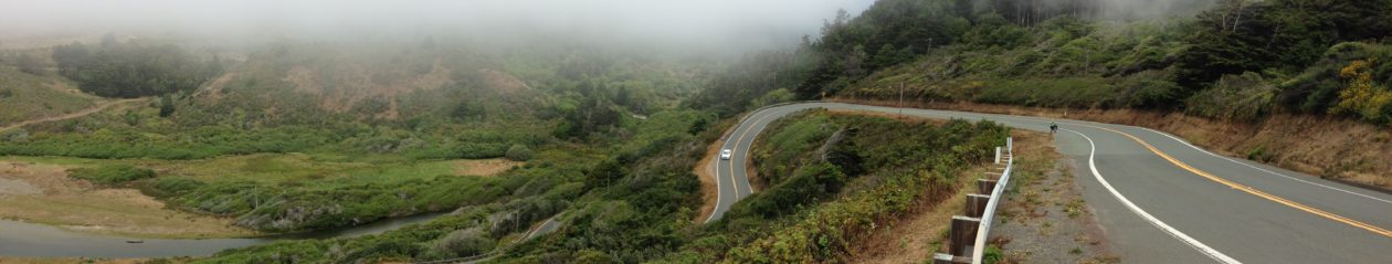
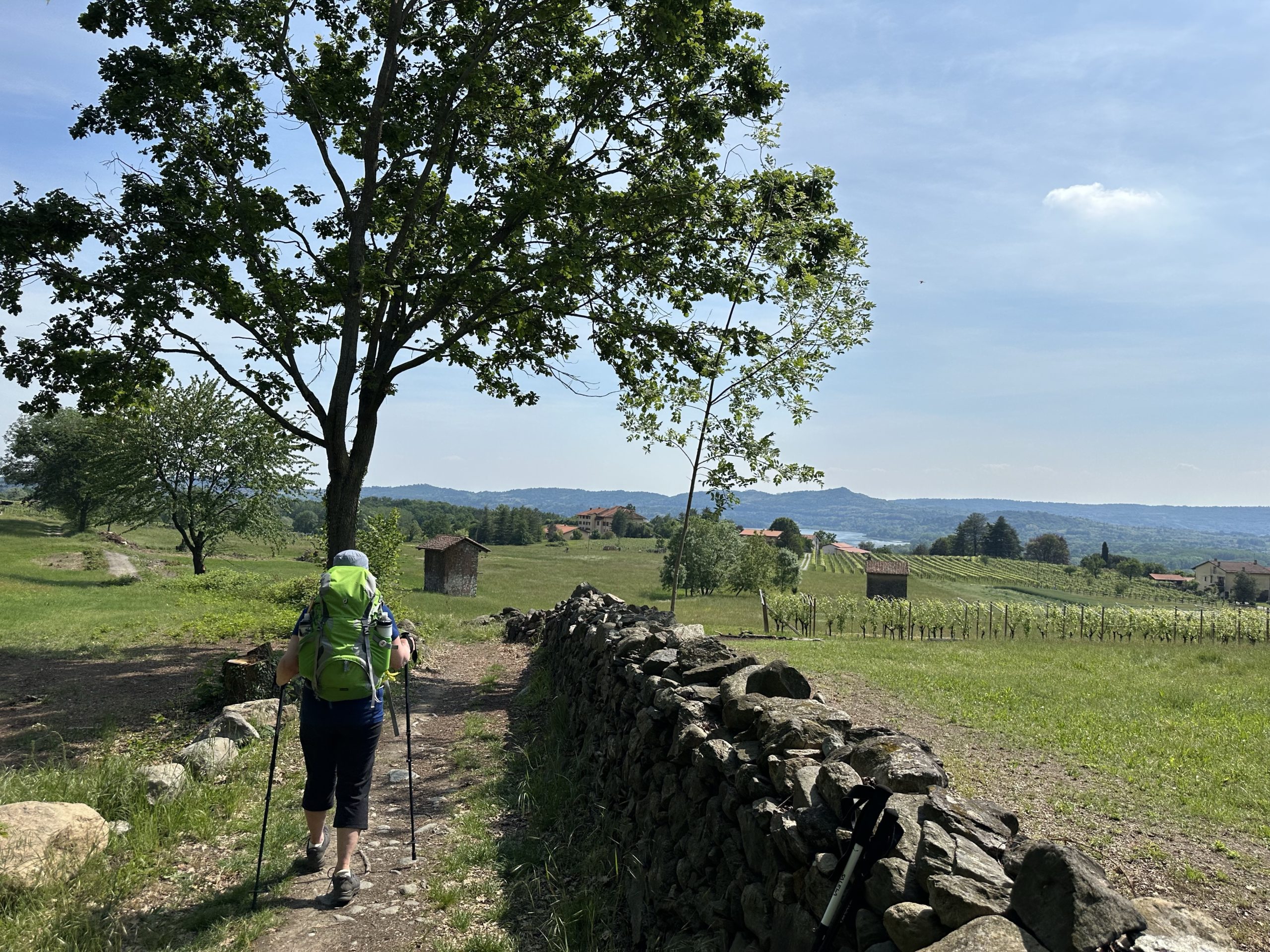
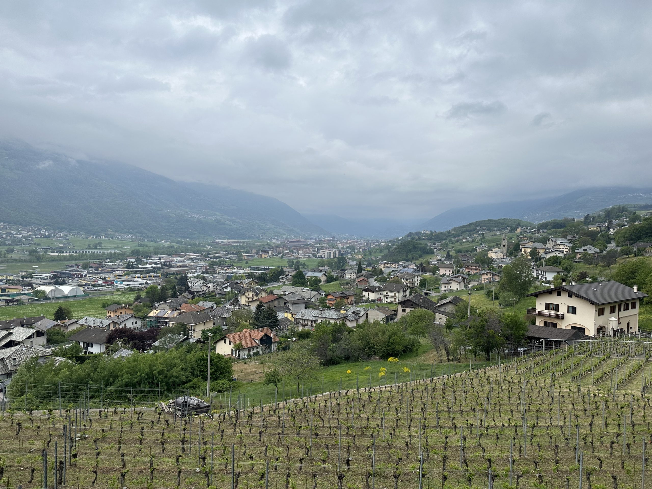
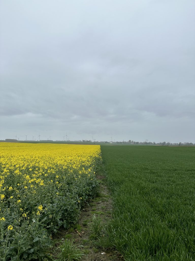
Eventually, the trail dropped down through vineyards to the valley floor and continued to Sarzana alongside a canal.
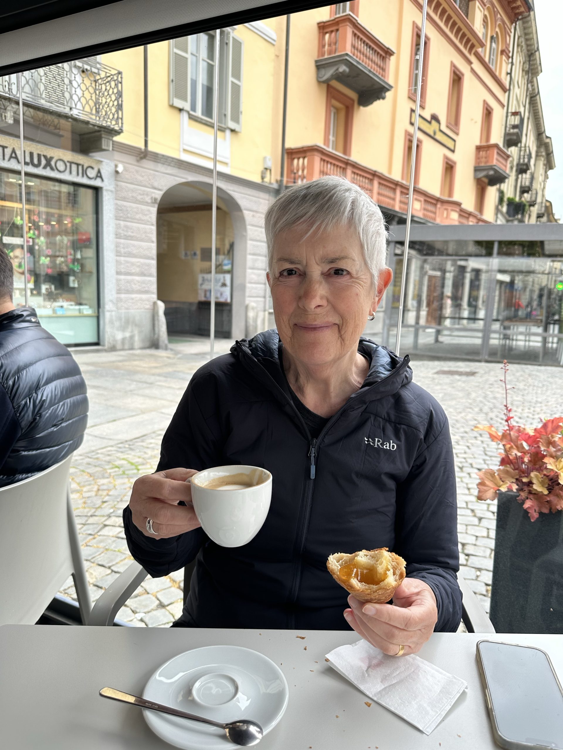
The early morning rain ended as we left the apartment, backtracking into the centre of the town for coffee and croissants. Here, we found the Saturday market setting up, where we bought bread, fruit, and potato and onion flan for lunch.
On the outskirts of Pontremoli, we noticed sculptures of Disney figures. We later read that there are two popular Italian cartoon booklets, Topolina (Mickey Mouse) and Paperion (Donald Duck), often in serial form, about the adventures of these Walt Disney characters.
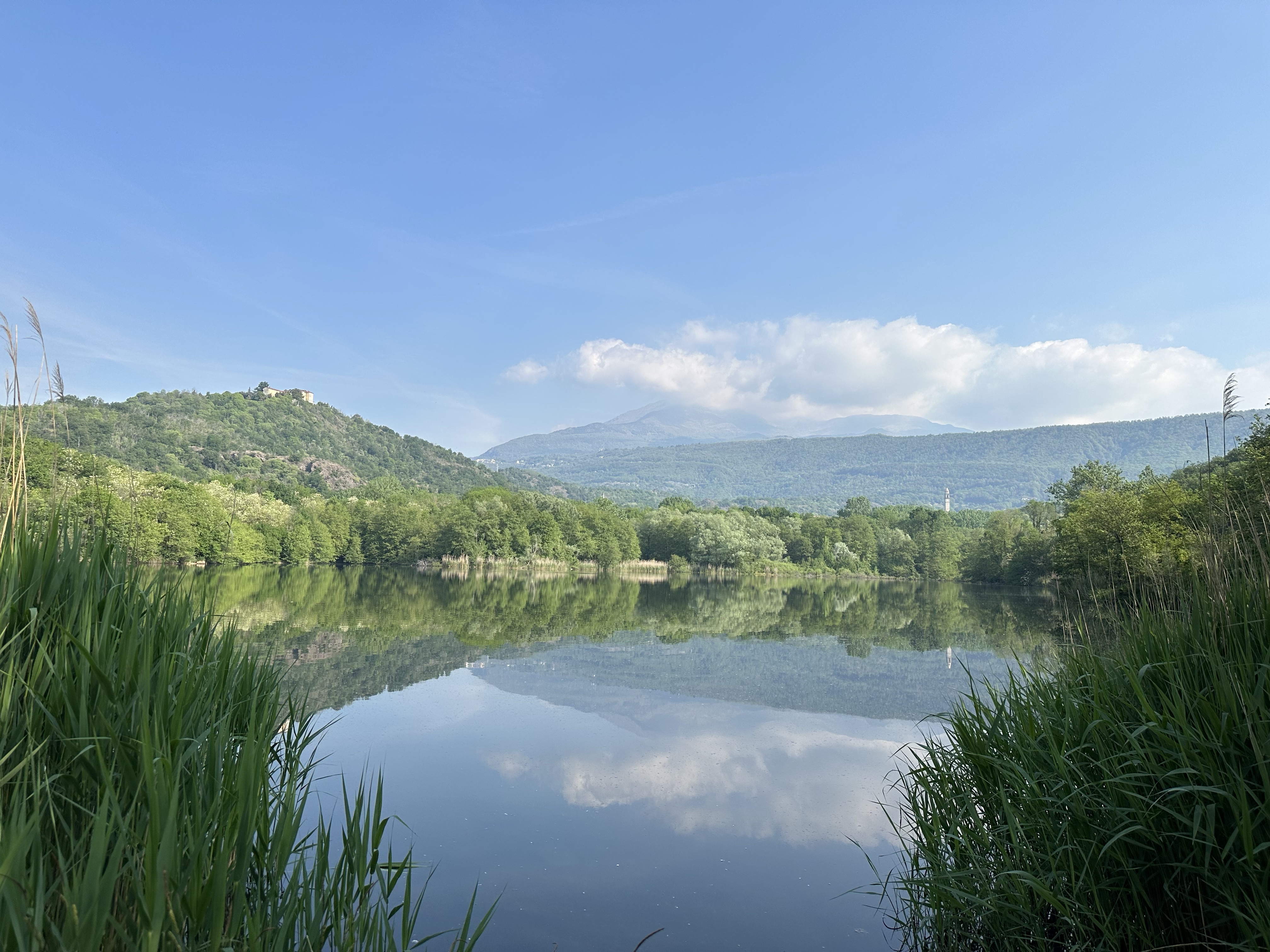
The route today stayed mostly in the valley, meandering through forest and amongst vineyards and orchards. In the small medieval village of Ponticello, we were interested to find tower-houses. Locally called caminà, this type of housing was created as fortified buildings.
A placard details: “These were stone structures that served simultaneously, as the name suggests, as both residences and fortresses. The access door was on the upper floor and was served by a retractable staircase. On the ground floor there was a cistern for access to drinking water in the event of a siege. These structures date back to the 11th and 13th centuries.” We couldn’t find any remaining retractable staircases.
Further on in Filattiera, we passed the 12thC Romanesque Santo Stefano Church, which houses two of seven Stele Statues found locally. We assumed the stele behind the church must be replicas.
Aware that thunderstorms were forecast, we watched the sky grow progressively darker and decided to hop the next train to Aulla from Filattiera as lightening began to flash.
It was raining hard when we arrived the delightful B&B Bed and Bike. It is run by a couple of cycling enthusiasts, who own a bike store below. The host was gracious and the apartment wonderful. We shared some cycling experiences with the help of Google Translate.
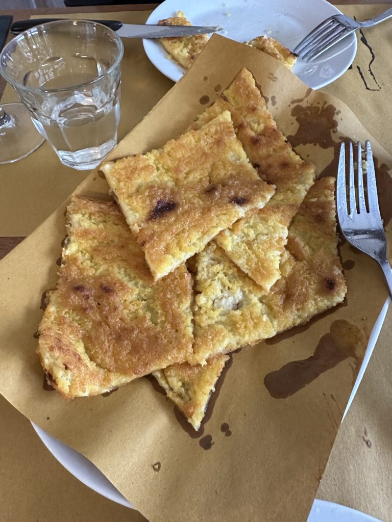
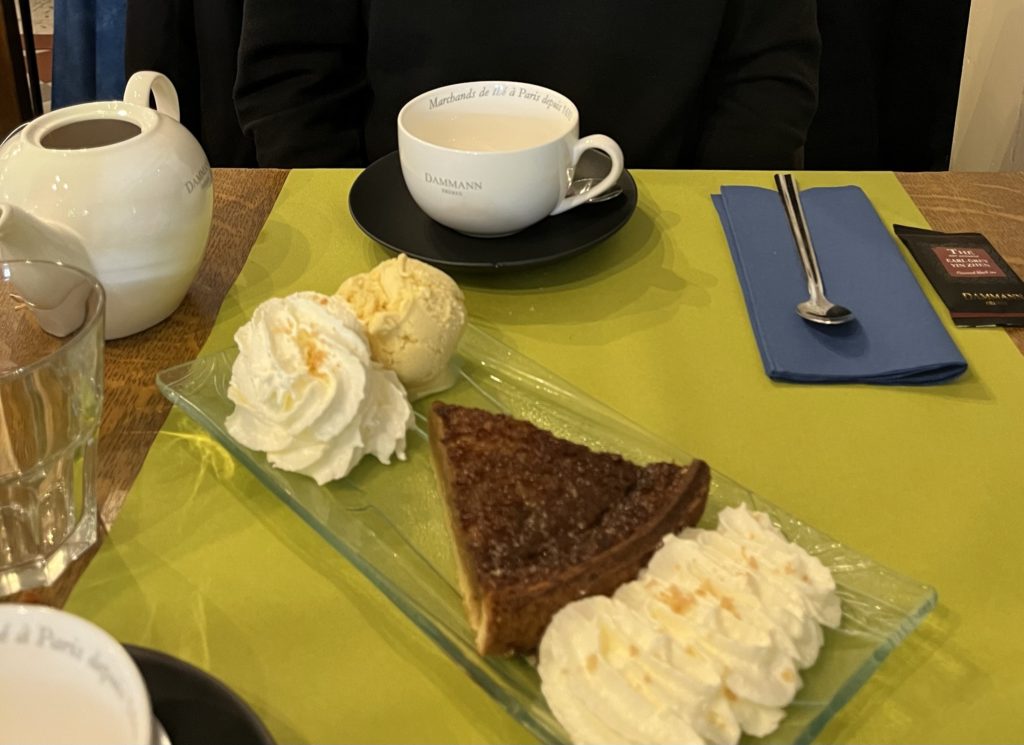
Our host recommended a pizza restaurant nearby and urged us to try the farinata as an appetizer, which we did and it was delicious. It is a shallow savory pie made out of water and chickpea flour, baked in a wood-fired oven to form a golden crust.
We booked with The Natural Adventure company to support us through the Apennines. As the first date available with them is May 17, we will walk ahead on the route, ie, between Pontremoli and Lucca, and return to do the stages between Fidenza and Pontremoli.
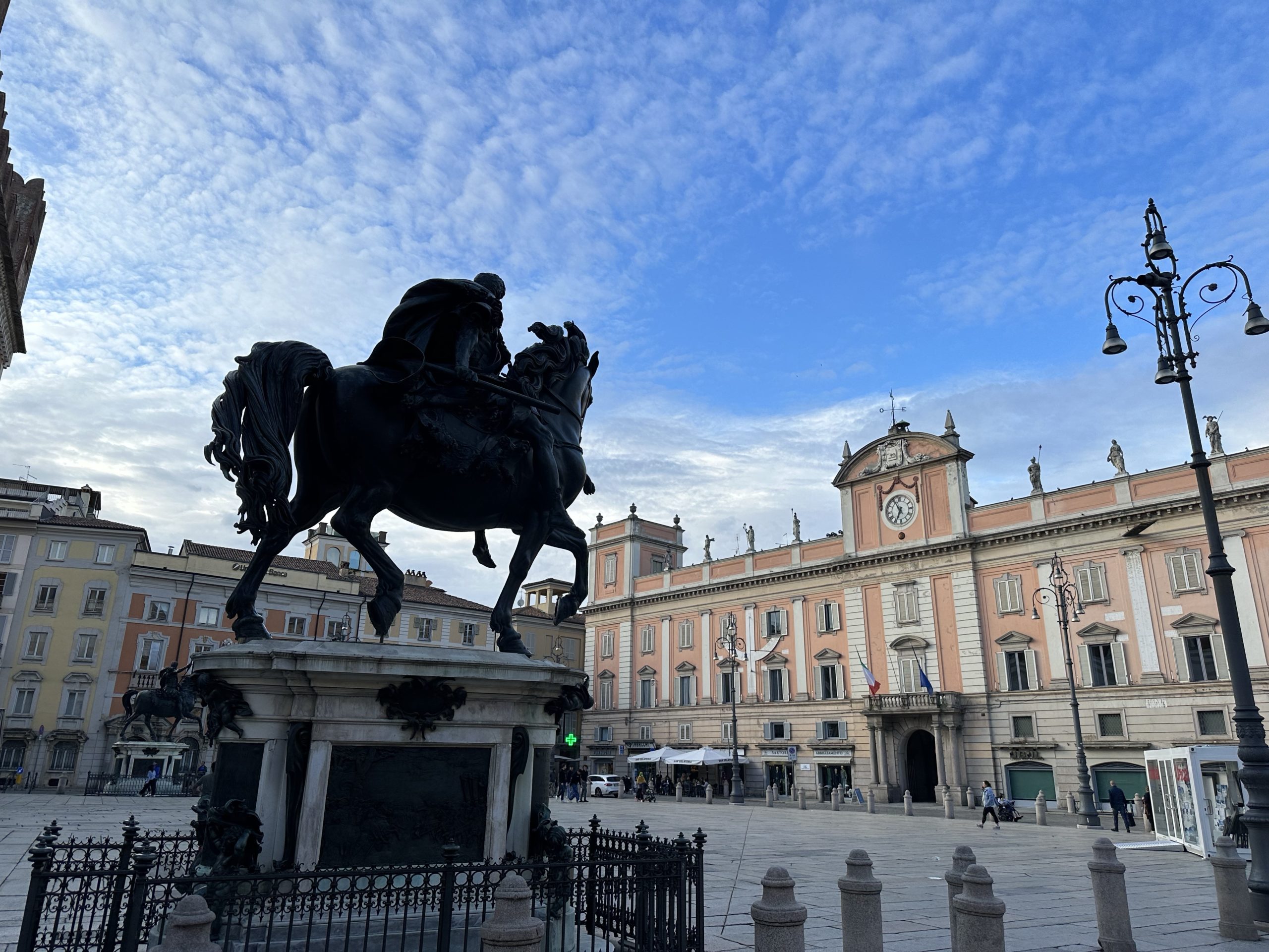
We stopped in Piacenza, only because we had booked accommodation before we had changed our plans. But, it was also an interesting city. The Cicerone guide succinctly describes its history:
“Though captured and destroyed many times in its first centuries, Piacenza always recovered and its rich agricultural roots helped it become one of the most prosperous cities in Europe in the Middle Ages. In the 17th c. one-third of its residents died from famine and plague and in 1802 Napoleon annexed Piacenza and carried many of its artworks away to French museums. Piacenza was heavily bombed by the Allies in WWII to slow the German retreat. Rail lines, industrial areas and bridges were targets, but the center suffered collateral damage.”
Our apartment in the Centro Historico was old, richly decorated and voluminous. On a closer look, the electrical wiring was also very dated! There was also no sign of heating, despite the 12C temperature.
On our way to the train station Friday morning, we stopped for breakfast (coffee and croissants) at a great bar/cafe, Pisarei e Fa… Blues. The walls were covered with written notes from customers and artists, including Canadian blues singer, Layla Zoe. Great music played in the background.
Palazzo Malaspina
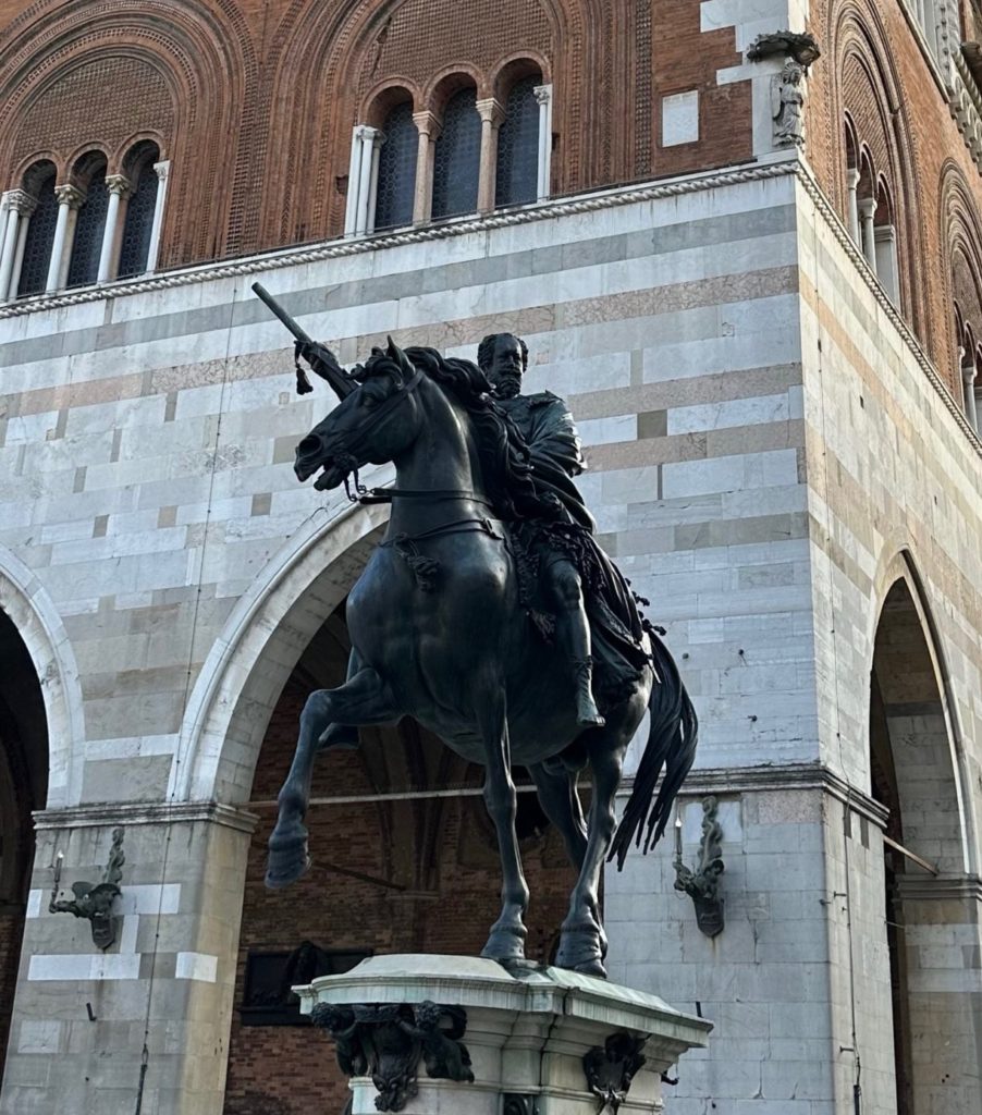
Piazza Cavalli
Church of San FrancescoPiacenza
During a brief wait between trains in Parma, we went across the road to the Cafe Stazione and had an especially good coffee, 9/10 on the Gully scale. (We can get a good espresso anywhere in Italy and we would rate them all above 8/10.)
Changing to a bus in Berceto, it started to tip down with rain. As the bus sped along the autostrada, we looked out at the Appenines, shrouded in mist, and (Lois) wondered how those walks will go. At Pontremoli, we quickly headed to our AirBnB.
It had cleared up when we went out exploring later. First stop would have been the Church of San Pietro, where, in the modern building, there is a small sandstone labyrinth from the 12thC on a piece of wall remaining after the original church was damaged in 1944. Unfortunately, we discovered that the church is only open on Sundays.
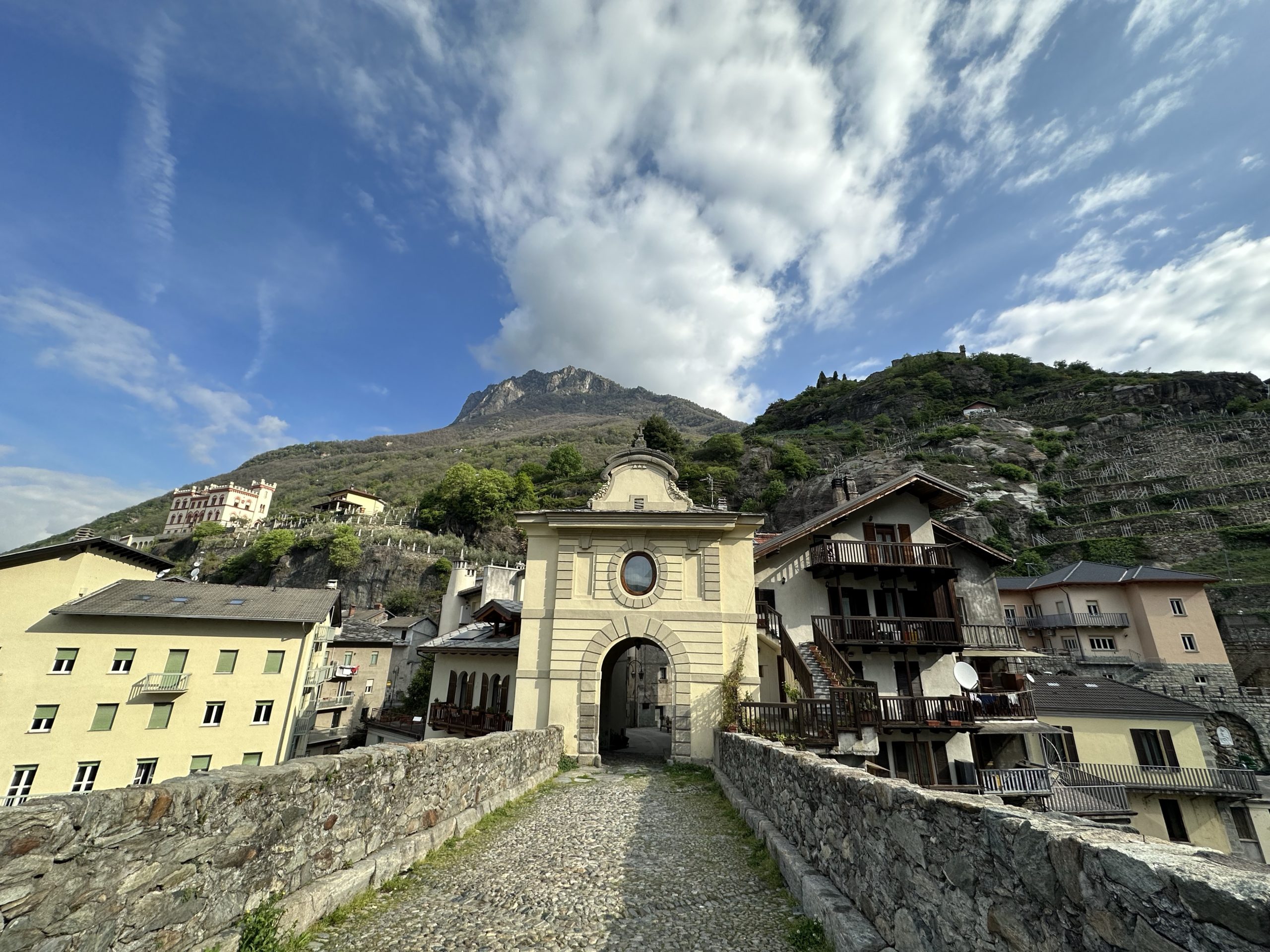
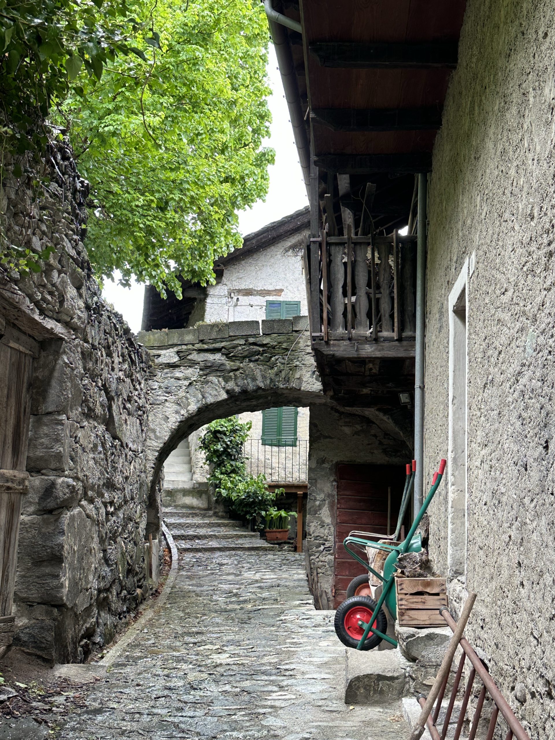
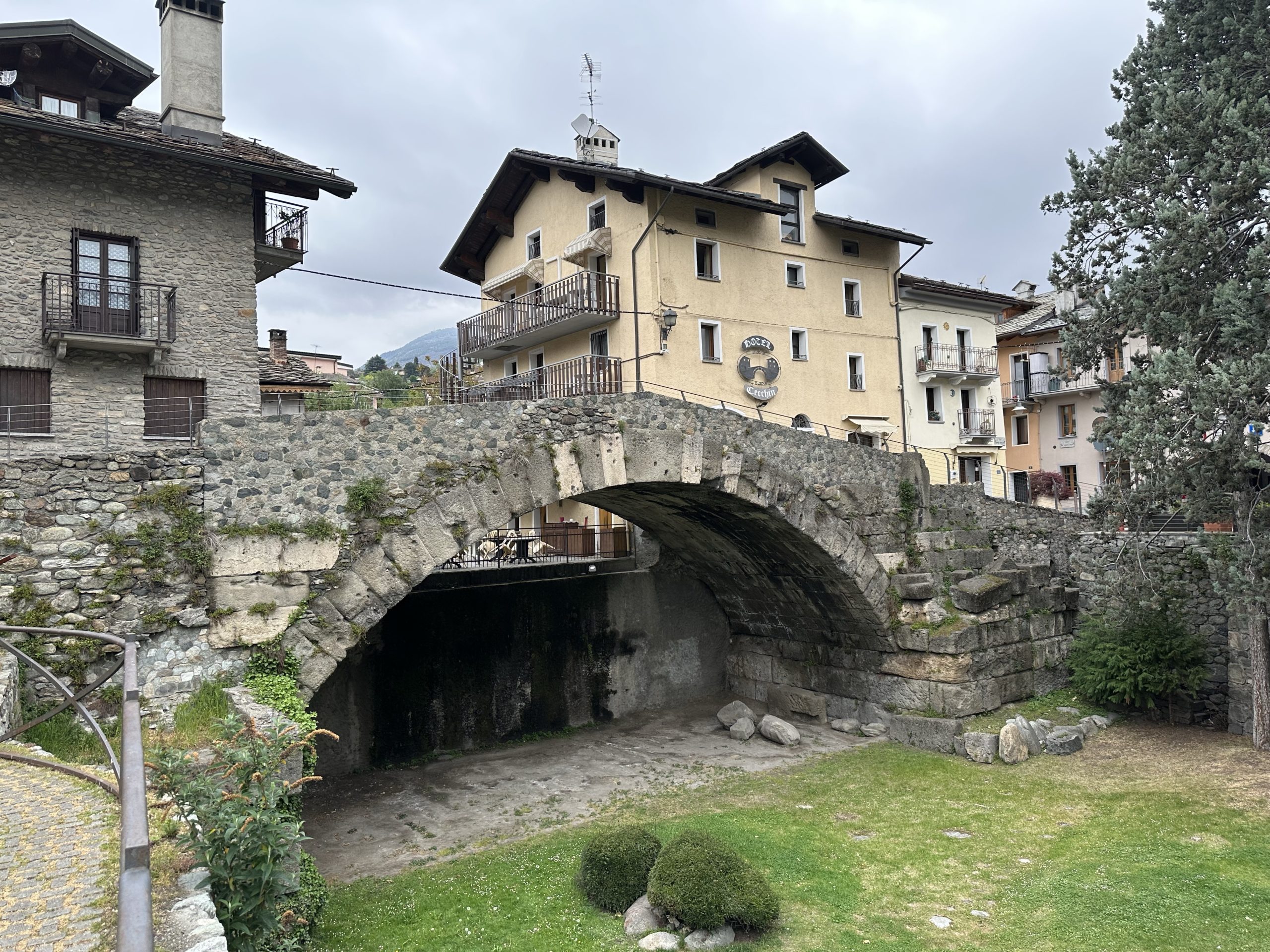
The medieval village of Pontremoli, believed to have been first settled around 1000 BC., lies in the heart of Lunigiana, a mountainous area stretching from the Tosco-Emiliano Appenines to the Mediterranean Sea following the Magra River. While a part of Northern Tuscany, the village of dark stone and narrow alleys appears to be relatively untouched by tourism.
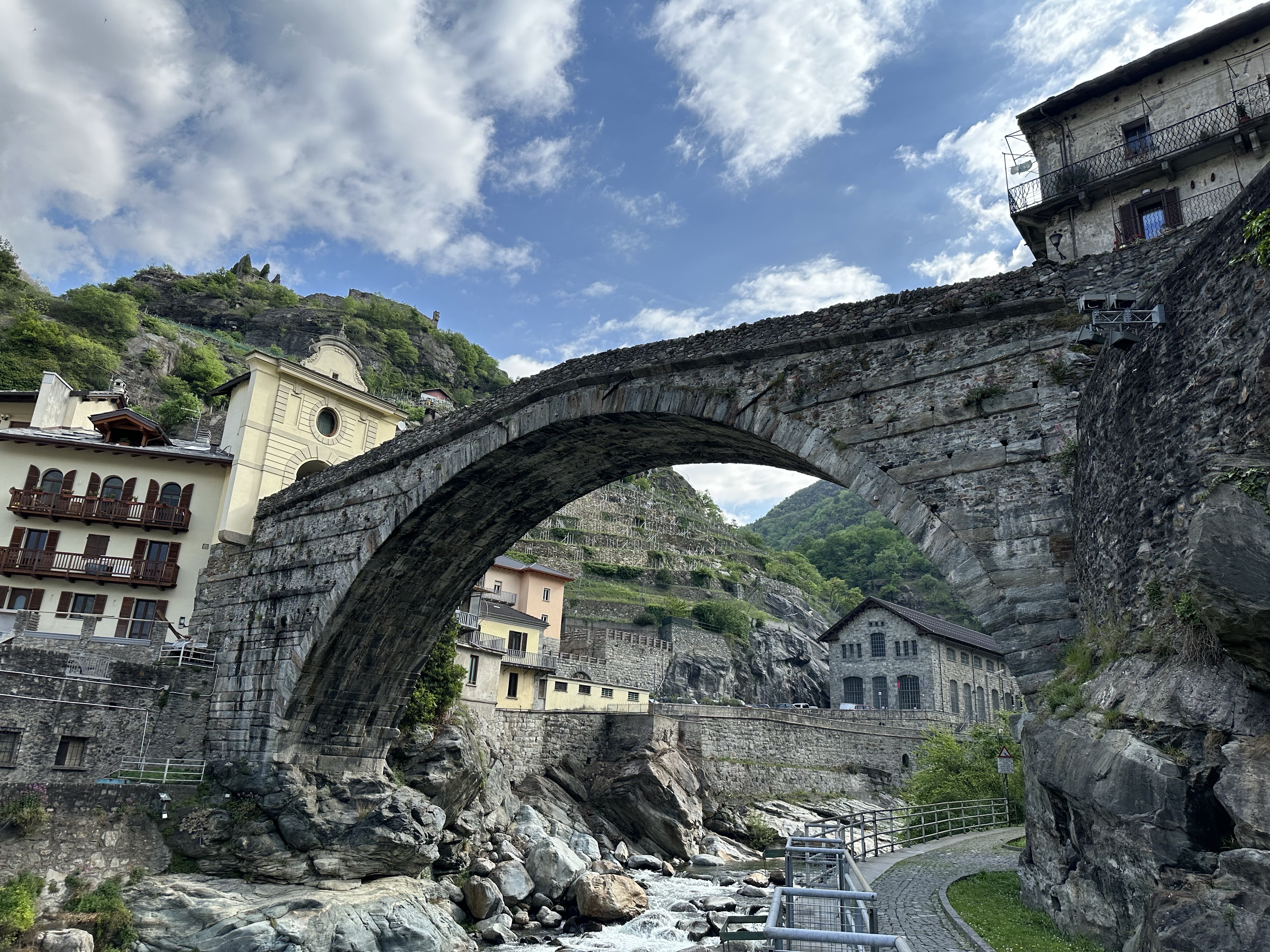
The town may get its name from the phrase “Ponte tremulus”, because of a bridge with a shaky constitution that spanned the river Magra, a bridge that already existed when Henry VI reigned around the year 1165. There are several bridges across the Magra and Verde Rivers which join at the south end of the city. One bridge, the Ponte della Cresa, spans the river Verde with four stone arches. Originally built of wood, this bridge dates back to the 1300’s, although rebuilt many times due to continuous damage by floods and sieges.
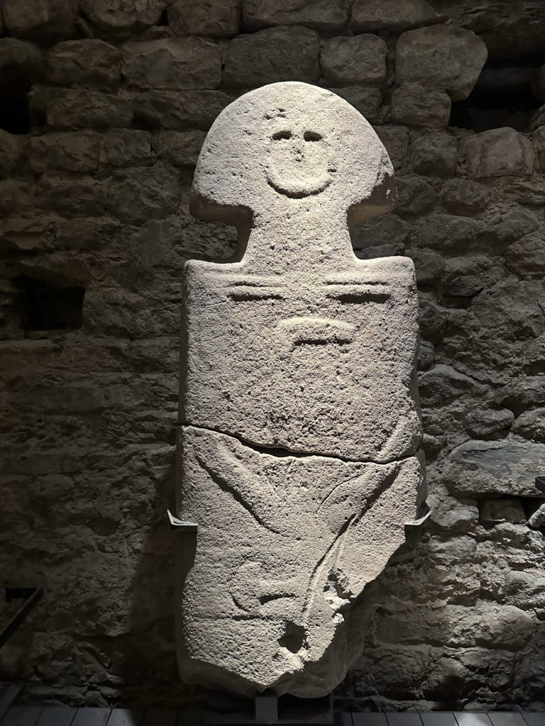
We wandered through the town, stopped for gelato, and then took an elevator up to the Castello del Piagnaro, a medieval castle designed to guard the main roads leading through the Apennine Mountains to Rome. While the castle itself was interesting, we were intrigued to find that it now houses the Museo delle Statue Stele Lunigianese. This is a fascinating collection of stele statues dating back to the European Neolithic era. The sandstone figures representing stylized male and female human figures have been discovered all over Lunigiania, this part of Tuscany, but primarily in the area south of Pontremolli.
Berceto to PontremoliRiver Magra
Torre del Cacciaguerra. Ponte Cesare Battisti and Porta di Toscana
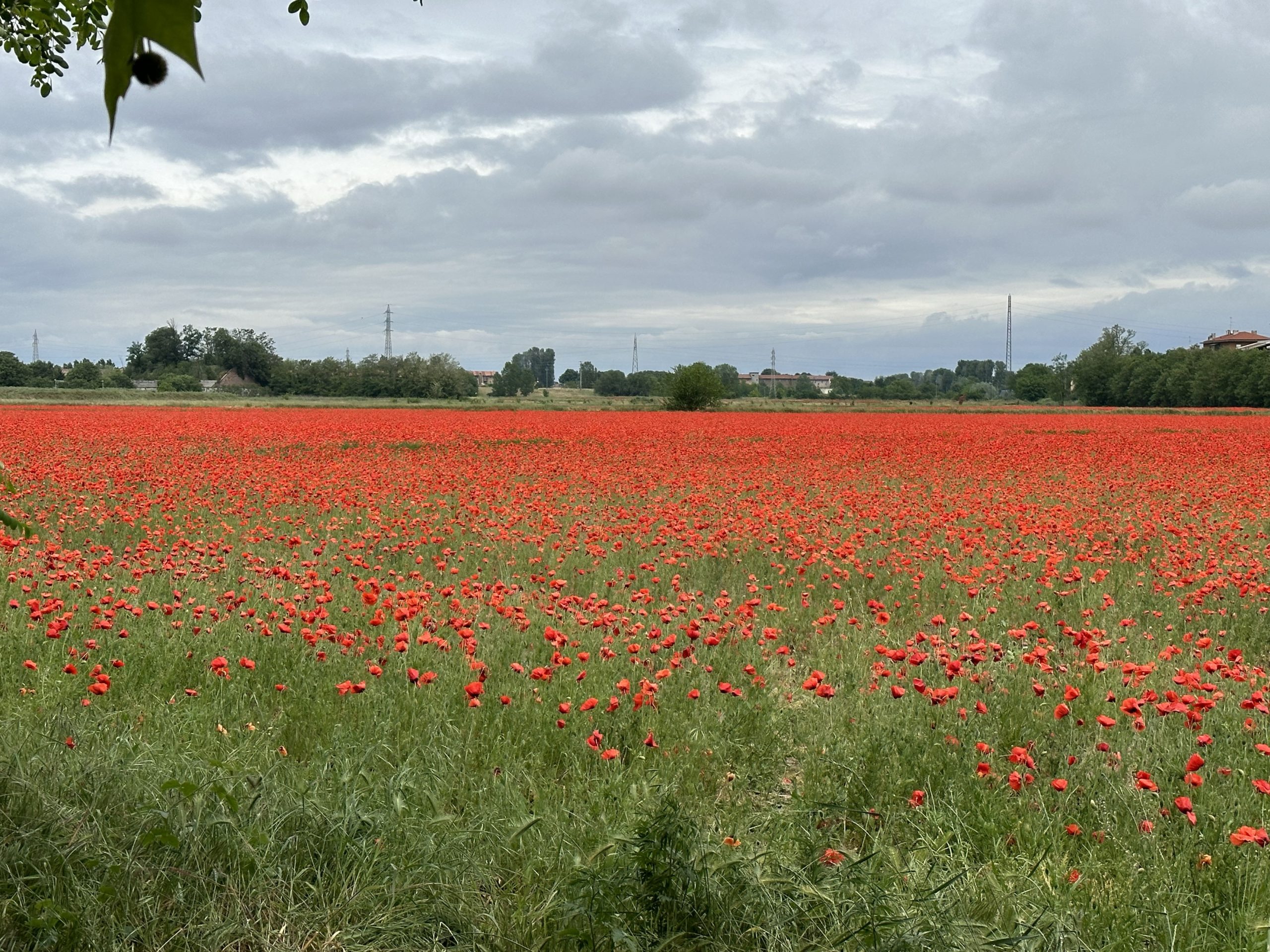
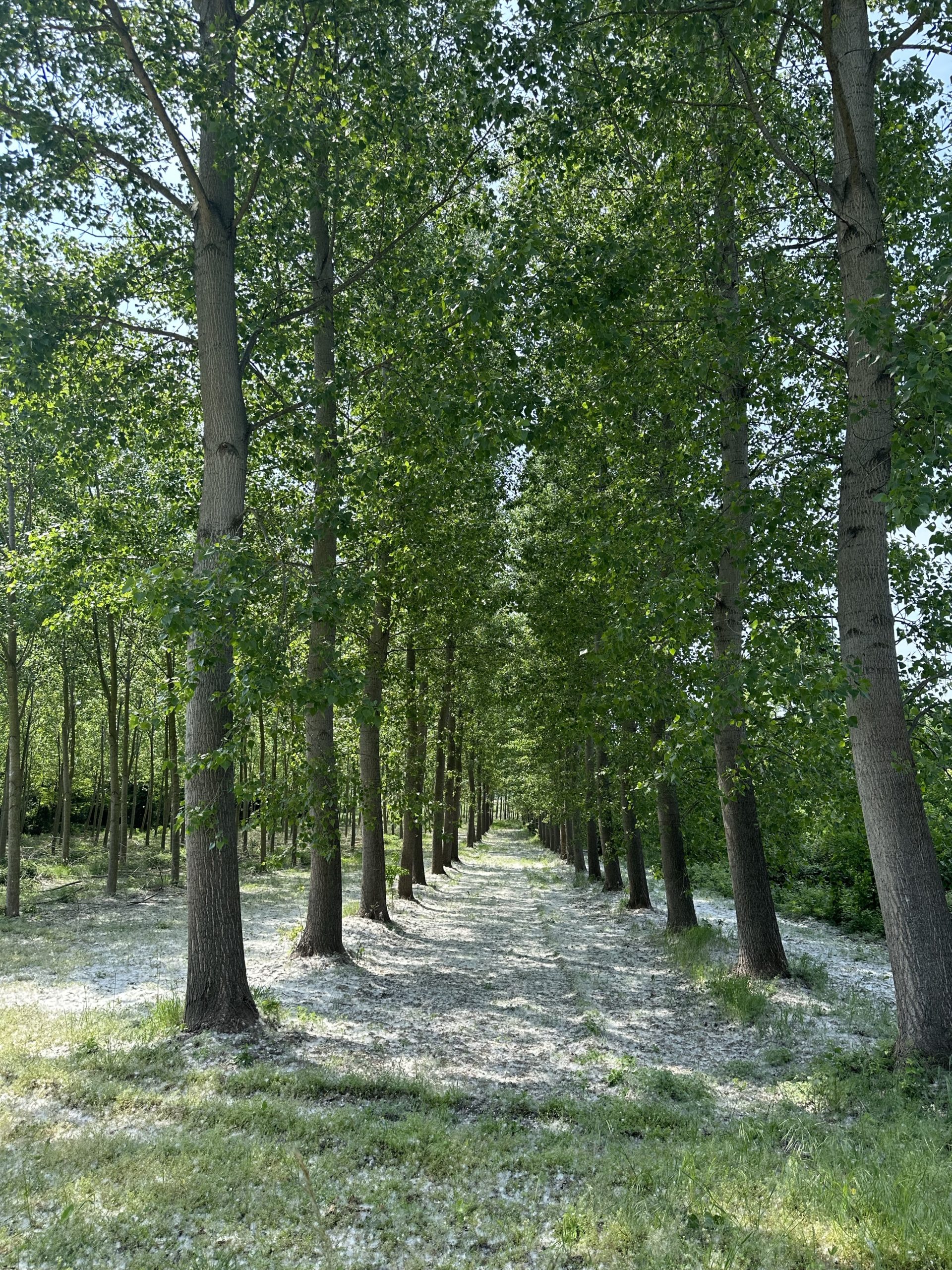
By way of a 1.5 hr train trip to Pavia, we avoided four days of walking alongside the flat Vercelli rice fields, now levelled and flooded again with water for planting during May. The rice seeds will be sown in the water, using specially-equipped amphibious tractors.
After locating our apartment, we spent some time over gelatos planning the days ahead. We realize now that our original plan to primarily walk the VF route is not always practical (stages are long and often challenging) or desirable (ie, flat farmland), and often conflict with our equal desire to experience the culture of the cities. We needed a plan to allow for both. Lois downloaded the Cicerone guide for another viewpoint and, as it turned out, better maps. We agreed that, if possible, we would both like to walk the stages of the route in the Apennines and also in Tuscany. After that, we would see. For the Apennine Mountains, we decided to book a tour that would look after luggage transfer and also provide backup, if a stage is found to be too long or strenuous.
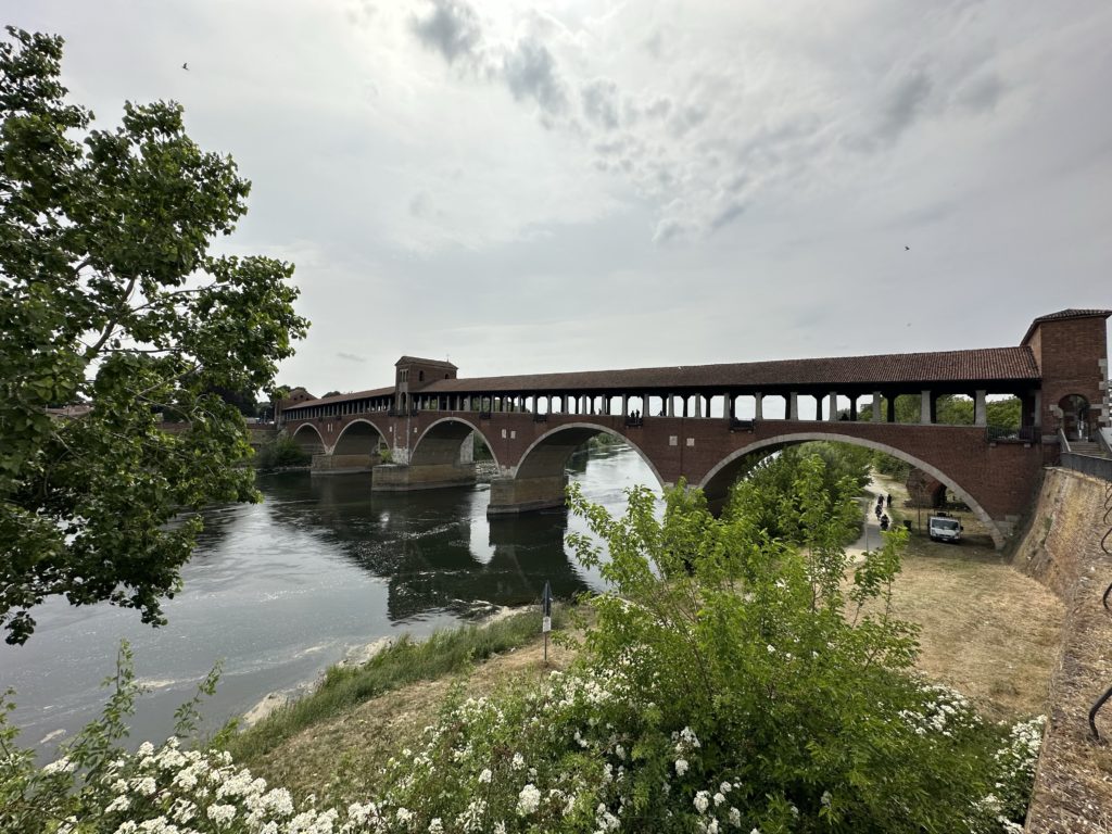
In the meantime, we set off to explore Pavia. We walked to the Ponte Coperto, a reconstruction of an ancient bridge across the river Ticino. The Ticino originates in the Alps, flows through the Swiss canton of Ticino and into the Po river near Pavua. The stone and brick arch bridge , including a chapel, was modelled on its medieval predecessor (itself a replacement for a Roman construction, parts of which are still visible on the river floor) which had partially collapsed following Allied bombing in 1945. While the bridge looked old, the knowledge that it dated from 1951 was a bit disappointing, although the desire to replace a beloved bridge in the same style after the devastation of WWII is understandable.
On Wednesday morning, the temperature had dropped to 12C and it was pouring, making Lois question her decision (when it was 26C) to send back her long hiking pants, warm jacket and rain pants! She also second-guessed her decision to wash out her capris (only remaining hiking wear), as they had not dried overnight. Fortunately, Paul came to the rescue, suggesting she use the hair dryer, which worked a treat! Wanting to walk today, we were debating between walking ahead on the route and returning by train to Pavia or walking around the city and beyond to view the sights. We chose the latter.
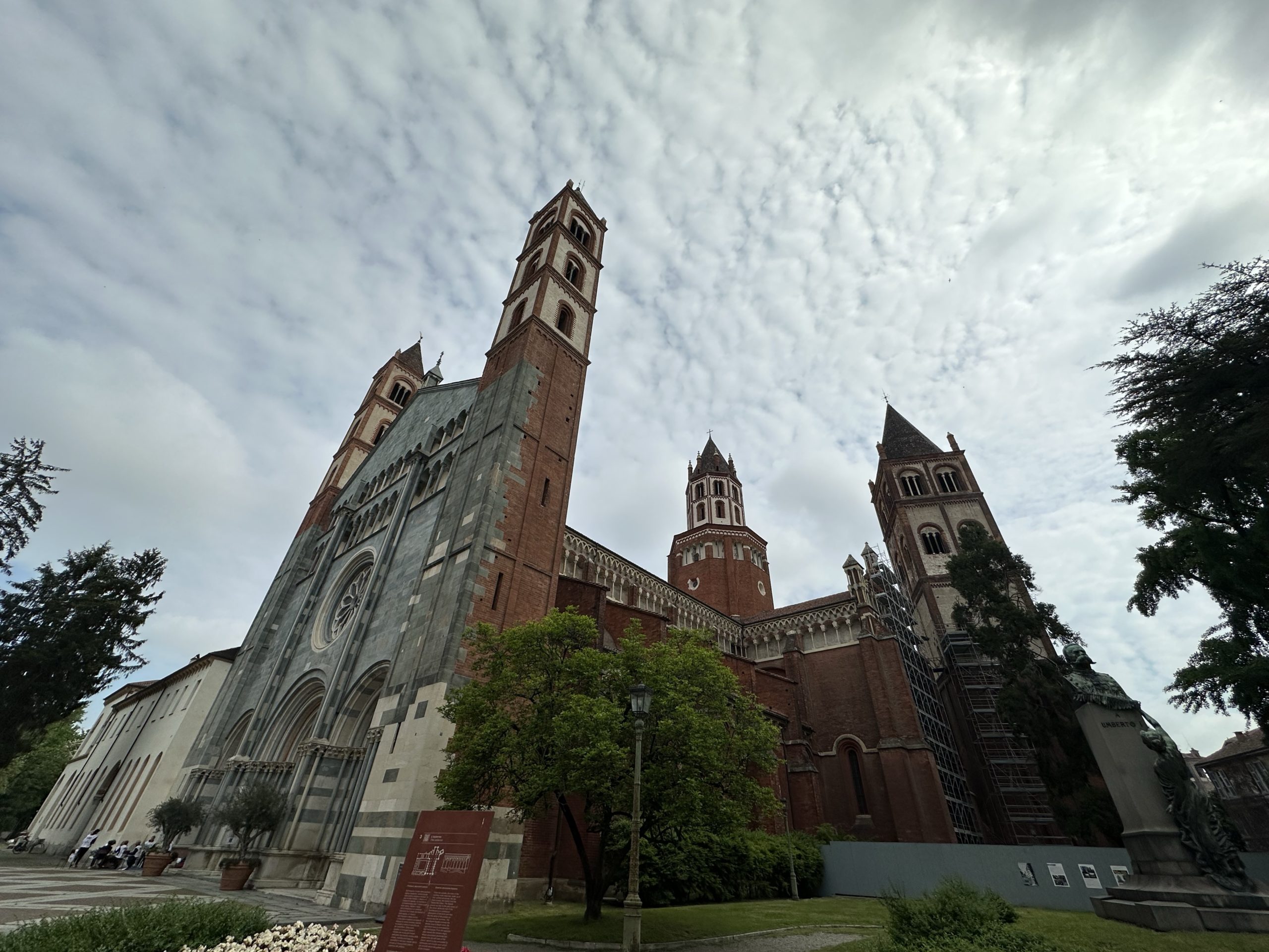
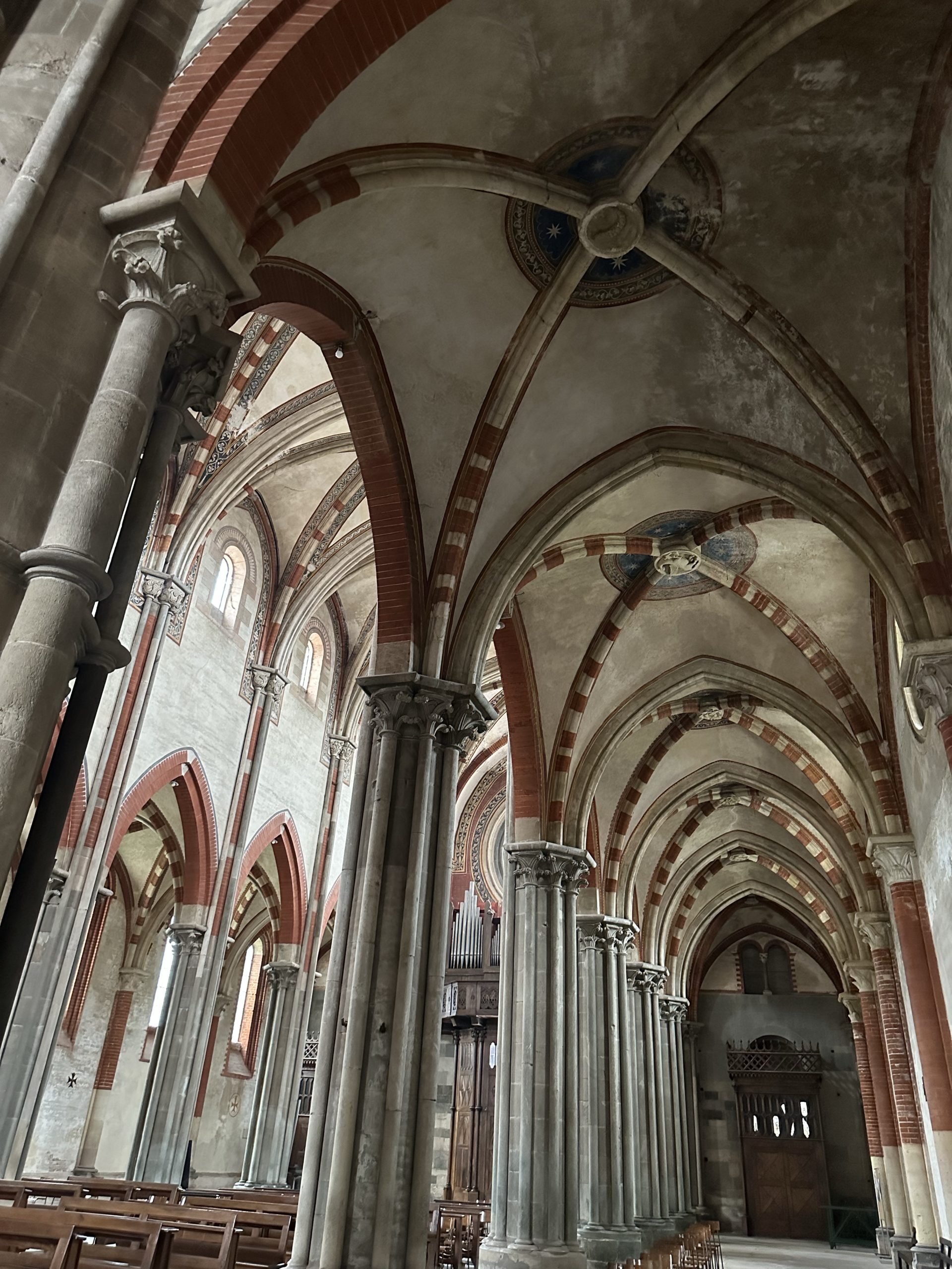
After a visit to the very helpful tourist office, we headed first to view the Cathedral (Duomo di Pavia). From the outside, the unusual building principally made of red brick almost looks ruined, but inside reveals a massive , somewhat overwhelmingly opulent Renaissance-style church, one of the largest buildings in central northern Italy. Built in the 15thC to replace two existing “twin” Romanesque cathedrals, the Duomo is made in the form of a Greek Cross, with three naves flanked by semi-circular chapels. Leonardo da Vinci is said to have worked on its foundations.
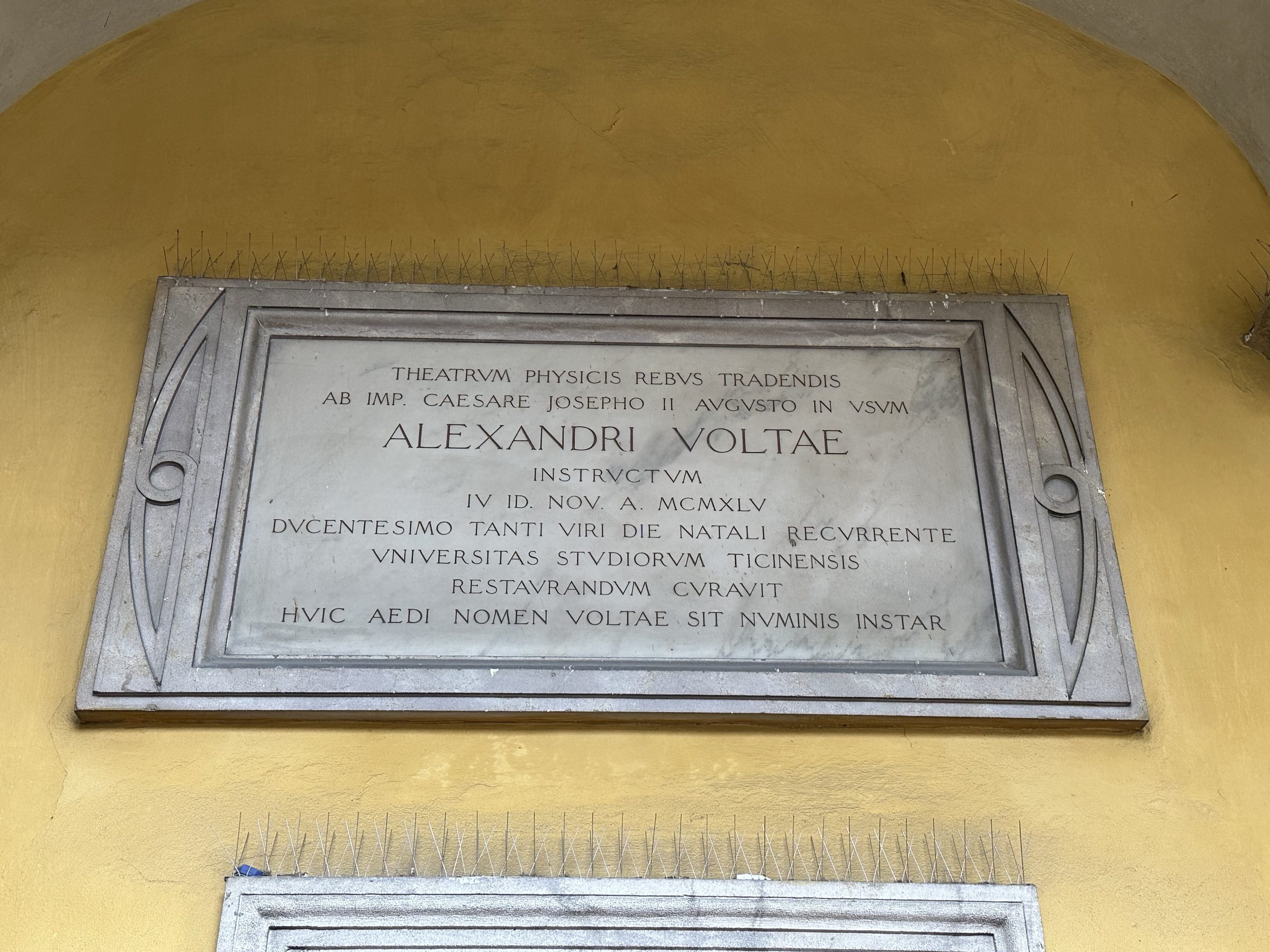
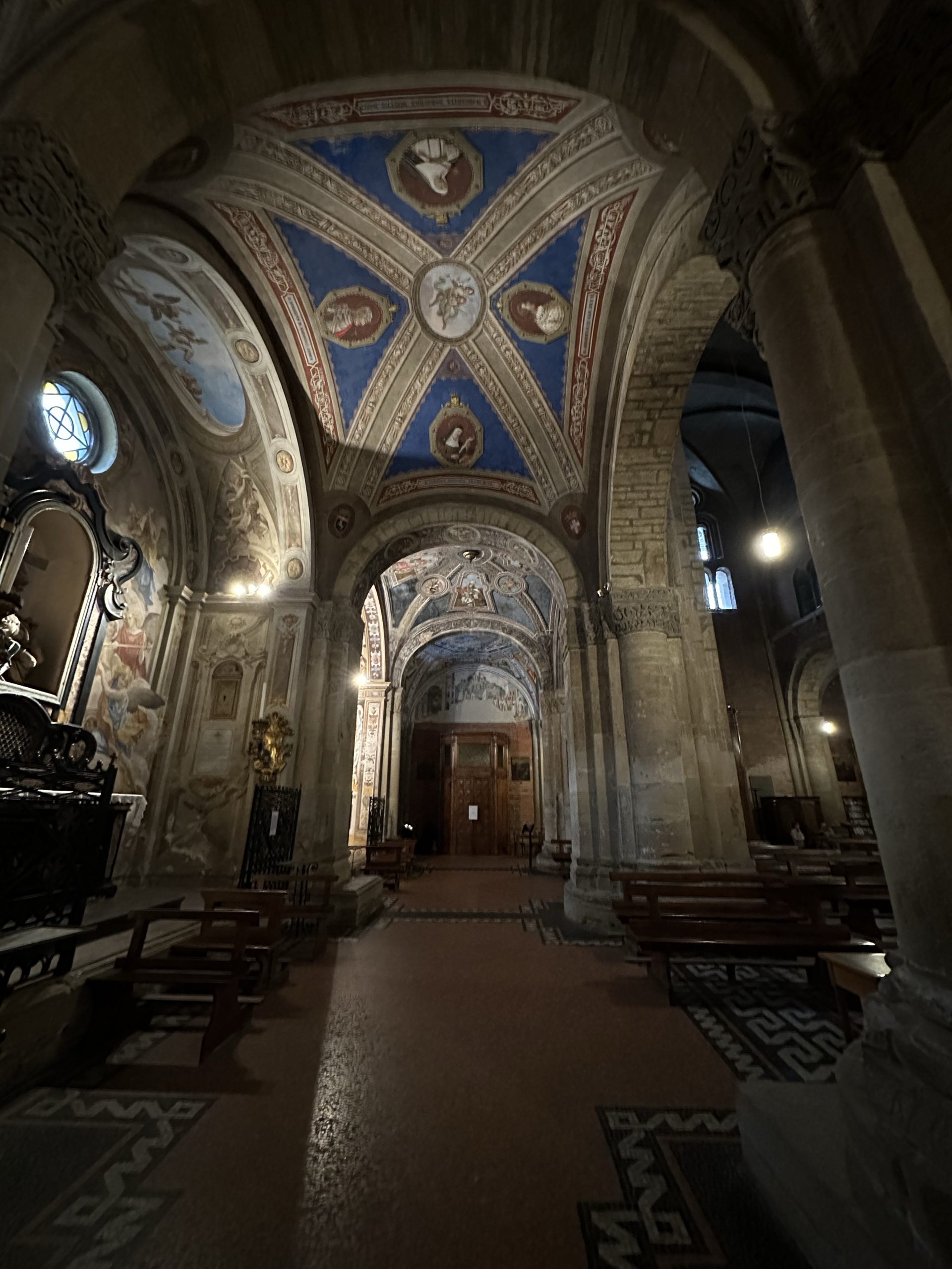
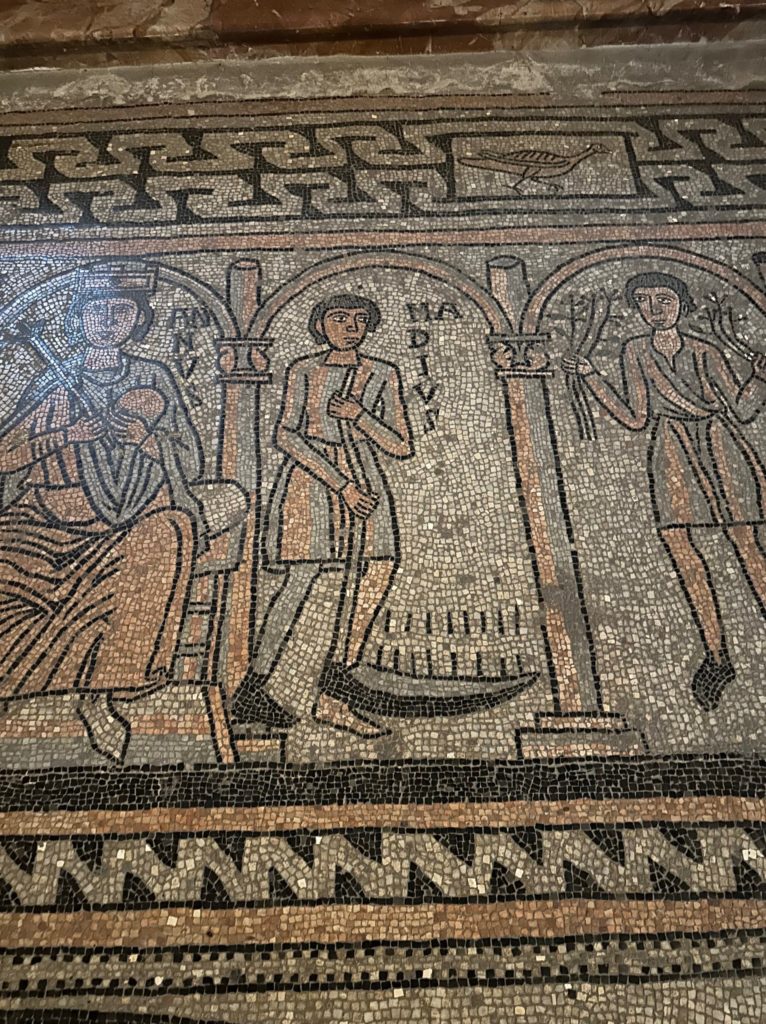
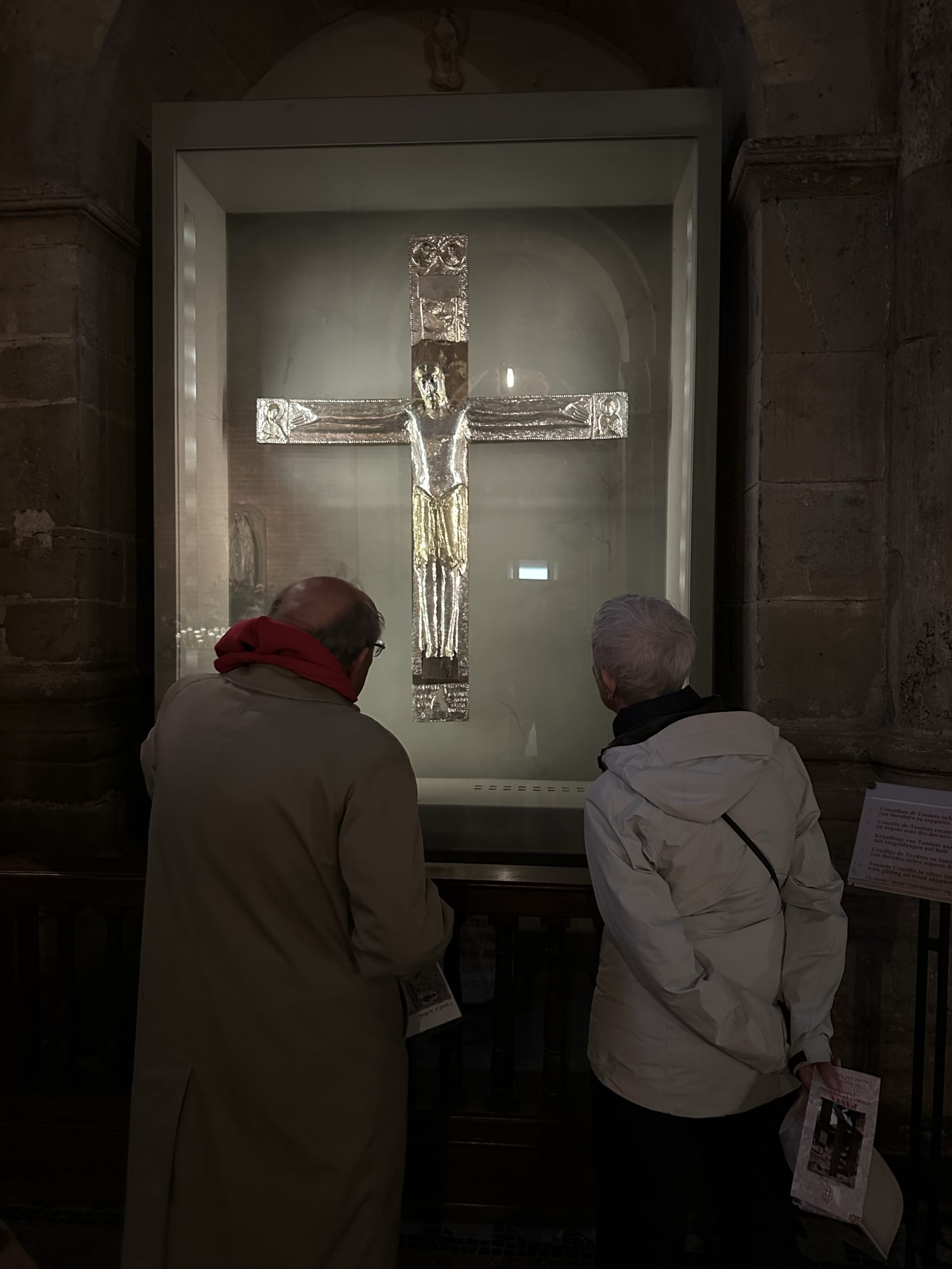
Next, we walked over to the University of Pavia, passing by three medieval brick towers, the only ones still standing of a hundred or more of these structures built to reflect the stature and power of prominent families. The University, opened in 1361, is one of the oldest in Europe. On our wander through, we went into the lecture theatre where Alessandro Volta presented the newly invented electrical battery to Napoleon. Our visit to the lovely Romanesque Church of San Michele nearby was memorable for the delightful man who showed us the important sights inside: a partially preserved floor mosaic from the 1100’s in the form of a labyrinth, with panels above representing the months of the year and the activities in the community associated with each month, and an unusual gold laminated silver crucifix from the 10thC, depicting a peaceful Jesus, with no wounds, his arms outstretched in welcome.
After lunch in a small, smart Vietnamese restaurant, we went to visit the 14thC Visconti Castle, but, as it didn’t reopen until 2:00, we carried on walking north out of the city towards Certosa, an 8 km walk along the Naviglio Pavese Canal. The canal and its locks, two of which we passed (non-working), were part of a plan of Leonardo Da Vinci to link Switzerland, Milan, Venice and the Adriatic.
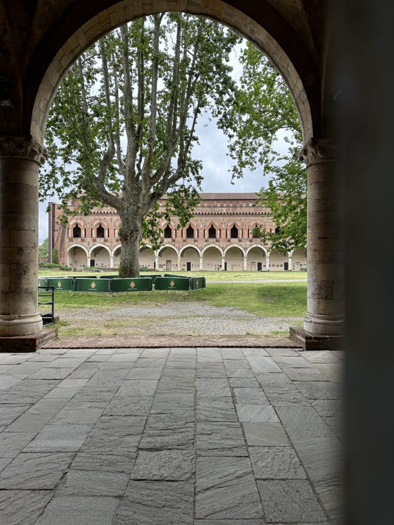
The canal led us close to the 15thC Certosa di Pavia, a monastery and complex built in 1396-1495, by the Visconti family of Milan. The church was to serve as a mausoleum for the family. The location was strategically chosen midway between Milan and Pavia, the second city of the Duchy, where the Duke held his court, at the end of a large hunting park, which connected the Certosa to the castle of Pavia.
According to Wikipedia, “Certosa is the Italian equivalent of Charterhouse: a monastery of the cloistered monastic order of Carthusians founded by St. Bruno in 1044 at Grande Chartreuse. Though the Carthusians in their early centuries were known for their seclusion and asceticism and the plainness of their architecture, the Certosa is renowned for the exuberance of its architecture, in both the Gothic and Renaissance styles, and for its collection of artworks which are particularly representative of the region”.
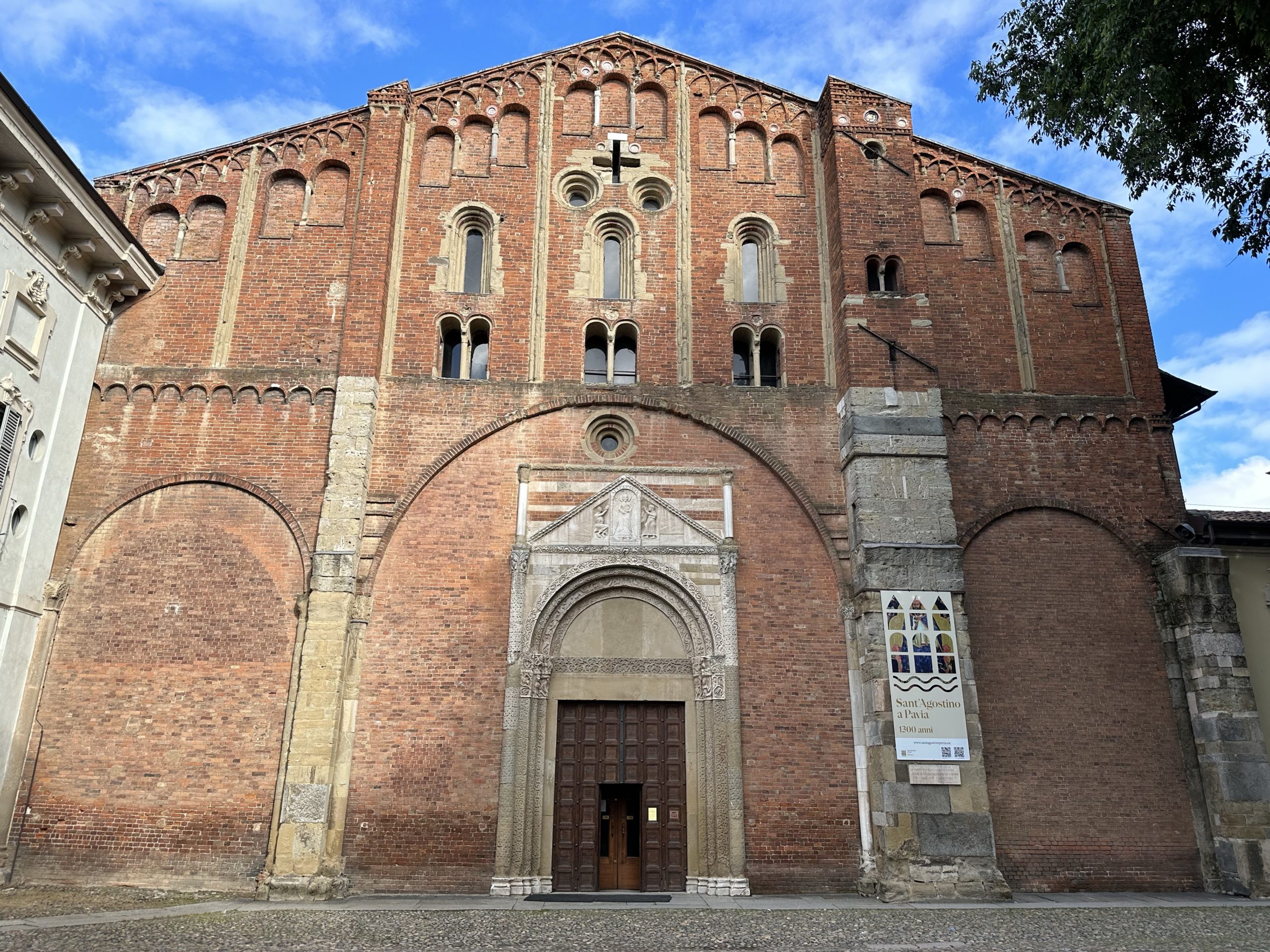
As parts of the complex could only be seen on a guided tour by one of the monks in Italian, we had a look in the church and peeked into the cloisters, then walked around the high walls of the perimeter to the train station in Certosa to get a train back to the city. Finally, we visited the Church of San Pietro in Ciel d’Oro. As we had become acquainted with the life of Saint Augustine in Canterbury, we thought that we might see his tomb here. Dating from 1402, it is described as a “splendid monumental marble ark”. A plaque outside bears a passage from Dante’s Divine Comedy, recognizing the Church as the burial place also of the philosopher Severinus Boethius.
We decided that we would prefer to look at the rice paddies from a train, rather than walk through them for hours on end, possibly while being bitten by mosquitoes! Additionally, Paul was nursing a couple of painful blisters. So, we hopped on the 9:17 train, arriving in the town of Vercelli 10 minutes later.
One of the oldest urban sites in northern Italy, Vercelli was founded, according to most historians, around 600 BC. It is the largest European rice-growing region and rice is the main factor in the economy. The ancient system of irrigation, described below, has been found to be a double-edged sword, however. While saving water, the system increases greenhouse gases by releasing carbon.
The large plains located between the Alps and the Mediterranean Sea allow for an effective system of irrigation by submersion. When the summer period starts, water melts from the Alps’ glaciers, reaching the Pianura Padana. The water is stocked there for a few months, from April to September, thanks to artificially constructed embankments. Once the rice fields have been flooded and rice has grown, the water is then released and returns to the sea.
We dropped our bags at the flat we had booked and headed for espressos and the tourist information centre. The staff person there was very helpful and guided us to the most interesting sights, most of which are churches. Unfortunately, a sculpture exhibition that looked interesting featuring a major retrospective dedicated to the work of Italian sculpture Giacomo Manzù was not open today.
We headed first to the Basilica di Saint’Andrea, built from 1219 to 1227 with funds that a cardinal obtained from being granted, by Henry III, “perpetual rights to the income of St Andrew’s Church, Chesterton, near Cambridge”! The cardinal also supported the construction of a hospital for pilgrims on the VF. The bell tower was built in the 15thC and is unusually positioned at an angle to the main body of the building. The inside features colourful and decorative vaults. In 1511, the Cremonese cabinet maker Paolo Sacca created exquisite inlaid wood depictions of the town places which are in the quire.
After lunch, we continued our tour, which included a huge synagogue, built in Arab-Moresque style between 1875-1877, the first Jewish temple to be built in Italy after the emancipation of the Jews in 1848 (Carlo Alberto, King of Piedmont and Sardinia, granted the Jews civil and political equality which was extended to the whole of Italy as it became unified, concluding in 1870.)
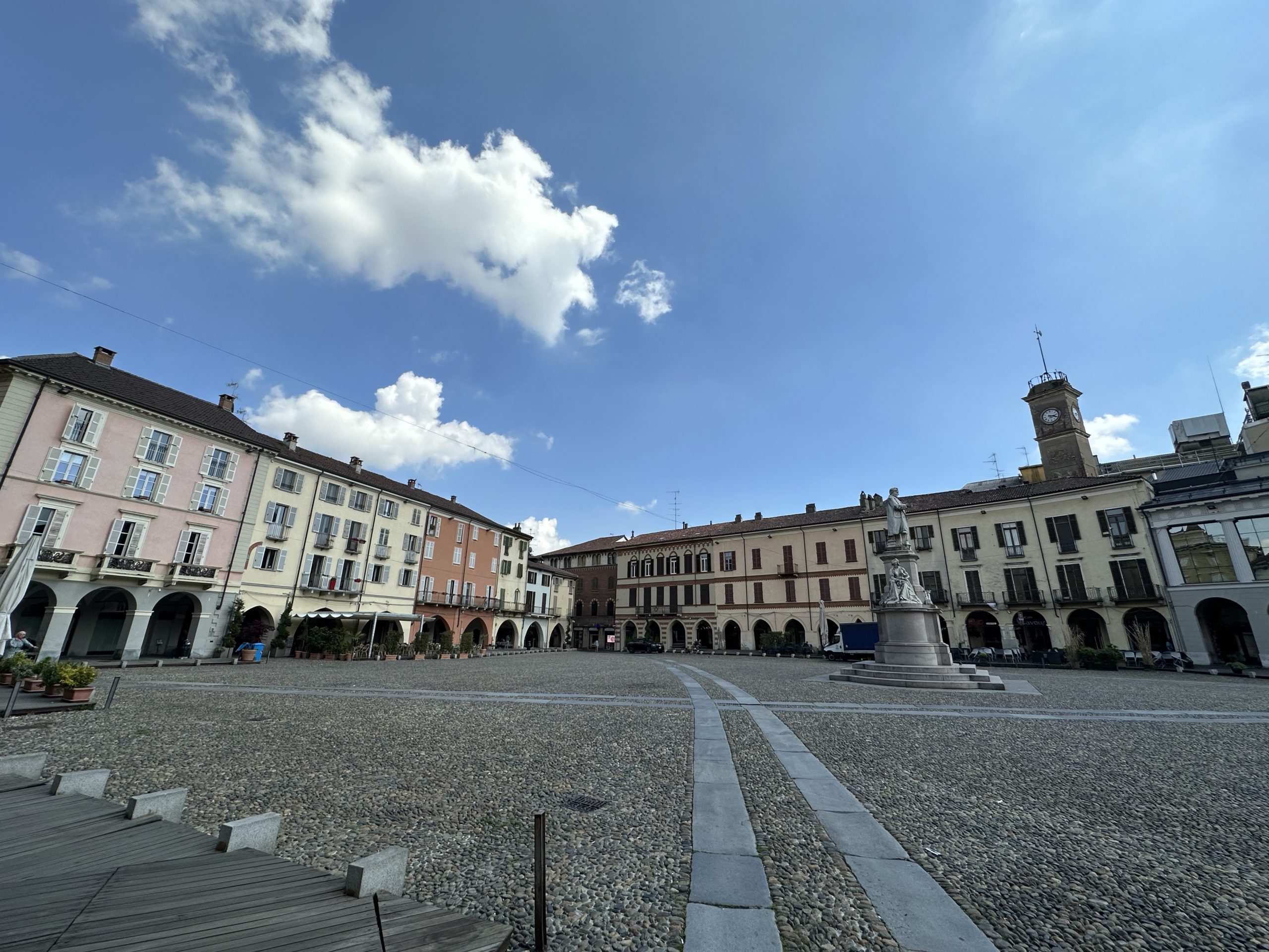
Our accommodation is on the Piazza Cavour, the arcades of which date from the 13th and 14thC. Two towers overlook the square, the Torre dell’Angelo, which is the remains of a fortified house, and a 16thC bell tower. We spent the late afternoon at a cafe/ bar in the Piazza where Lois enjoyed her first ever Aperol spritz.
A thunder storm during the night was dramatic and had cleared the air. Hoping for an early start, we arrived at the pasticerria soon after 8:00, but it was already hopping on a Sunday morning in the touristy town of Viverone. They provided great espresso, pastries, yoghurt and fresh fruit. We even stayed for a second capucinno when Paul realized his Apple watch had not charged during the night!
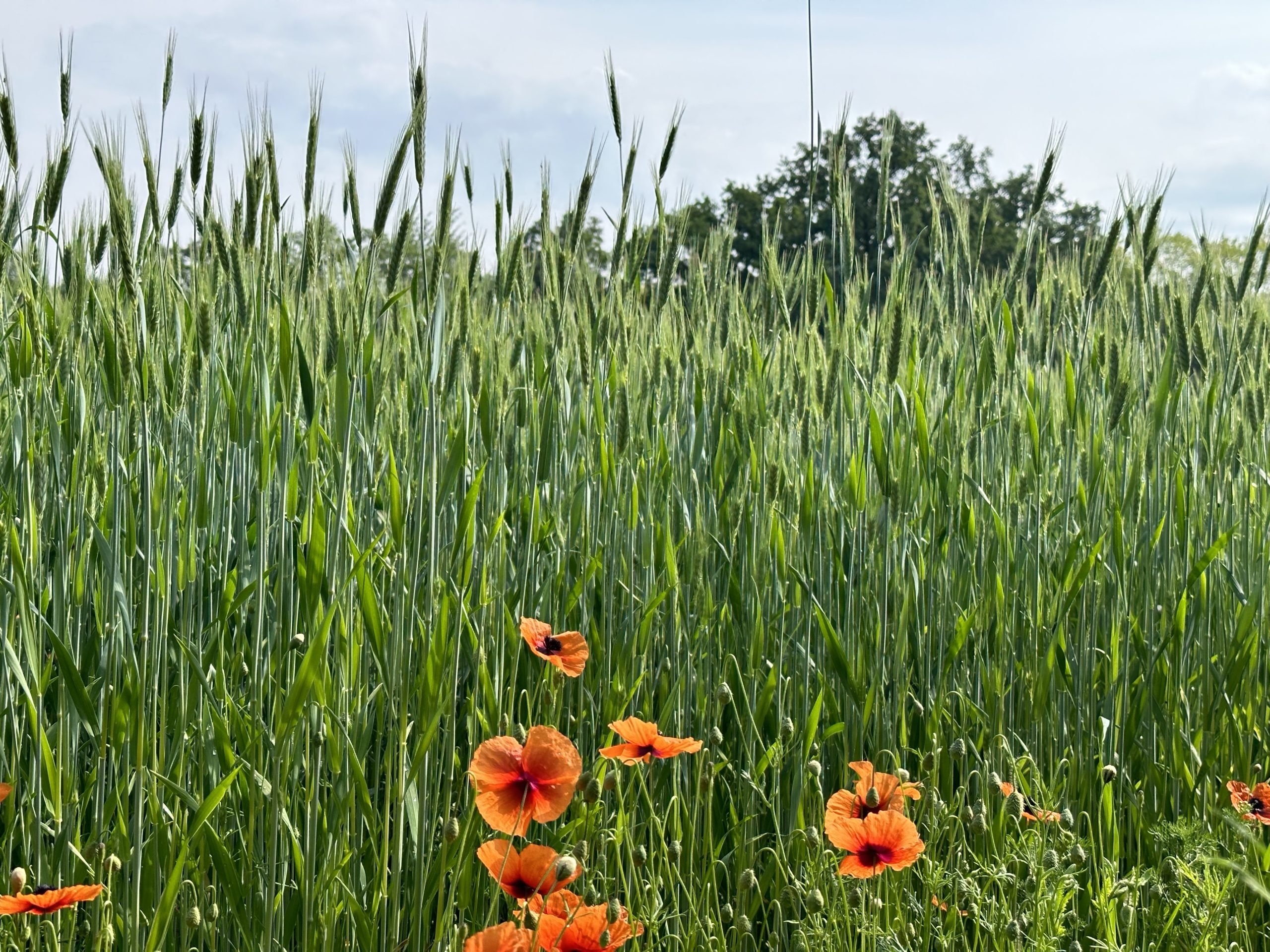
Rejoining the VF, we gradually climbed out of Viverone and along the moraine. It was pleasant countryside of woods, vineyards, orchards and meadows. Descending to Cavaglia, we had yet another coffee (ie, bathroom break!) The terrain became flatter and we found ourselves walking along unshaded tracks on completely flat farmland, with fields planted with corn, wheat and barley. We ate our lunch sitting on our groundsheet at the edge of a field. As the day got warmer, the walk across fields became more tedious, especially when the route went over and then alongside the motorway. By Santhia, we were rethinking the next few days’ walk.
Our spirits were revived when we found a cute restaurant which served antipasto like Mrs. Gobbi used to make, and lemon risotto.
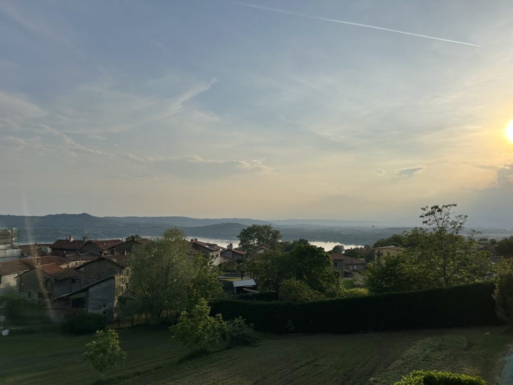
Walking away from Ivrea, we could identify the long completely flat moraine that encloses the plain of Ivrea in a horseshoe shape. The Moraine Amphitheater of Ivrea, which spreads over an area of approximately 530 sq. km, is one of the world’s most important geological formations of glacial origin. It was generated by the actions of the Balteo Glacier a “river” of ice 100km in length and 800m tall which came down from the Valle d’Aosta. The glacier also left numerous lakes, nested in different morainic hollows, one of the larger being Lago Viverone, today’s destination.
Continuing to follow the Dora Baltea River, the route took us first along a path beside tiny Lago Di Campagna, along generally flat tracks, through forest and alongside vineyards and orchards. At Buroli, we found one of two “susta”- places offering a bench and source of water for pilgrims/walkers. We stopped at a cafe there to use the facilities (no public washrooms on the VF!) and to enjoy a glass of thick and delicious local pear juice. Later, at the next “susta”, a group of four Italian hikers were just leaving and motioned for us to use the space. Coming from the Lago Garda area, they were doing the VF in stages – this year from Chatillon to Pavia. While we rested, four other younger walkers passed by. At Canavese, we sat in the shade of the 14thC bell tower and gate, Paul trying to photograph the barn swallows nesting in the ceiling.
The weather was warm and increasingly humid. After a long climb up to Piverone, we passed through another bell tower and gate, this time from the 13thC. Soon after, we came upon the ruins of the small Romanesque church of San Pietro di Livione at Gesiùn, dating from between the 10th and 11thC. The name Gesiùn means big church, despite its miniscule size! We chatted with a couple of young cyclists who wanted their picture taken to show they had cycled all the way up there!
By now, we could see Lago di Viverone down in the valley, looking very inviting in the afternoon heat. Unfortunately, when we checked the location of the apartment we had reserved, we discovered it was not in the valley, but at the very top of a very long hill overlooking the lake. Great views, but not at the end of a long day with temperatures up to 26oC!
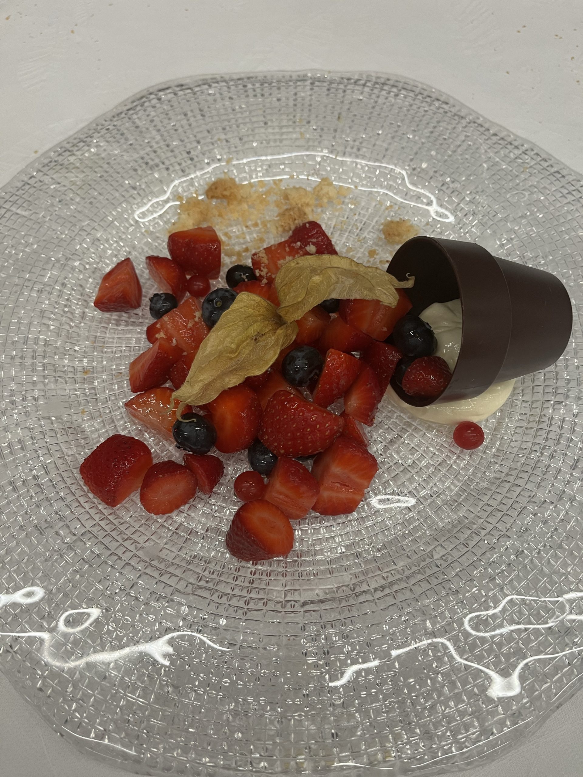
For dinner, we were not going anywhere that required any walking so reserved at the restaurant attached to the apartment. This turned out to be a perfect choice as the restaurant was amazing (as well as being extremely popular for those arriving by 4 wheels!). We had fresh ravioli with a braised onion relish, followed by whitefish from Lake Viverone and ended with a desert of fresh berries and cream, flowing out of a chocolate pot. The local white wine was Erbaluce (?)
As we left the restaurant, we were told apologetically that breakfast would not be served before 09:00 as the restaurant would not be closing until 01:00! We were directed to their sister pasticerria down on the village, with a voucher.
Topography of the area
Lago di Campagna
Sostas CanavesePiverone
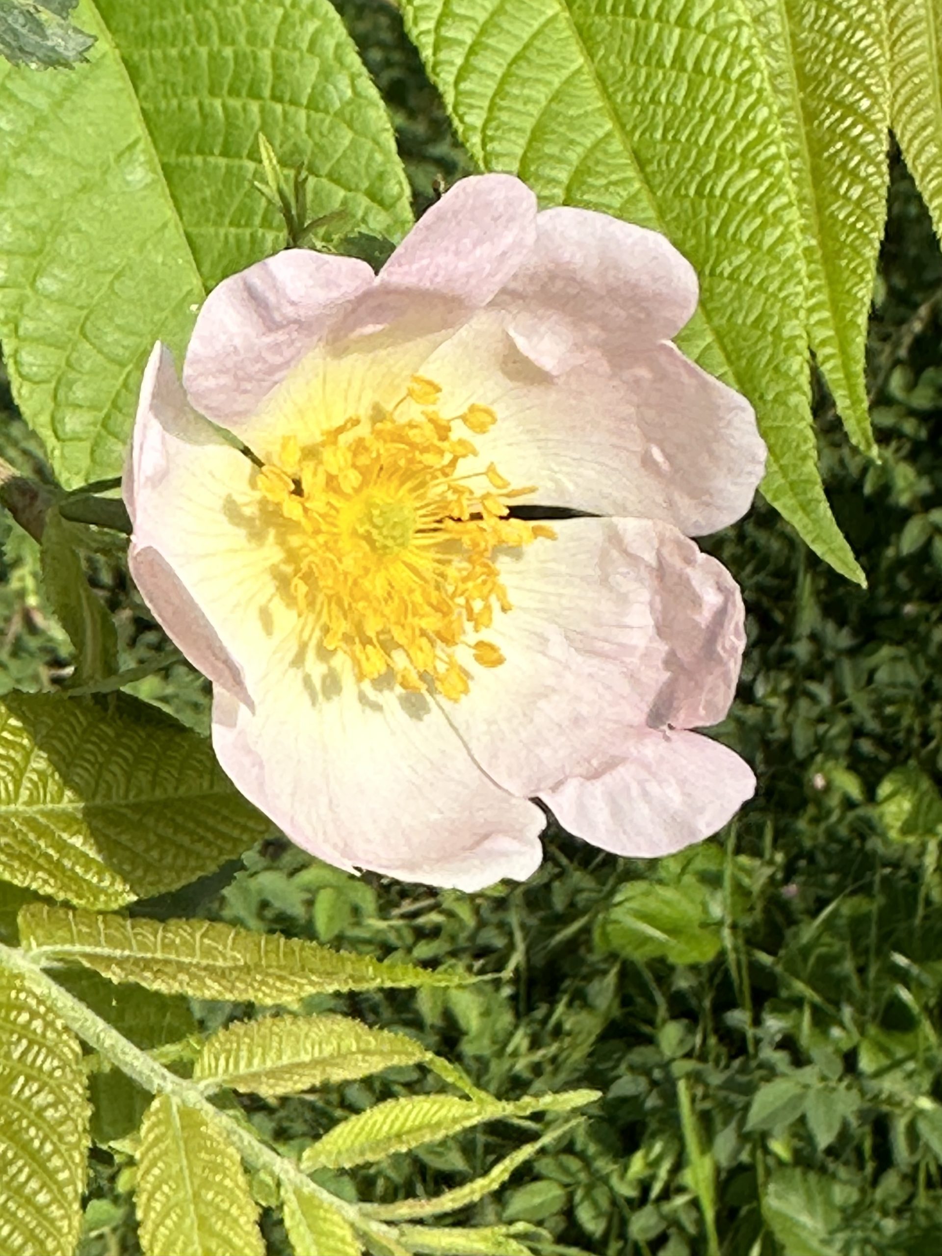
Black Poplar. Wild RoseView from Viverone apartment
Now that we are out of the mountains, it is harder to justify having our bags transported, so we spent a day in Ivrea to organize a parcel to send extra weight back to Canada. With the help of Google Translate, we bought a box at the post office which we duly filled with 5.25kg of stuff that we do not now or did not ever need! (Lois, who had less to send back, is a bit resistant to the idea of carrying her 30L pack again, after the luxury of hiking with a daypack – we shall see!)
In a couple of sports shops we found rubber tips for our poles (to stop the clacking on cobblestone!) and new, lighter socks for Lois
Later in the day after gelato: strawberry for Lois and lemon in a brioche(!) for Paul, we climbed up to the castle. It was built in 1358 as a symbol of the dominance of the House of Savoy in the region. Undergoing needed renovations, it is impressive from the outside, although strangely has only 3 towers. We discovered that, in 1657, one of the towers that served as a powder magazine was struck by lightning causing deaths and extensive damage. That tower was never totally rebuilt.
Ivrea Castle
Cityscape and tribute to founder of Olivetti typewriters which were made in Ivrea.
Arranging for our bags to be taken by taxi again on this final stage of the Aosta valley, we walked a short distance through the old town to view the Roman bridge of Pont-Saint-Martin. Built in the 1stC BC, the bridge carried the Via delle Gallie across the River Lys. While most of the surrounding buildings were destroyed by the Allied bombing of Pont Saint-Martin on August 23, 1944, this bridge remained standing.
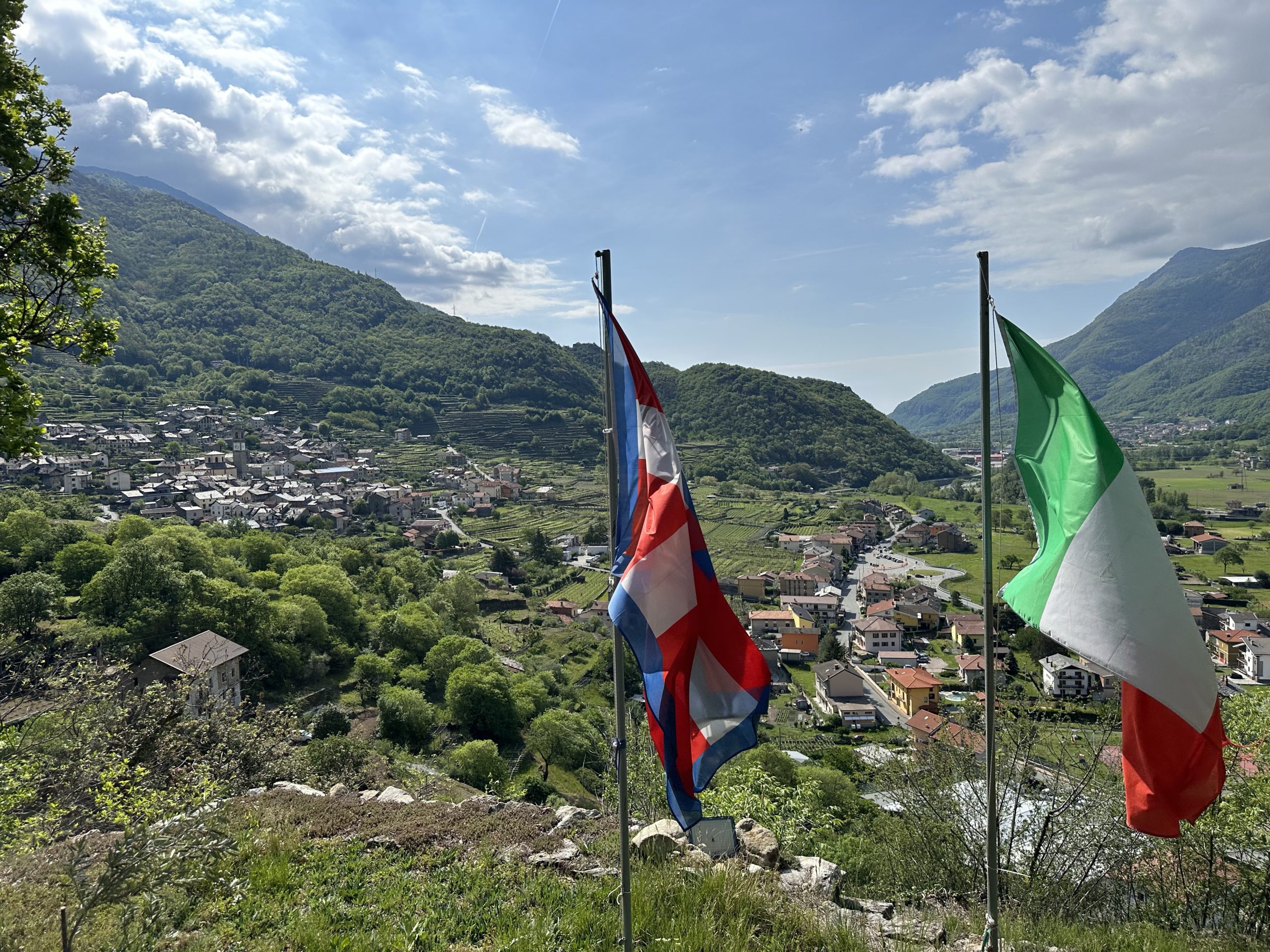
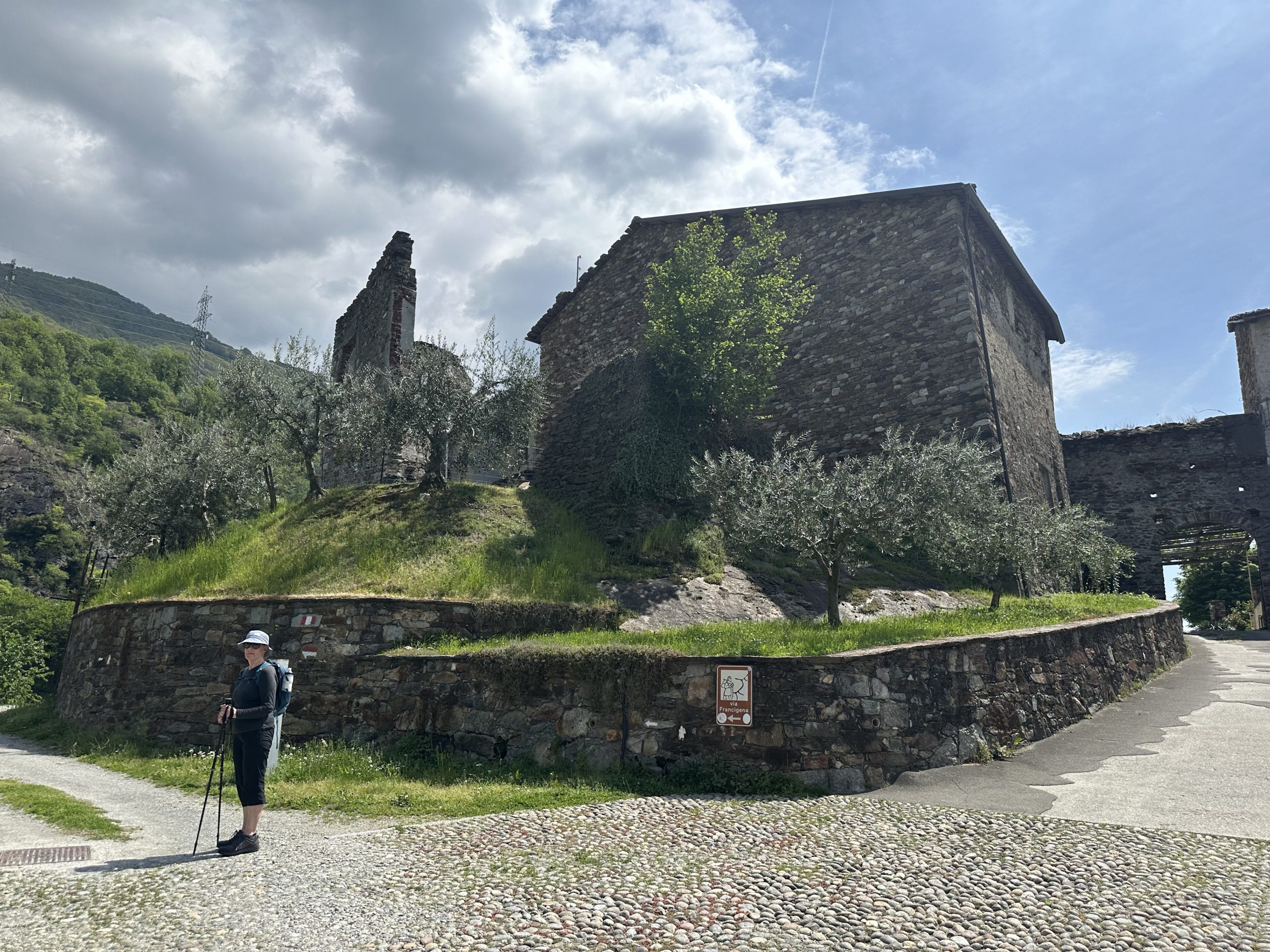
It was quite a challenging walk today, the route returning to the lower hillsides, the path often narrow, steep (both up and down) and rocky. Taking a break at the Capella di San Rocco, we got a wonderful view south along the valley. The flags of both Piedmont and Italy marked our crossing over from the province of Aosta.
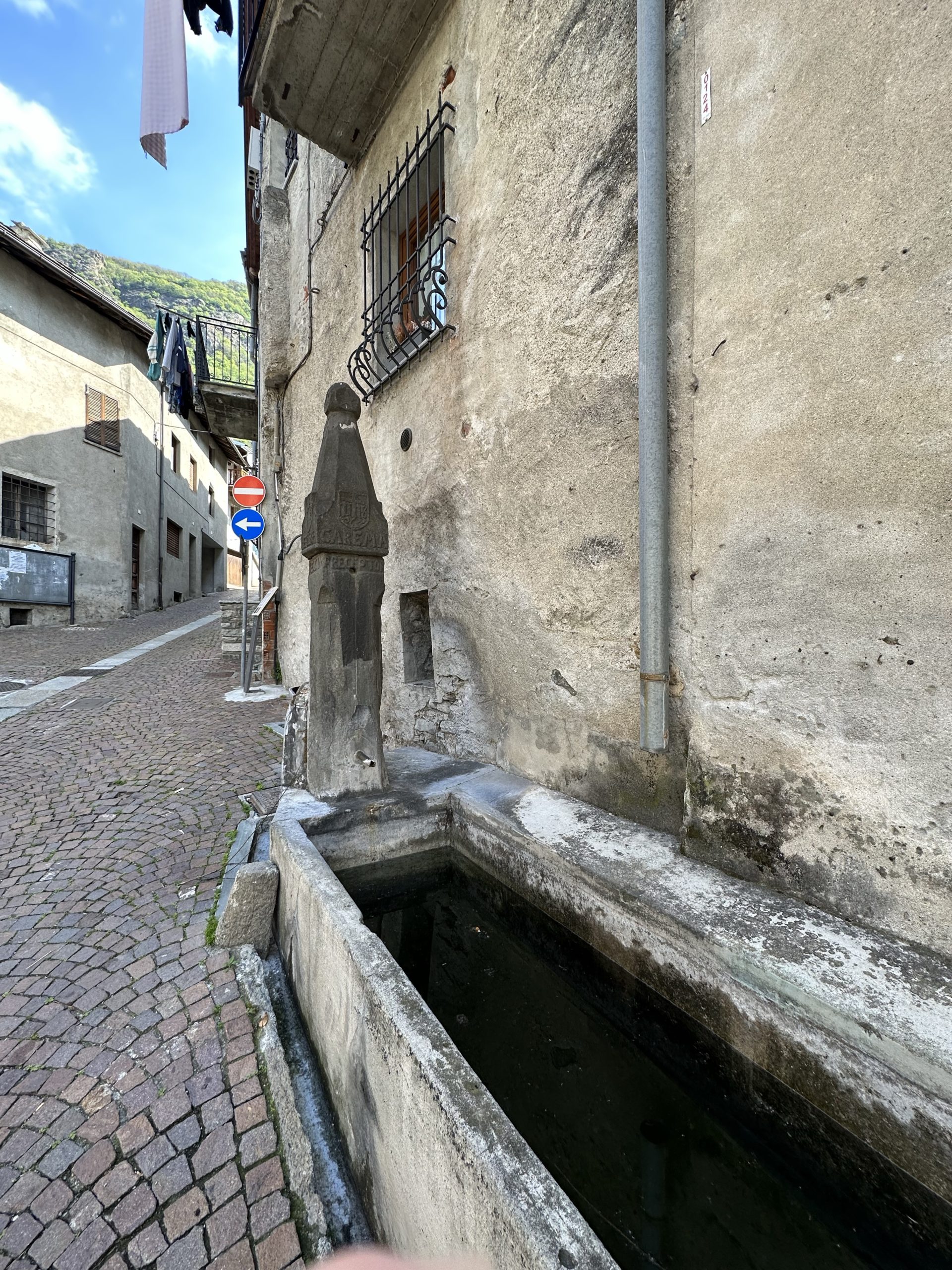
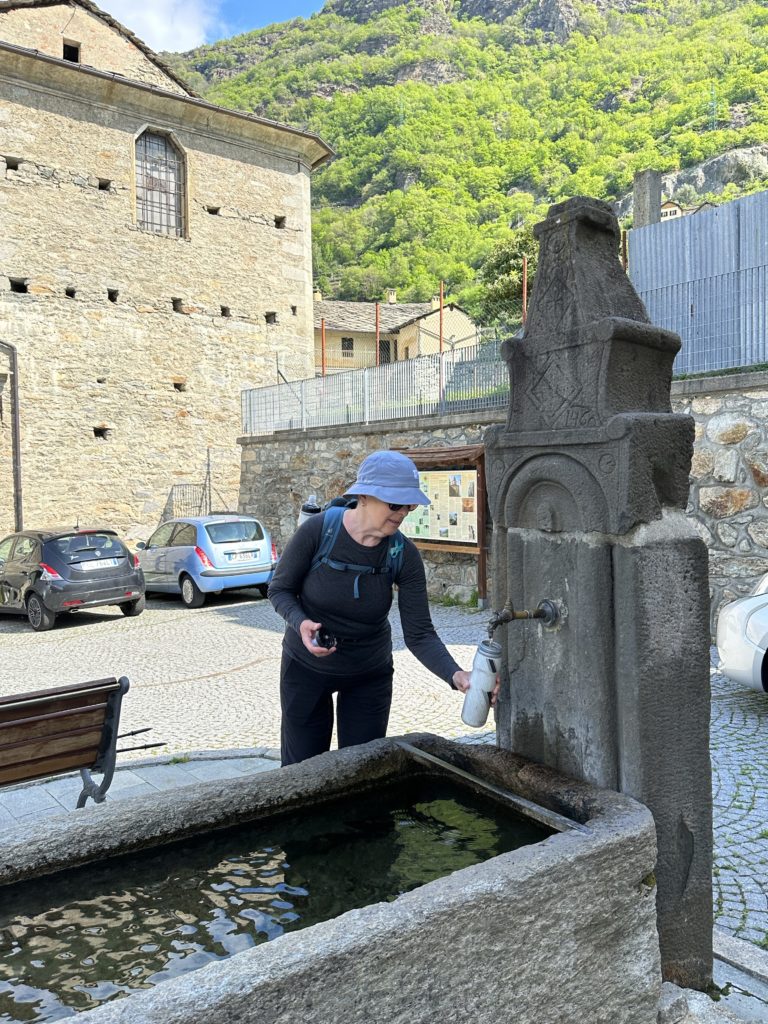
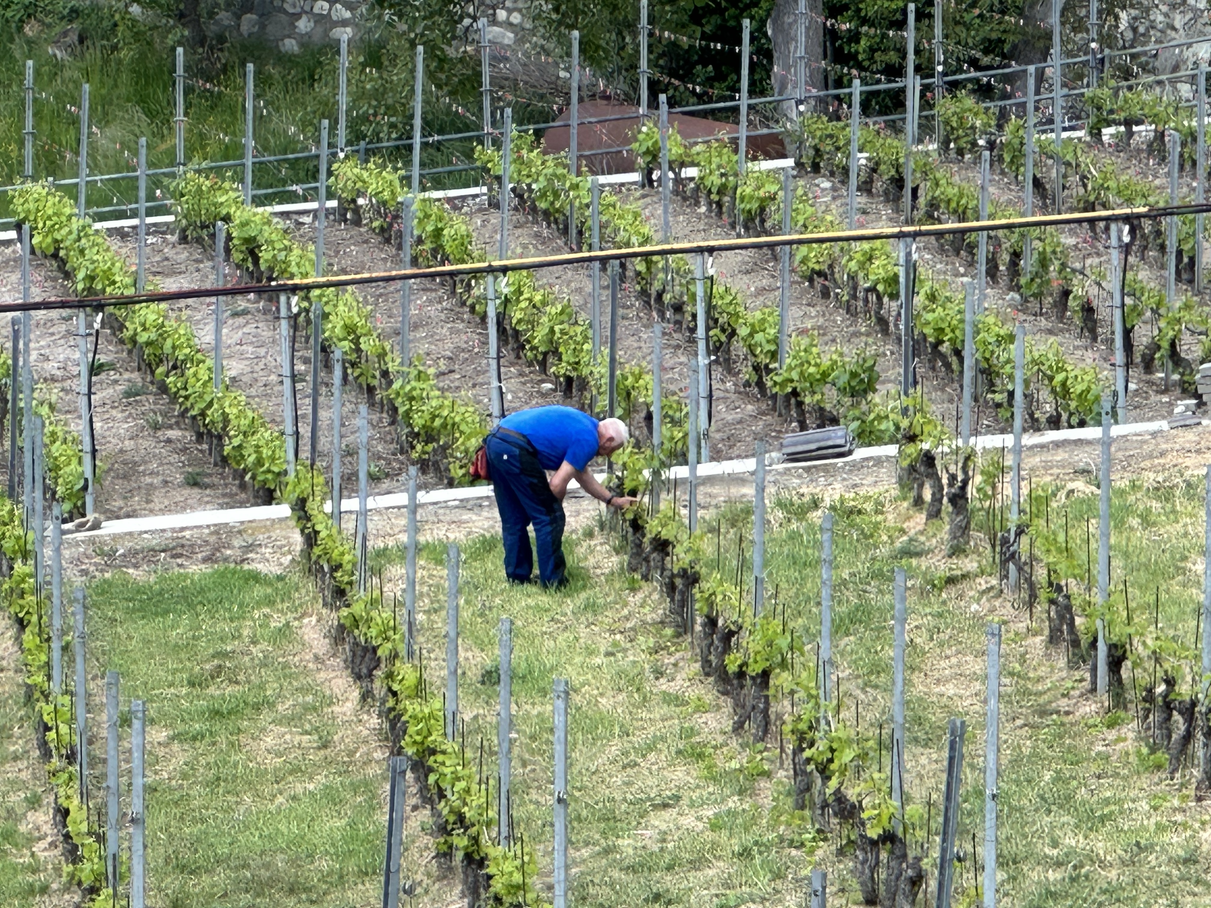
The area around Carema, a small village on the border between Piedmont and Valle d’Aosta, is covered with terraced vineyards of Nebbiolo grapes, used to make Carema DOC wine. Described as a natural amphitheatre protected from the cold north winds and with plenty of sunshine, but on a steep slope, the mountain has been terraced with dry stone walls with pergolas.
Each chestnut wood pergola, called a topia, is supported on one side by a dry-stone wall and on the other by a system of stone columns called pilun. The stone supports not only have the task of supporting the vines: they store the sun’s heat during the day and maintain an ideal microclimate at night. In addition, the suspended “wolf’s mouth” pergola also allowed the space underneath to be used for growing vegetables. When occasionally the path passed under a pergola, we appreciated the shade from the grape vines above!
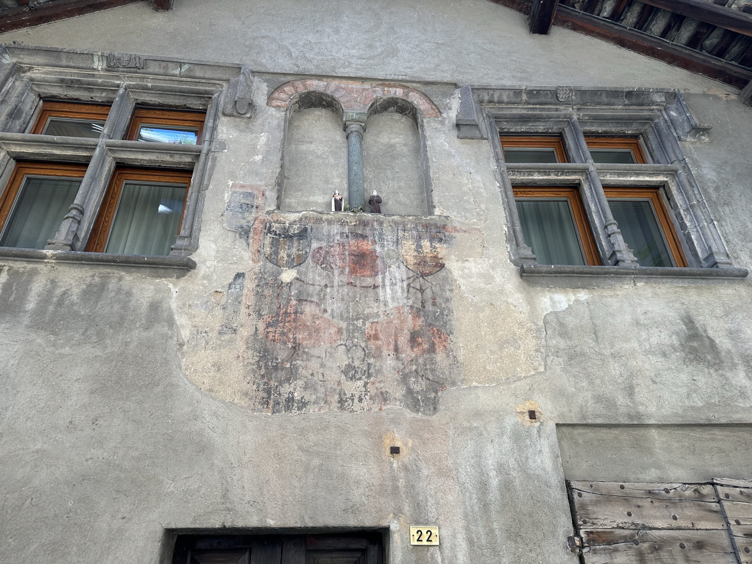
The Fountain in the Via Basilia in Carema was noteworthy for the inscriptions and coats of arms on the top of the stele: a cross-shaped coat of arms, French coat of arms, coat of arms with monogram of Saint Bernardino and Savoy Knot coat of arms with the probable date of construction of 1571. Put together all the phrases translate as “If someone is thirsty let him come to me and drink”.
The valley of Aosta was under the House of Savoy from the 11thC until the creation of Italy in 1870.
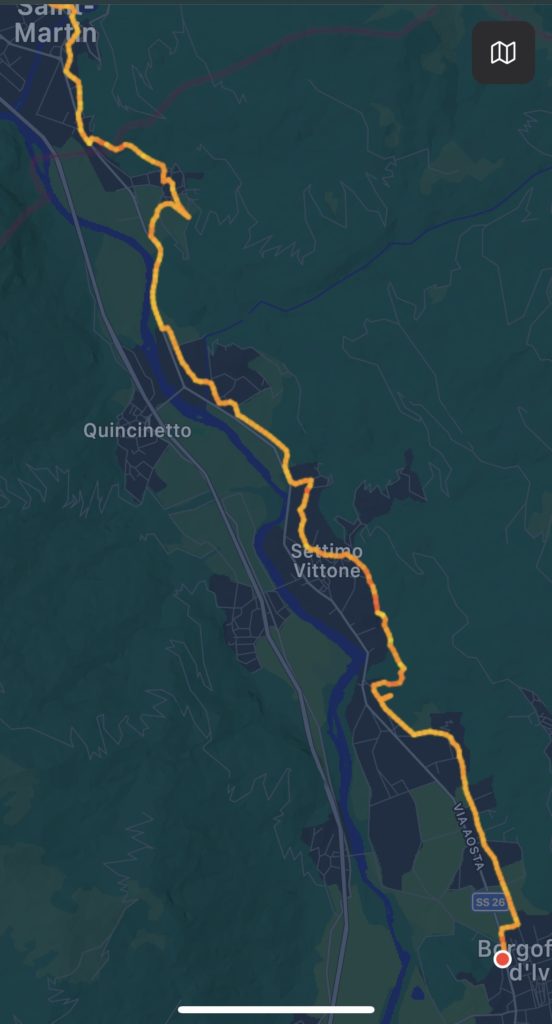
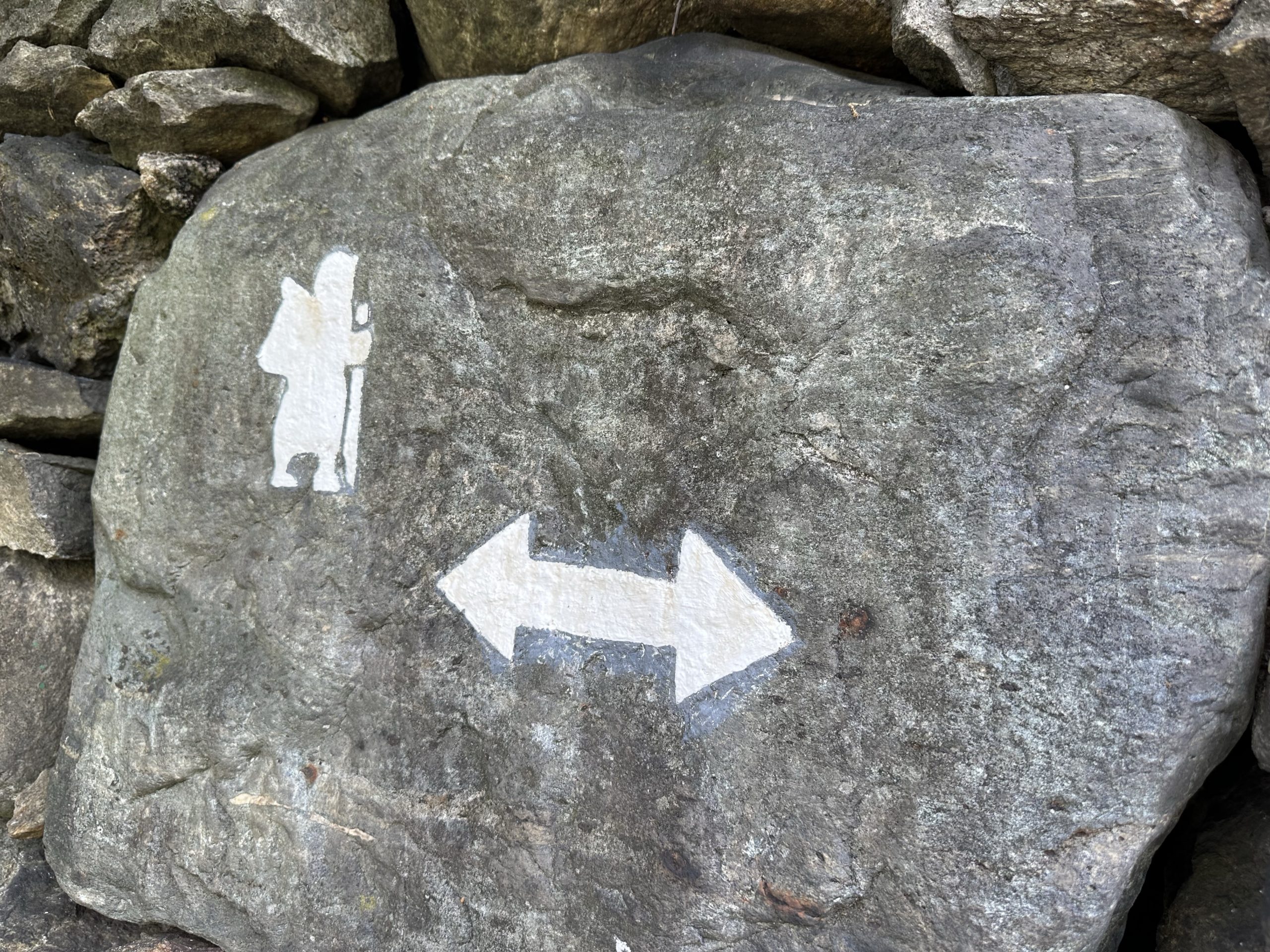
Walking past a campsite in Torredaniele, we were stopped by Claudia, a volunteer with the Ivrea chapter of La Via Francigena de Sigerico, a group dedicated to supporting the VF, including marking of the route with temporary signs until definitive signs are in place. Claudia and another volunteer were repainting the white pilgrim image along the route.
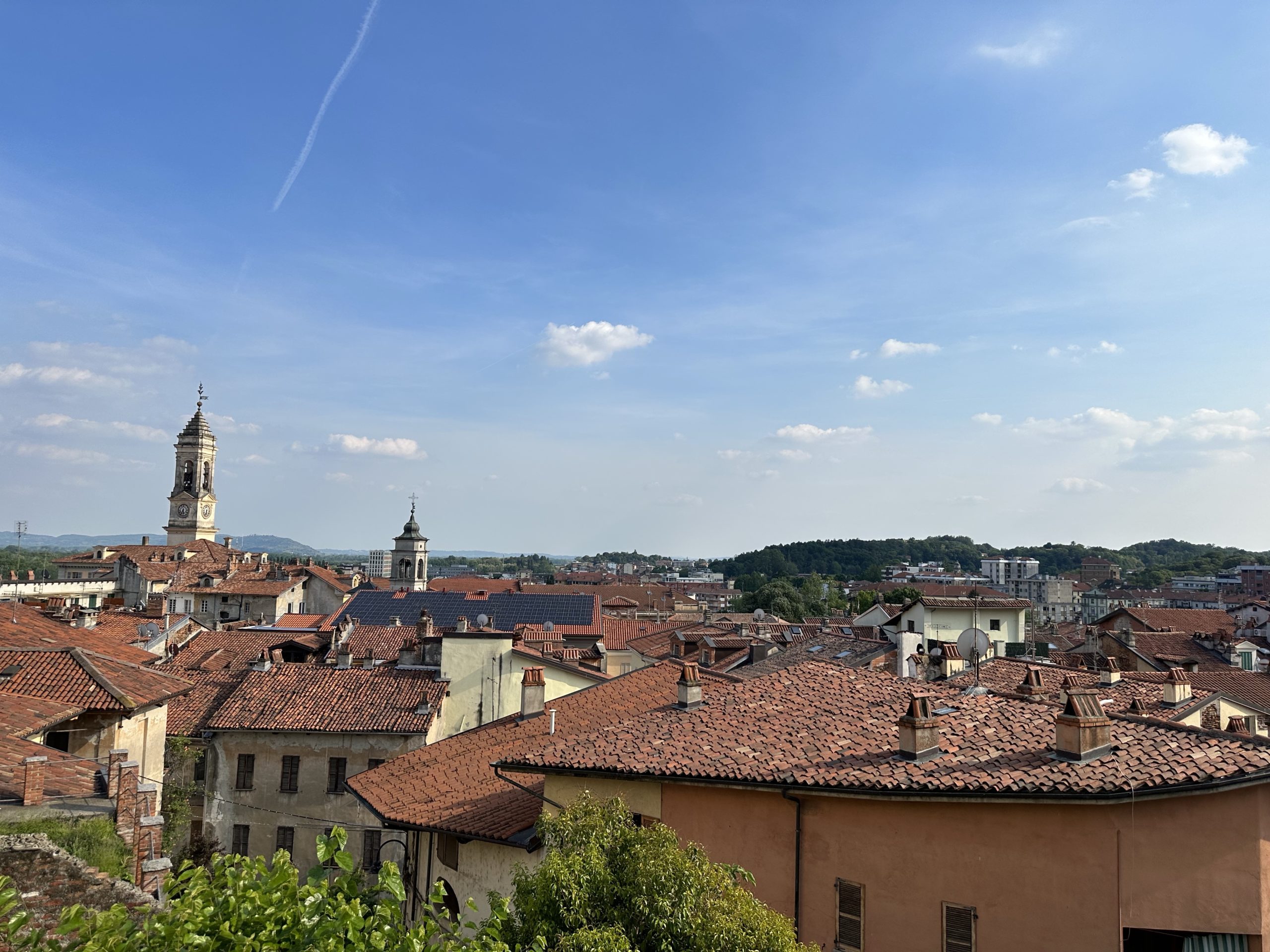
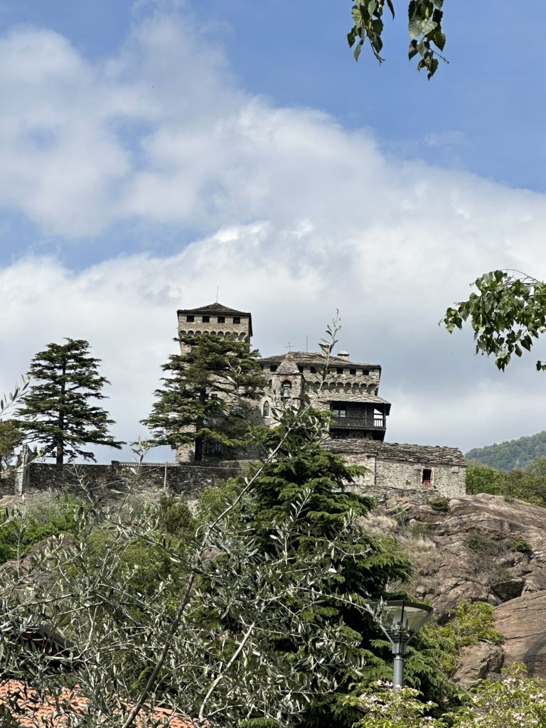
In Settimo Vittone, we passed by the “old” castle from at least the 9thC which was built on the route of the Via Francigena. Later we saw, from a distance, the castle of Montestrutto, from the same period.
At Borgofranco, we bought some fresh strawberries from a stand and waited for the local train to take us the rest of the way to Ivrea.
Al Drit, our B&B in Verrés was the kind of place you want to stay for a few days. A delightful property with a garden and private terrace, it sits just below the Castillo de Verrés, with a view out over the Valley. What’s more, the family also operates the excellent Ristorate La Tour next door. Although the restaurant is closed on Tuesday, we were served a lovely meal from their normal menu, including vegetable and saffron tart, vegetarian polpettes, tagliatelle with Aosta Bleu cheese, panna cotta and crostata (jam tart). Breakfast this morning included orange cake, croissants alla marmellata, cheese, yoghurt and good espresso.
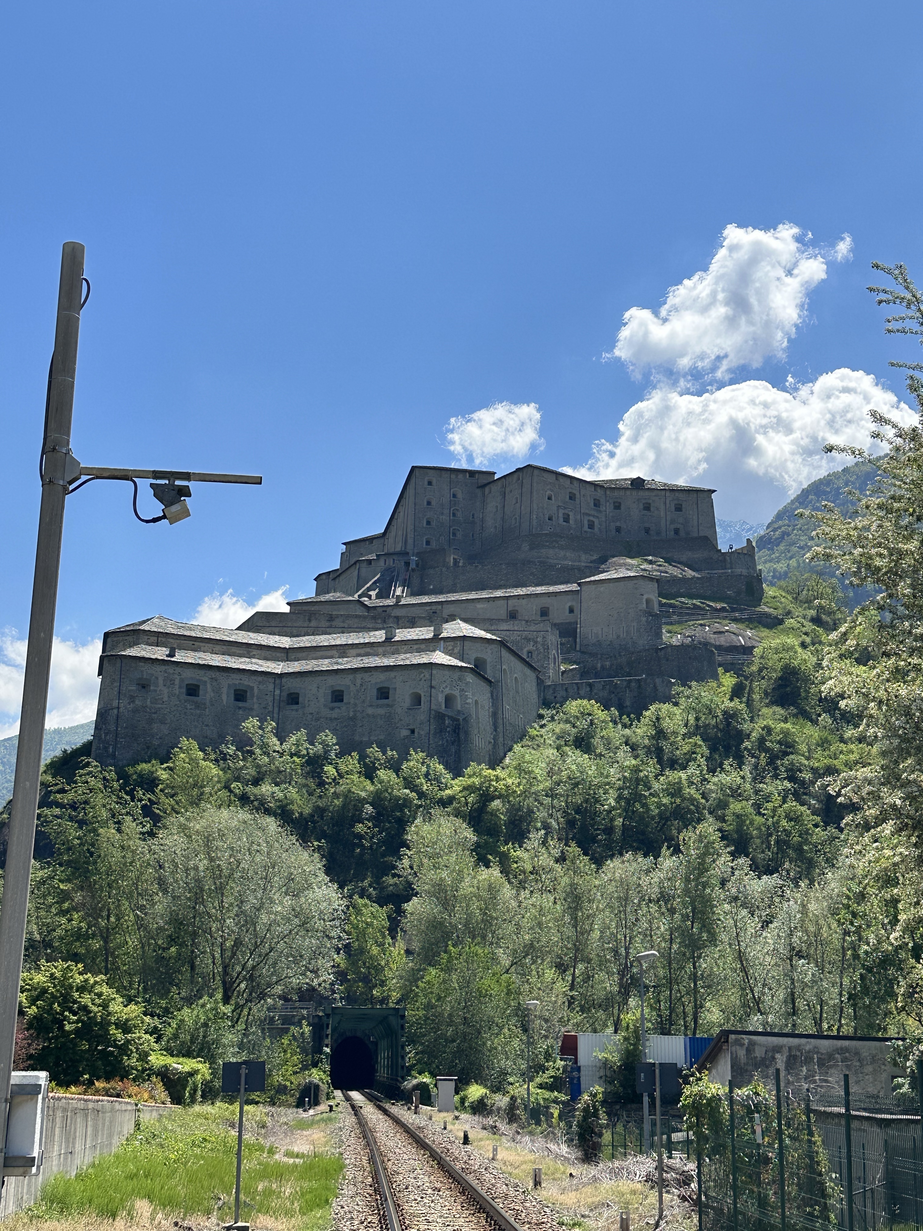
After seeing our bags off by taxi to Pont-Saint-Martin, we walked up to the castle to have a look at this impressive 14thC fortress which dominates the town of Verrés and the Val d’Ayas. By the beginning of the 19thC, the building was falling into disrepair. Through the efforts of the “Director of the Crown Delegation for the preservation of Piedmontese and Ligurian Monuments” restoration began in 1894 and was completed in 1920.
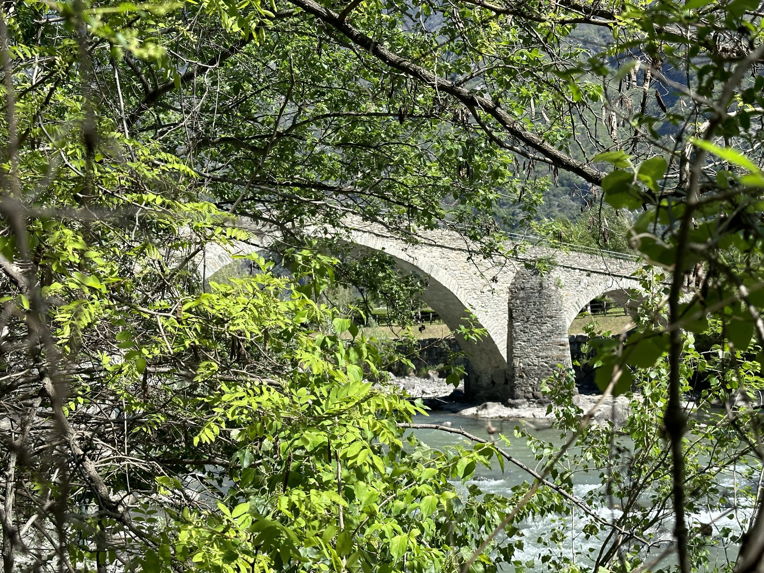
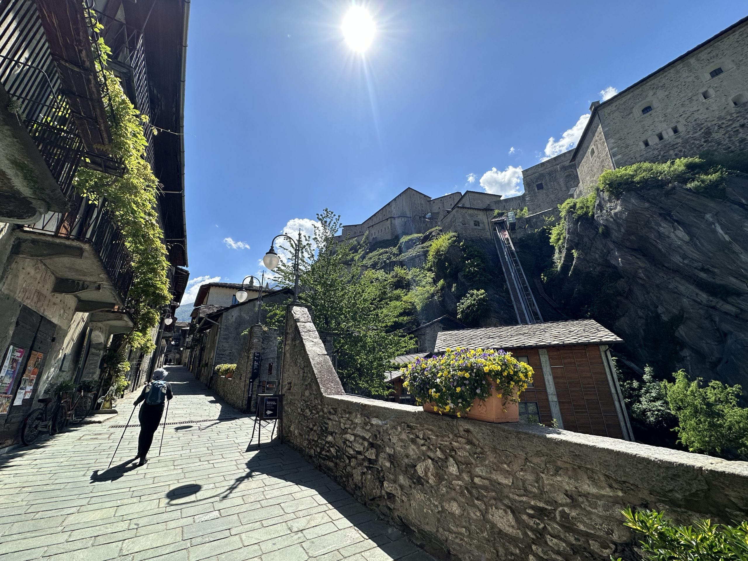
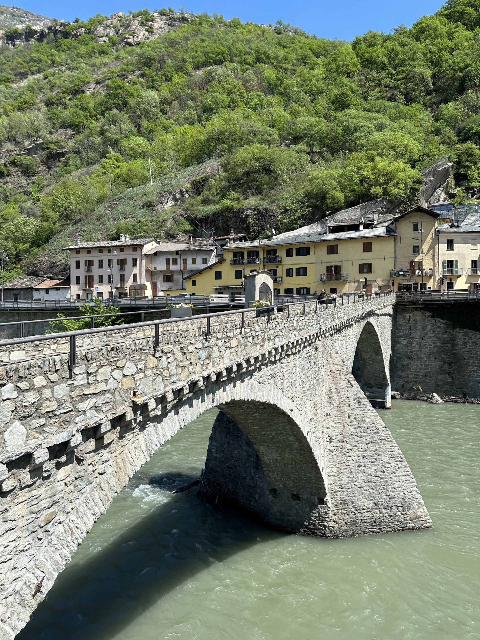
A cobbled path took us back down to the town centre, where we rejoined the VF which took us across the Dora Bâltea River and then along the western side of the valley floor. (We chose an alternative route avoiding a wide loop to visit the church of San Martino in Arnad.) The route was easy walking and interesting. Of note: the 18thC Bridge of Echallod (where Paul got caught up in thick underbrush and vines trying to get a photo), the ancient town of Hône, where in 1867, flooding from the river resulted in 93 people succumbing to cholera; the medieval village of Bard, dominated by a fortress originating from the 11thC. The streets are lined with historic houses too numerous to detail! And, lastly, in Donnas we were privileged (and slightly awed) to be able to walk along a section of the Via delle Gallie, the Roman consular road that crossed the lower Aosta Valley into Gaul. The stretch of road was carved into the bare rock for a distance of 221 metres, opening in a 4-metre-high archway.
Castillo di Verrés, Al Drit B&B
Castillo di Issogne
Ponte di EchallodCholera cemetery, HôneForte di BardMain rail line
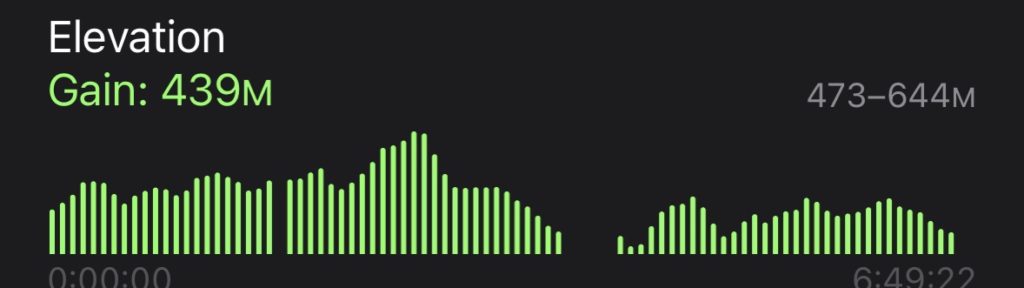
The guide book indicated that the 19km route to Verrez would be “another strenuous stage returning to the terraced hill-sides on the north and east flanks of the Aosta valley before descending to the broadening valley floor.” Unfortunately, this is where our interrupted training becomes relevant. While we have been walking 15 kms or more on relatively flat terrain in England and France, that same distance in the mountains requires a level of endurance I am still developing. (Paul, with his daily planks and push-ups, is fine!) I feel quite fit and strong for fifteen kilometres and then I suddenly crash. As today’s route is slightly longer, I did not want that to happen mid-hike. So, it was with reluctance that I saw Paul off on a brilliantly sunny morning, the snowy peaks revealed in all their majestic splendour. My job would be to transport myself and our bags to Verrés by taxi.
The frustration of not being able to hike this stage of the Via Francigena on such an exquisite day has me considering why I so want to do this walk, in whatever version I can. Herein are my musings.
Because this is an ancient pilgrimage route, there is much discussion among fellow “pilgrims” about purpose. For some, the notion of pilgrimage in a religious sense is appealing. Even for the non-religious, like me, as we walk the route, it is hard not to feel a connection with the many who have preceded us over centuries, perhaps in search of spiritual meaning. (The thought that anyone might assume a religious purpose on our part, however, prompted us to put a link on our blog to “Every child matters: National Day for Truth and Reconciliation”.)
A pilgrim, of course, does not have to have a spiritual purpose. As a York University site states,
‘Pilgrim’ and ‘pilgrimage’ are words that have carried a range of meanings over the centuries. The English term ‘pilgrim’ originally comes from the Latin word peregrinus (per, through + ager, field, country, land), which means a foreigner, a stranger, someone on a journey, or a temporary resident. It can describe a traveller making a brief journey to a particular place or someone settling for a short or long period in a foreign land. Peregrinatio was the state of being or living abroad.
(The term “peregrinus” was used in the Bible to refer to one’s journey through life. From the 4th century, peregrinus took on a further sense within Christian thought, describing a traveller with a particular religious goal.)
For me, the earliest meaning resonates. The notion of being on a journey, ie, rather than being a tourist, captures for me something of the experience I am seeking. There is always the hope that travel in a foreign land might expand the mind and broaden the heart. A slow journey, on bicycle, or in this case, by foot, assists this goal, through the gradual accumulation of information and new perspectives.
The physical aspect of hiking this journey is critical. Having previously toured by bicycle, we are both keen to experience again the satisfaction of pushing our bodies, the delight of being outside for a good part of each day, the sense of accomplishment and feeling of well-being. And, of course, we have the pleasure of seeing new places, meeting new people, eating great food and finding some basic connection in awkward efforts to communicate in another language.
Yet, I am also aware of another, more personal, reason for wanting to be here just now. Since a diagnosis of Stage 3C ovarian cancer in 2020, I live daily with the knowledge that I may have a recurrence. While this knowledge does not make me feel morbid, it certainly underlines for me the need to live my life fully. And that, ultimately, is why I’m here. I want the feeling of being truly alive that this whole experience offers.
It was a good day to walk but not as enjoyable as I was by myself. The description in the guide book referred to in Lois’ blog was accurate. I met Ad again a couple of times and passed the time of day with a couple of other walkers.
The 12-13thC Castles of Chenal and Saint-Germain -strategic fortresses controlling the valleyVia delle Gallie – Roman road along the valley, here with furrows left by countless wagons Green marble from local quarriesAlpine scenery, architecture and cows
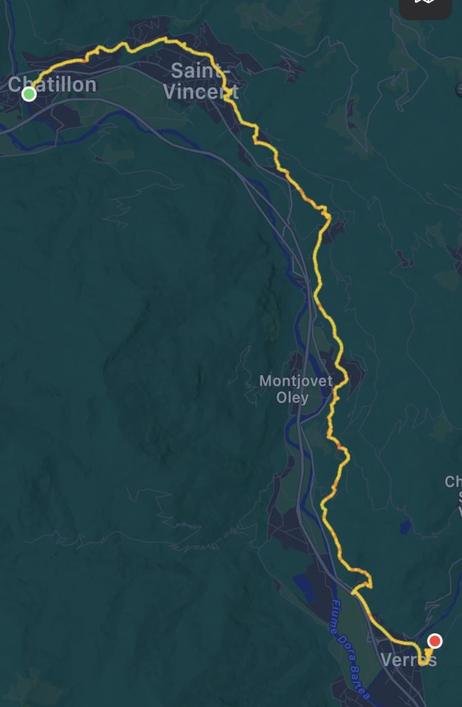
Our solution to the bag transportation issue was to take the 7-minute train journey to Châtillon, drop our bags at the hotel and return to Nus, all for 8€. The only problem was the hike up from the train station to the hotel, carrying 4 packs between us. Paul, being Paul, left Lois at a coffee bar enjoying a coffee and croissant while he lugged our 2 bags up the hill.
Seeing that the coffee shop sold panna cotta in small takeout quantities, we bought 2 of these to add to our lunch of cheese and ciabatta. It is May 1, a national holiday, but we found one bakery in the town open.
With light rain falling, we again took up the Chemin des Vignobles, with its frequent informative signs. We learned that the “adret” or south facing side of the valley, being warmer and more arid than the “envers”, was much more developed agriculturally, with the cultivation of wheat and oats at higher levels (now abandoned), and abundant vineyards and orchards lower down, as we have seen. Thus, the major settlements in early times were located in this part of the valley and became a preferred route of communication for trade over the Alps.
We could see the castle of Fenis (12th-14thC) across the valley, which is apparently the finest example of a non-single unit gothic castle in the Alpine region. We read that the castles in the valley were not self-contained entities in constant war with other fortresses, but that medieval lords, sharing the same needs and external threats, banded together, communicating among themselves by means of homing pigeons and visual systems employing mirrors, flags and smoke during the day and fires at night.
Walking through Chambave, we found an open bar where we stopped for hot chocolate and a cannoli. Later on the trail, as we were sheltering beside an overhang drinking tea, a fellow walker appeared. Ad, who is Dutch, had walked from Bristol (via Canterbury) to Reims last year and is trying to complete the walk this year. He was complaining that the weather was “bad, bad”!
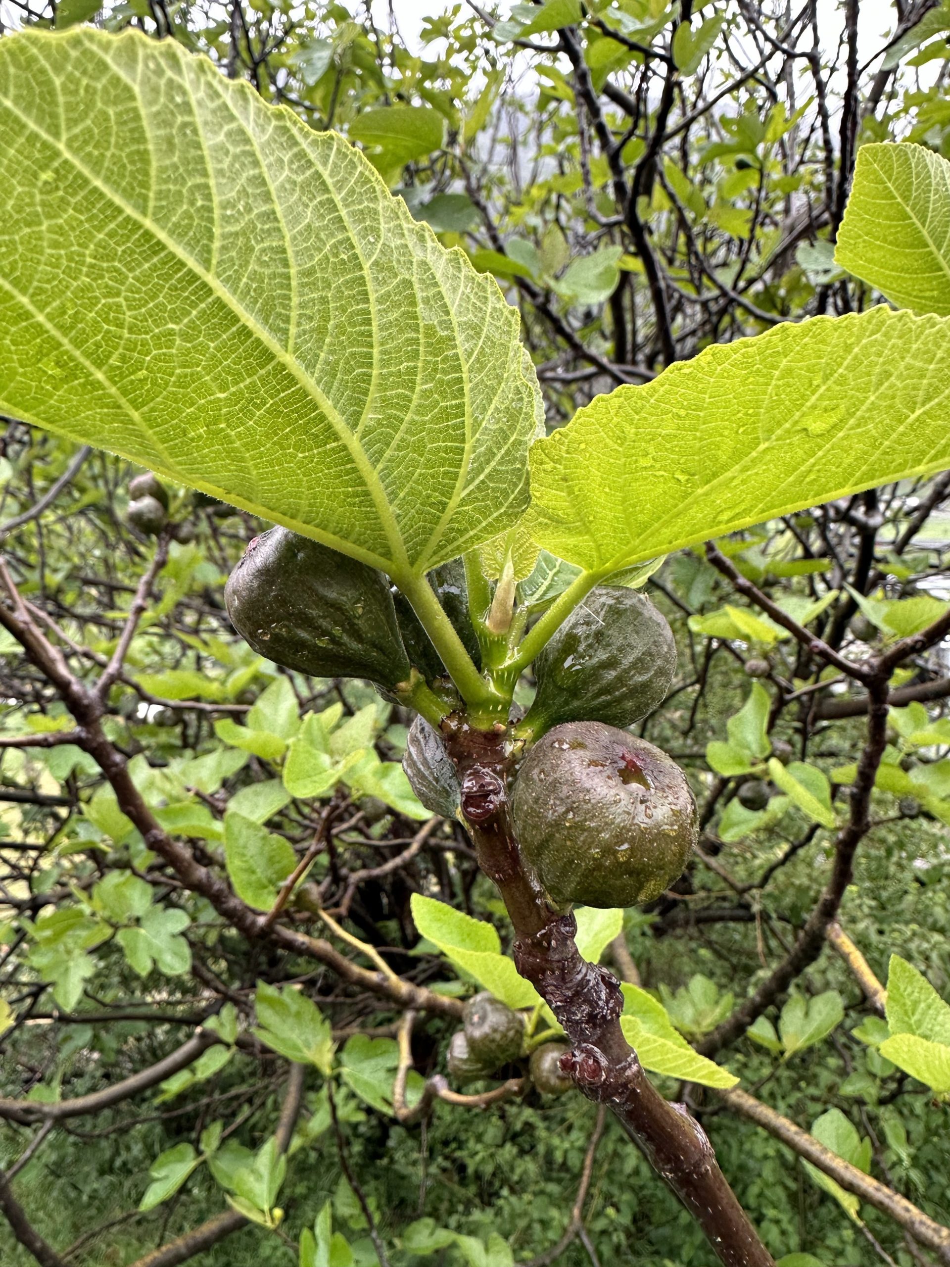
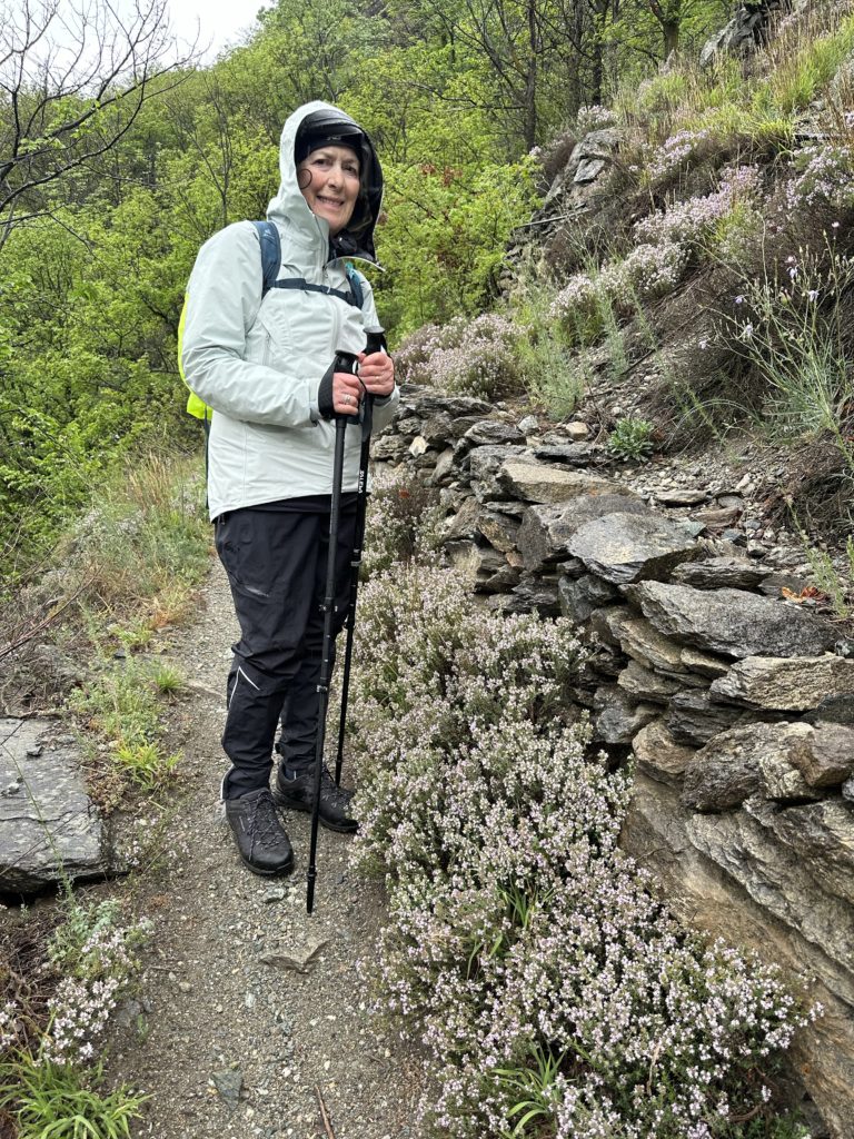
Along with vineyards and fruit orchards, including figs beginning to ripen, the path took us through deciduous forests of oak, chestnut and birch (among those species we identified). We had a few more very steep declines on narrow, rocky paths, which were slippery in the rain, but manageable with our new poles.
Ok, so you can’t have everything! The temperature dropped and the rain fell on us for most of the walk today. Clouds obscured the snowy peaks of the mighty Alps surrounding the Aosta valley. BUT, we saw Roman bridges, castles and spectacular scenery (even through the mist)! We’re happy. The walk was made even more pleasant with the aid of our new walking poles and by a significant reduction in the weight of our packs – Lois, in particular, traded her 30L pack for a new 10L daypack.
As arranged, our bags were picked up by Sr. Pelanda. An Air Tag enabled us to track them to their destination! After today, however, we will have to come up with a different plan, as he later texted to say the cost would go up significantly as we got further away from Aosta.
After espresso, cappuccino and a marmalata croissant for Lois, we headed east through the Porta Pretoria, built in 25BCE, passed by the Arco di Augusto from the same era and then walked across the Roman Ponte di Pietra, all in the space of a few minutes! We soon climbed high above the valley, the path often following the routes of ancient “rus” or irrigation canals, which have enabled agriculture and rearing of cattle (cow bells were heard), goats, and sheep for millennia. We stopped for our mid-morning hot chocolate and poppy seed pastry close to the Saint-Christophe 12C church, where a Sunday service was underway. Later, we passed the Castello di Quart, dating from 1185, currently under renovation. “At the mouth of the Valsainte, on a promontory that is steep on all sides, rises the castle of Quart”. Appropriately, the slopes were covered with ancient vines bearing new shoots along the Chemin des Vignobles.
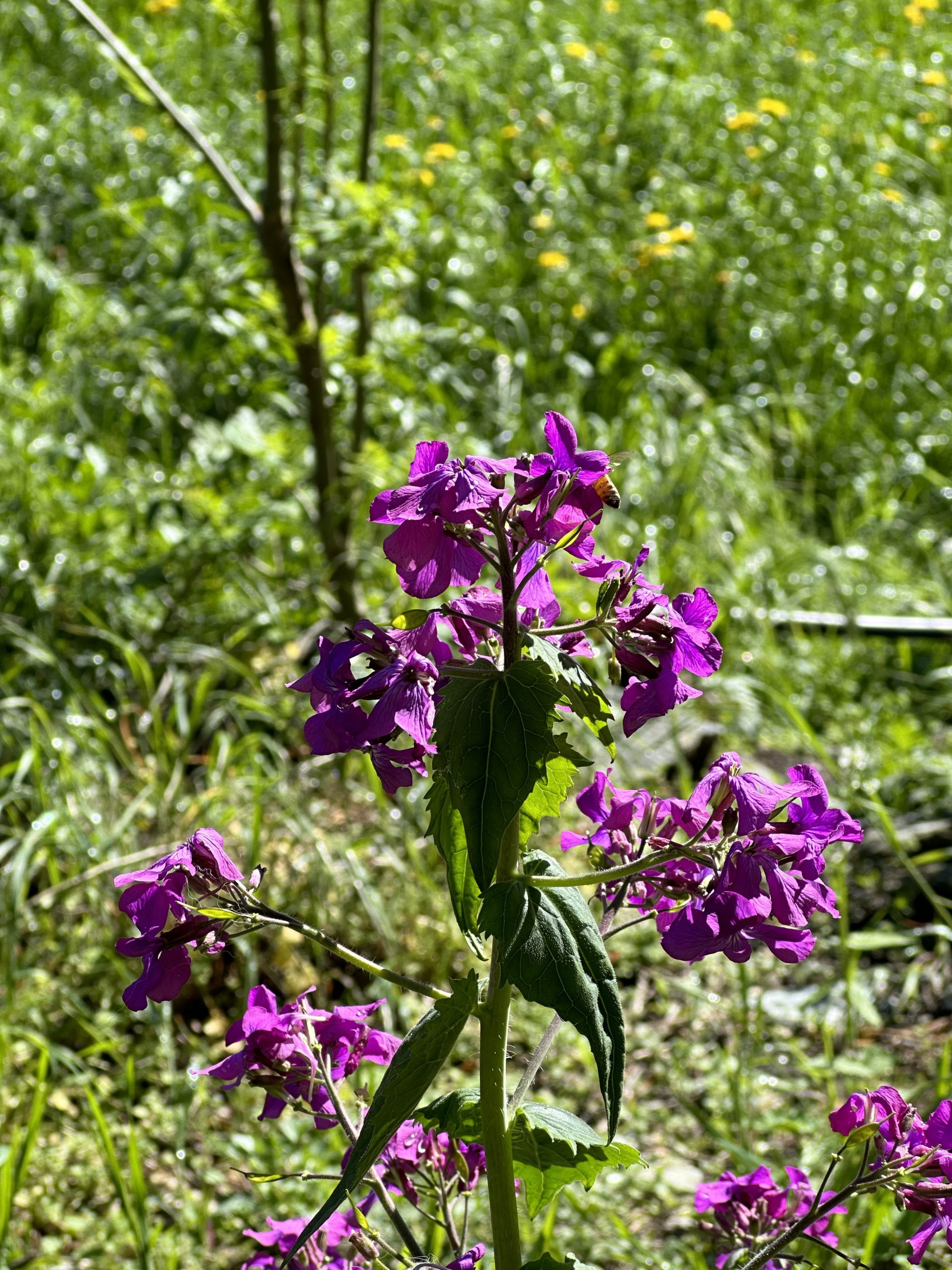
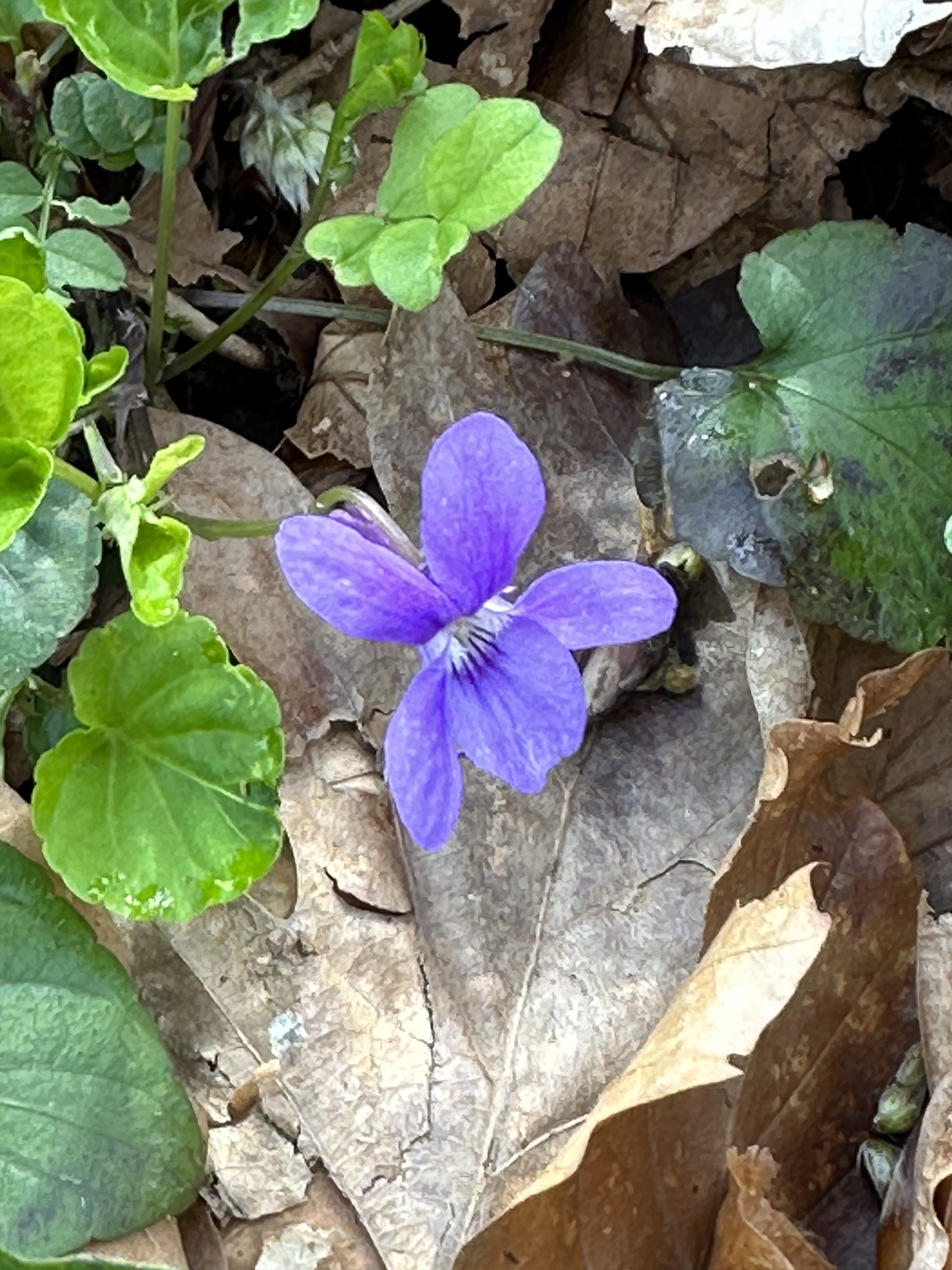
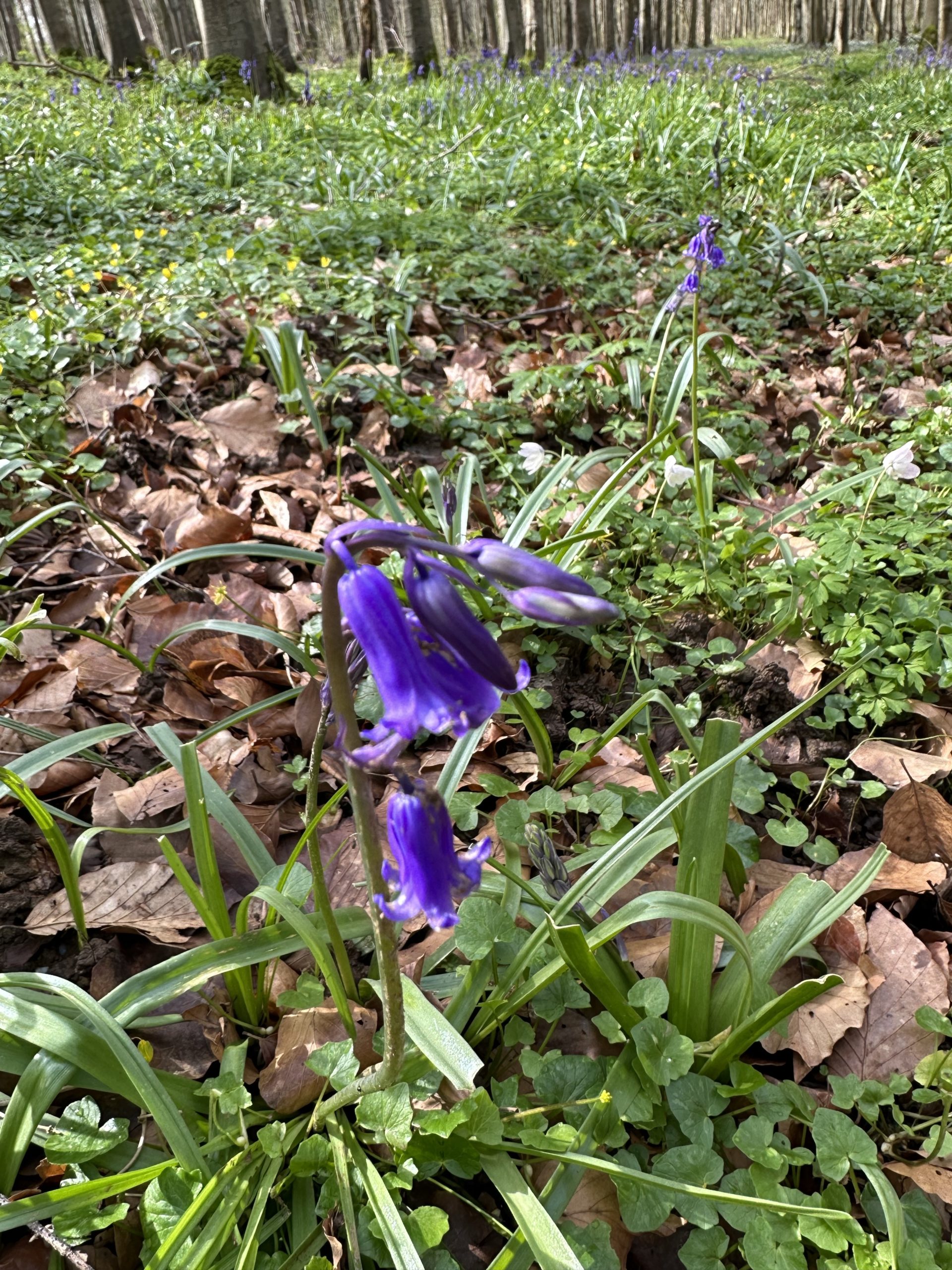
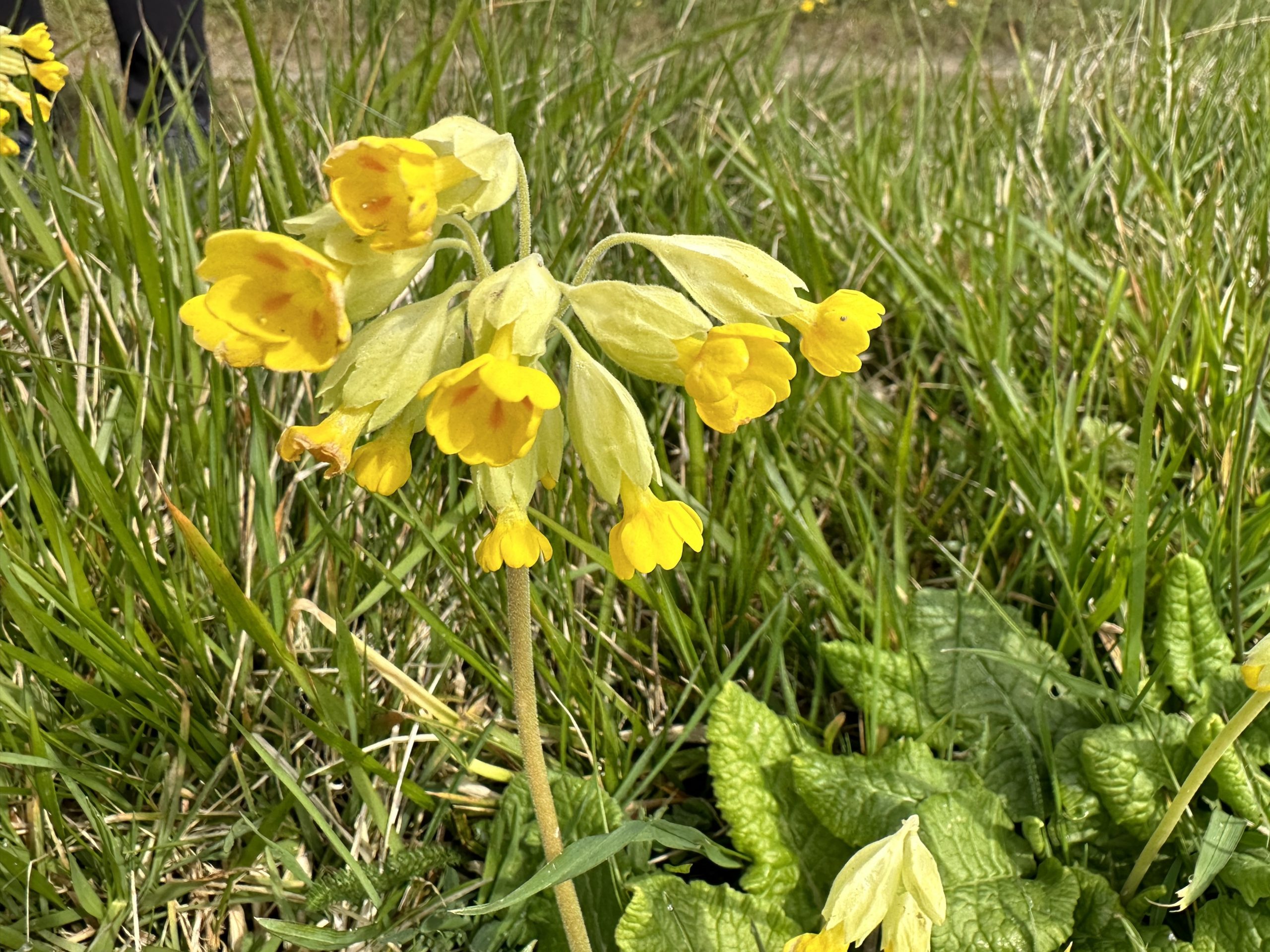
In other signs of spring, the fragrance of wisteria trailing along old stone walks, Rosemary in bloom, budding roses, flowering lilacs and purple irises.
The paths were great (no mud!) until a last steep section descending to Nus, where rains had washed rocks and stones down the path, making navigating difficult. Wet and cold, we recovered over pear, Gorgonzola and Fior di latte pizza and a glass of local red.
Marmelata croissant, Hôtel de Ville (the region is bi-lingual)
We left Saint-Quentin early on Thursday arriving at Paris Gare du Nord in time to take the metro to Paris Gare du Lyon, have an espresso and share a pain-au-raisin and catch the train to Geneva. A direct train to Turin left just before us, but was fully booked. In any case, we had time in Geneva to reminisce and enjoy a leisurely patio lunch at La Matze. Two trains later, we joined the TGV from Lyon to Turin (Torino). It was noticeably warmer when we eventually arrived in Turin, the summer feel confirmed by the nocturnal drone of mosquitoes in our hotel room!
Turin and Aosta
Friday morning, we took the slow train to Aosta which gave us a sense of the alpine valley we will be walking through. We checked into one of Le Lion apartments, very well-appointed and a 5-minute walk from a supermarket and the old city centre. There were also welcoming gifts of local products, including candies, cookies, apple juice, beer and a bottle of Aosta Valley wine (Torrette). We took an extra day off to see a bit of the city and to prepare to continue our trek. First, new poles were in order, having had ours confiscated at security in YYJ. We also decided to try to arrange baggage transport for what we wouldn’t need to carry each day, considering some climbing that we will have to do until we are out of the Alps. Locating someone to do this took some help from the local tourist office. We hope it works out!
Despite the mist and light rain that fell today, we had a lovely day exploring the city. Enclosed by the Alps to the north, south and west, the spectacular setting for the ancient city of Aosta competes for attention with the city’s impressive Roman ruins, pretty cobbled streets and historic centre, the latter filled with enticing restaurants, pasticcerias, gelaterias, and high-end shops. With some restraint, we limited our eating out to lunches and coffee stops, buying fresh pasta to cook for dinners (along with the excellent bottle of Torrette). Following a self-guided tour, we visited the Praetorian Gate, dating from 25BCE, and the remains of a Roman theatre from 1AD. Apparently, there are some arches still standing from the amphitheater, but to see them requires knocking on the door of a convent and requesting entry from the sisters. We had another gelato instead!
An unexpected treat was an exhibition of the art of Jean Miro which opened today in the Regional Archeological Museum. The well-curated and extensive exhibition gave us a quite different perspective on the influences and life of an artist we have both long admired.
Foodwise, espresso is much better here than further north (7.5/10 in Turin – from India)! We sampled gnocchi and fonduta – a cheese sauce made with fontina cheese which is made in the valley
We had a day off in Saint-Quentin today for two reasons. One, it looked like an interesting city to explore (it is), and, two, we needed to plan a change in our itinerary.
Our original plan had been to walk the first half of the Via Francigena, from Canterbury to the St. Bernard Pass, as spring turned into summer. However, spring seems a little slow in arriving in northern France this year and our thoughts are turning southward. We have now decided to head to Aosta and walk the second half of the route (or part of), in hopes of finding warmer weather and less mud.
We are grateful to have been able to do part of the northern half of the route (with interruptions due to illness, we walked 135 kms, just under half the way from Canterbury to here). We have met up with old friends and met new ones, attended Easter Evensong in Canterbury Cathedral, hiked the ancient North Downs Way, experienced gale force winds along the Côte d’Opale, witnessed the legacy of war and resilience of people in Hauts-de-France, enjoyed the people, history, architecture and great food of an area of France we hadn’t yet visited, eaten amazing cheeses and the best croissants (and the wines have not been shabby either!).
We will take the train to Turin tomorrow (via Paris) and then on to Aosta on Friday.
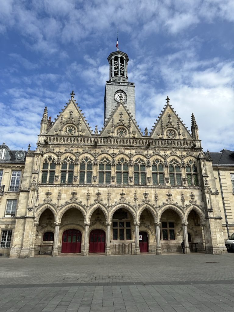
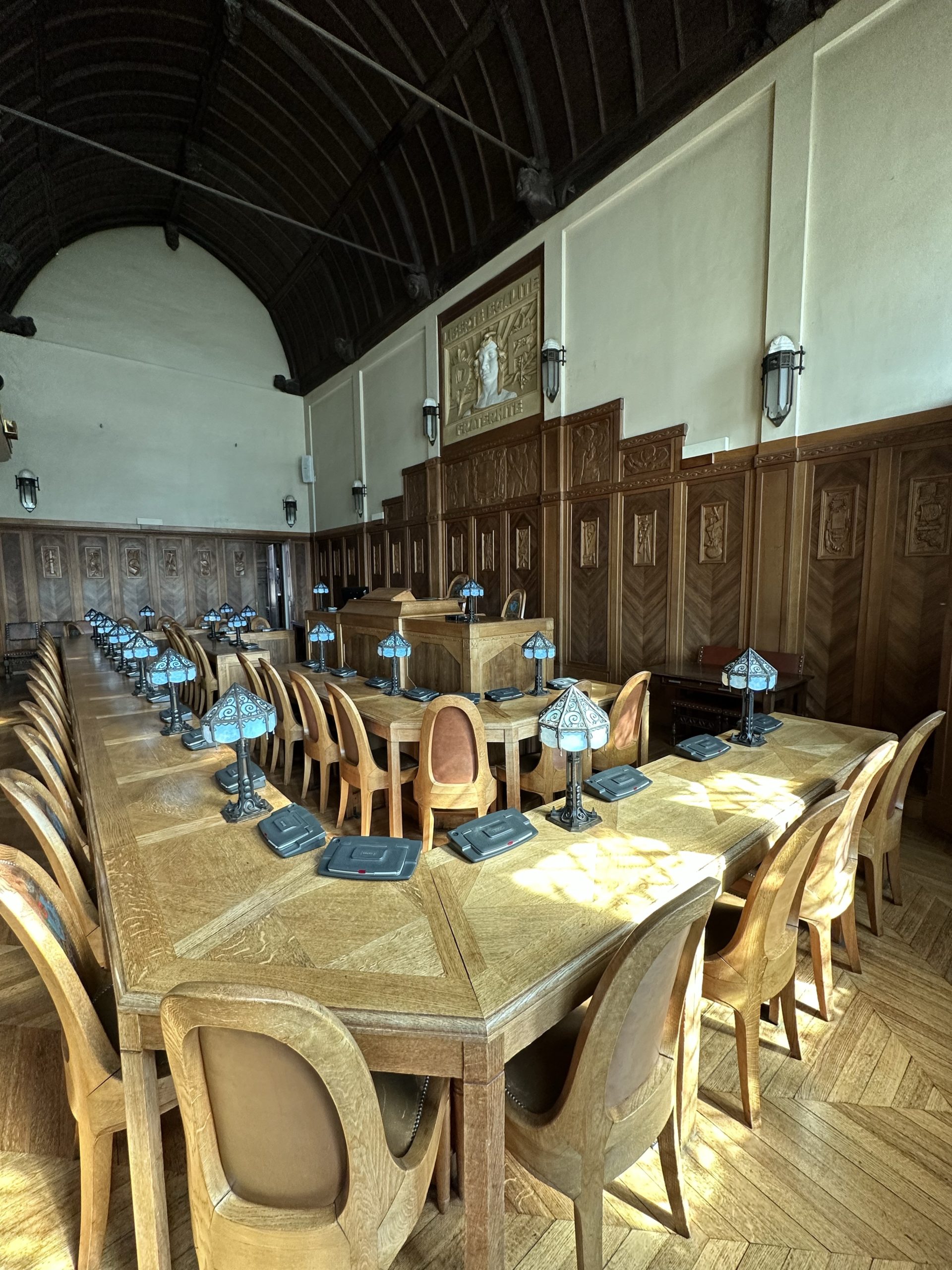
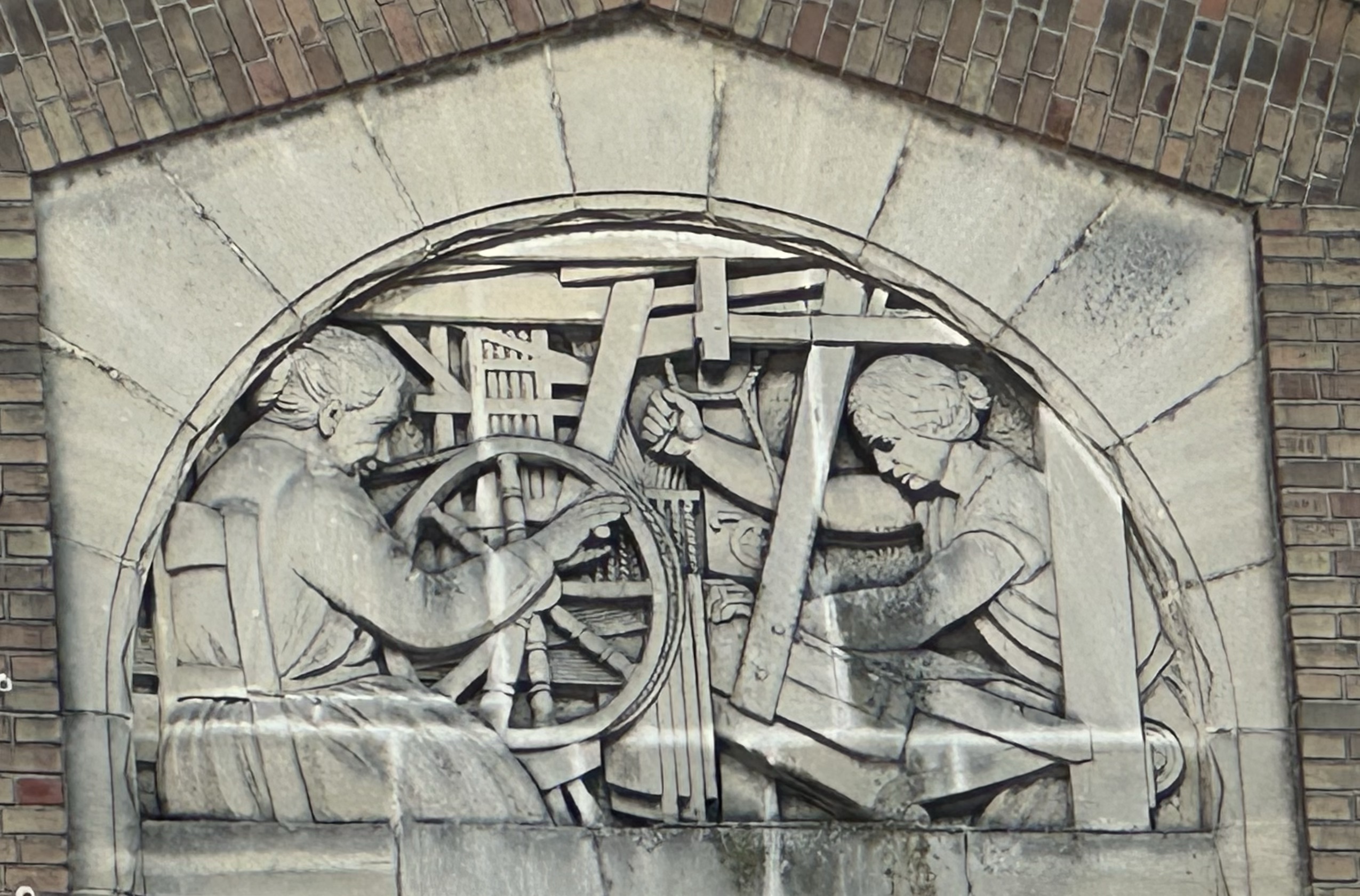
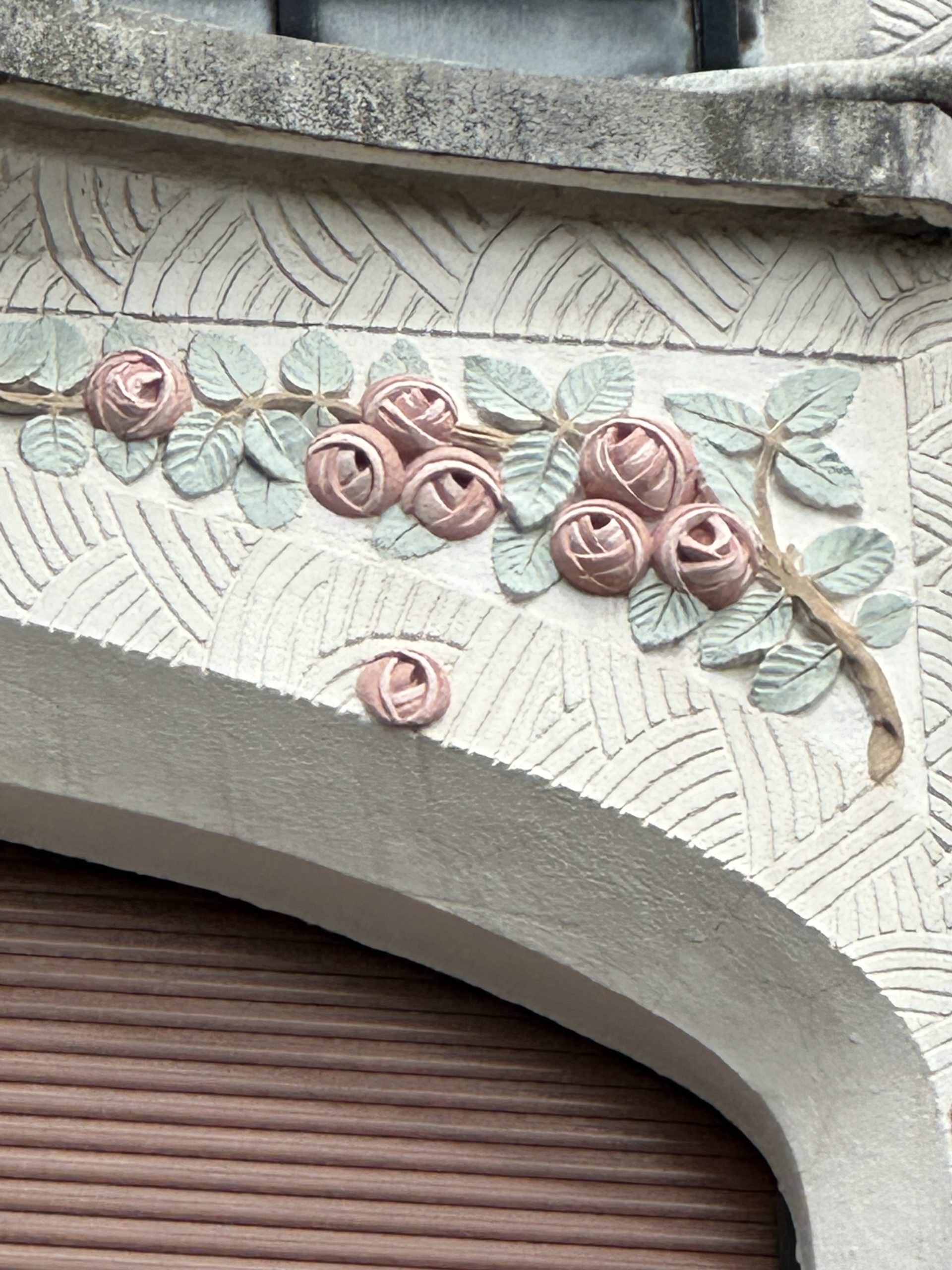
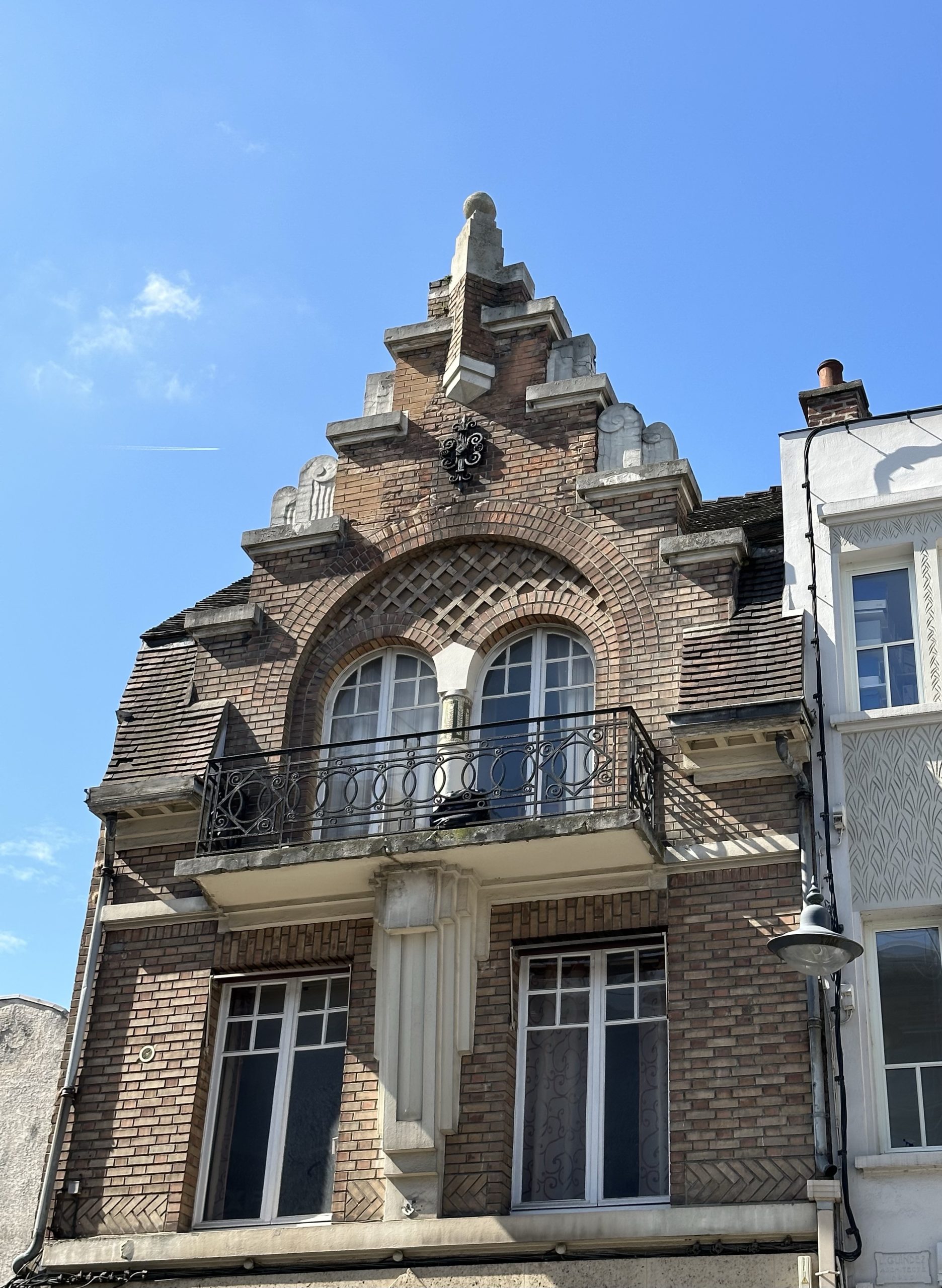
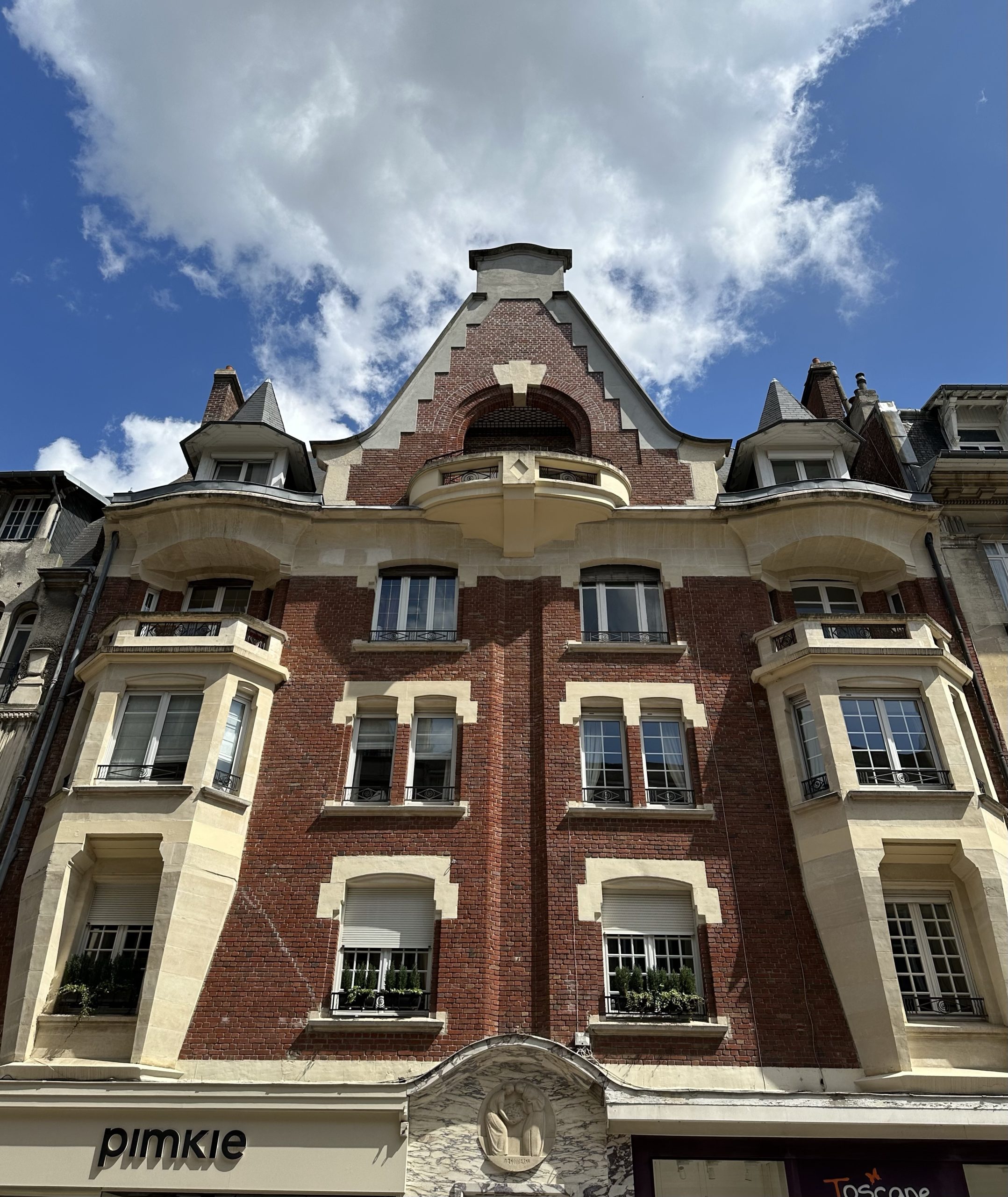
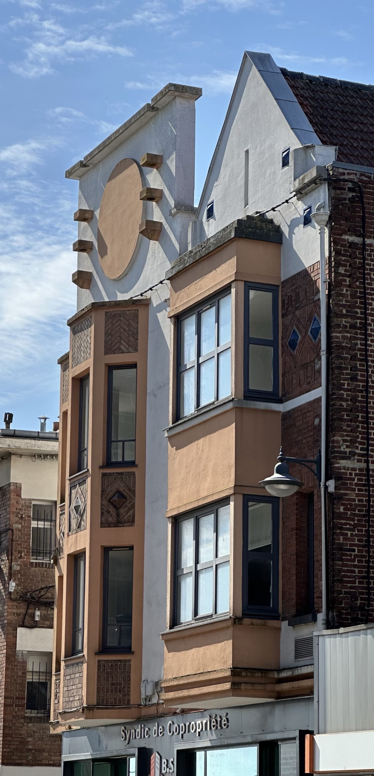
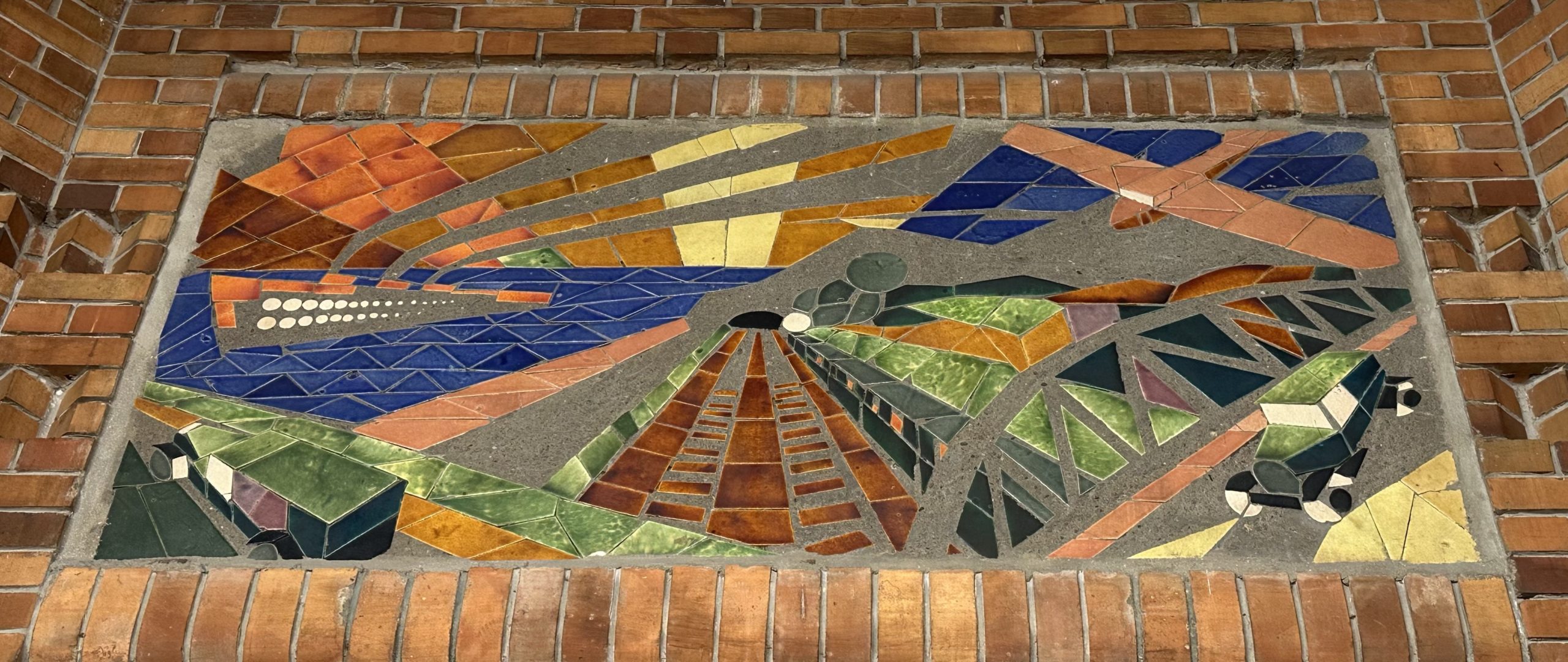
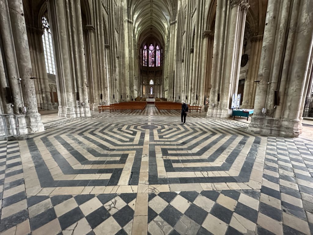
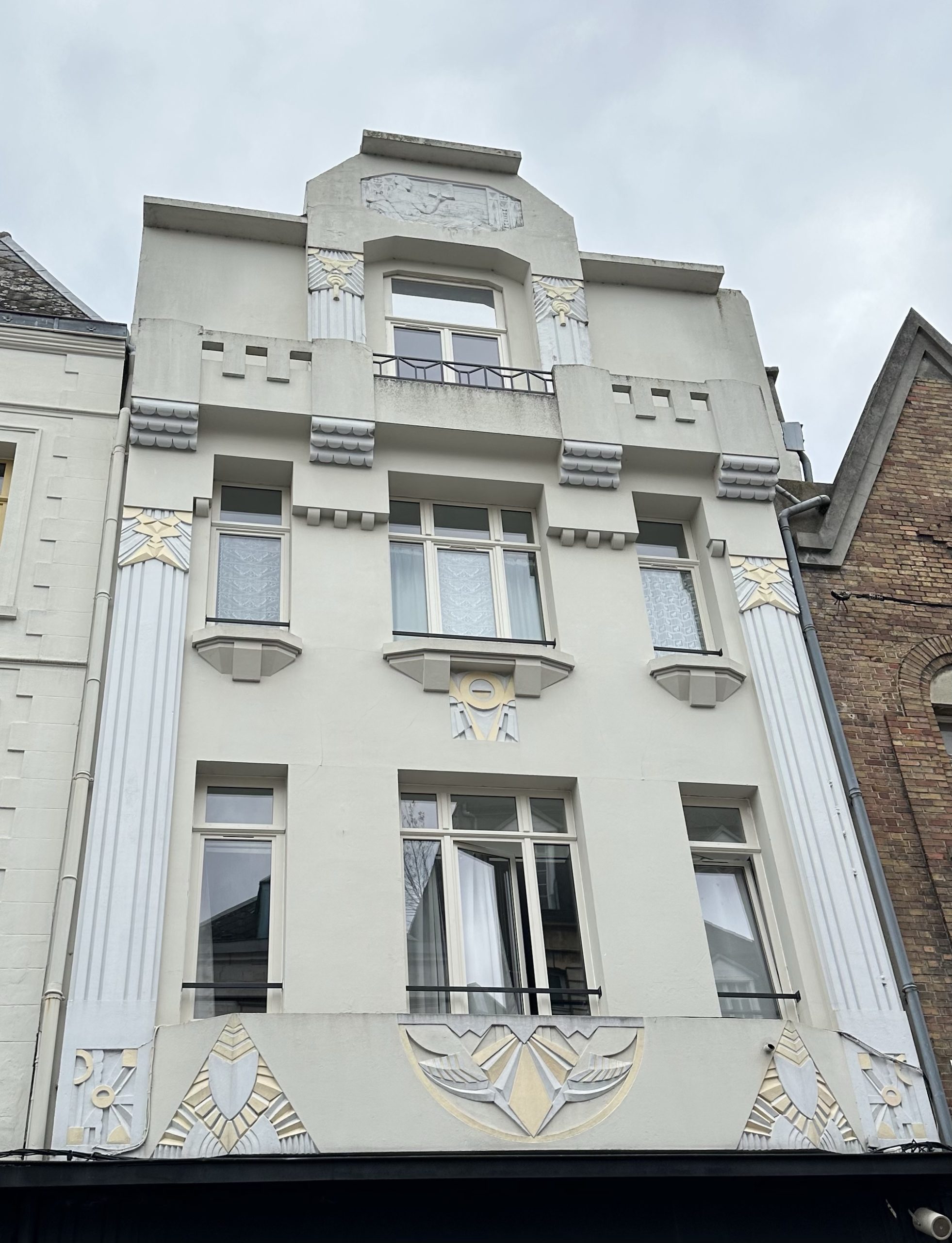
Saint-Quentin offered a fascinating insight into the Art Deco period of the 1920’s and 30’s. We hadn’t quite appreciated before the relationship between the Art Deco movement and the end of WWI, with its consequent need for reconstruction and the impulses for change, coupled with the developing use and availability of reinforced concrete. Saint-Quentin, like many of the towns we have passed through, suffered damage to 80% of its buildings in WWI. With an audio-guide and pass from the tourism office that gave us access to the exquisite Salle du Conseil in the restored Hôtel de Ville, we also saw wonderful examples of Art Deco architecture in a number of other buildings, including private residences, a pharmacy, a department store, a cinema and the post office. Two of the stained glass windows in the Basilica are also in Art Deco style. In addition, the Basilica has a labyrinth on the floor of the nave, in place since 1495.
Hôtel de Ville de Saint-Quentin
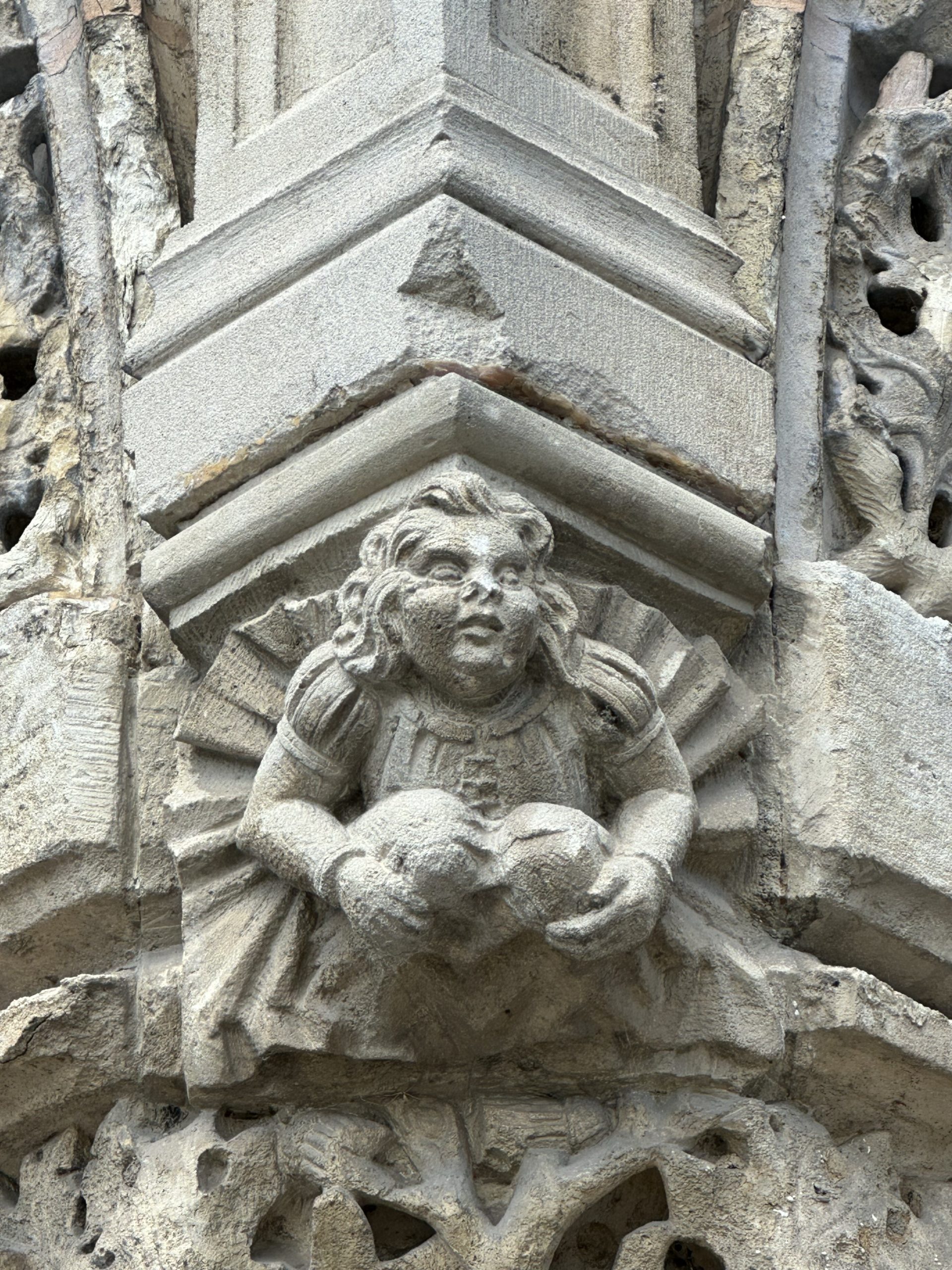
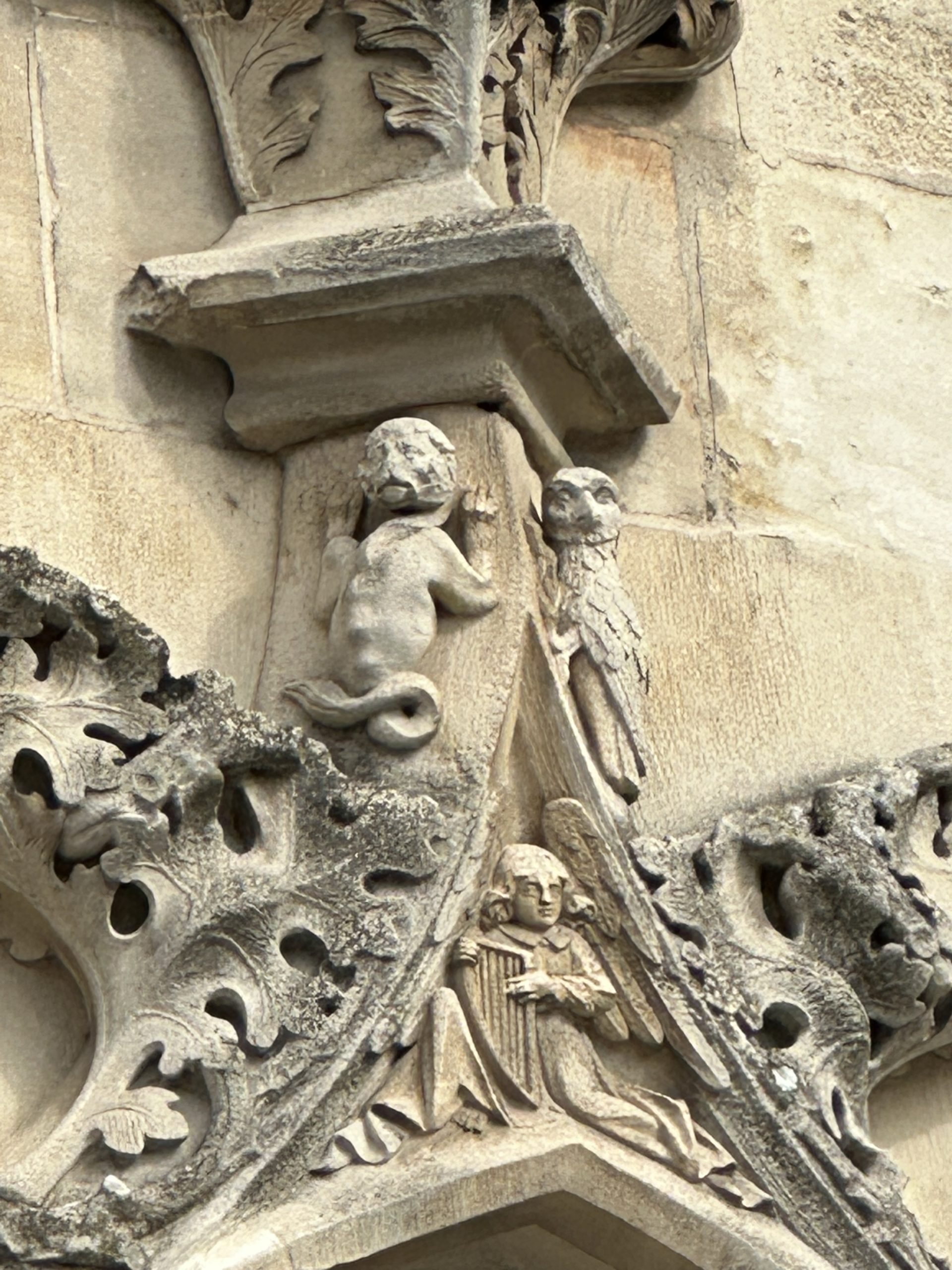
Some of the 173 figures carved in the facade of the Hôtel de Ville
La Salle du Conseil
Art Deco detail: the textile industry (important up to the ‘70s, le commerce, Coco Chanel roses
Top right: Cinema Carillon. Bottom centre city fish auction hallArt Deco “oasis” motif
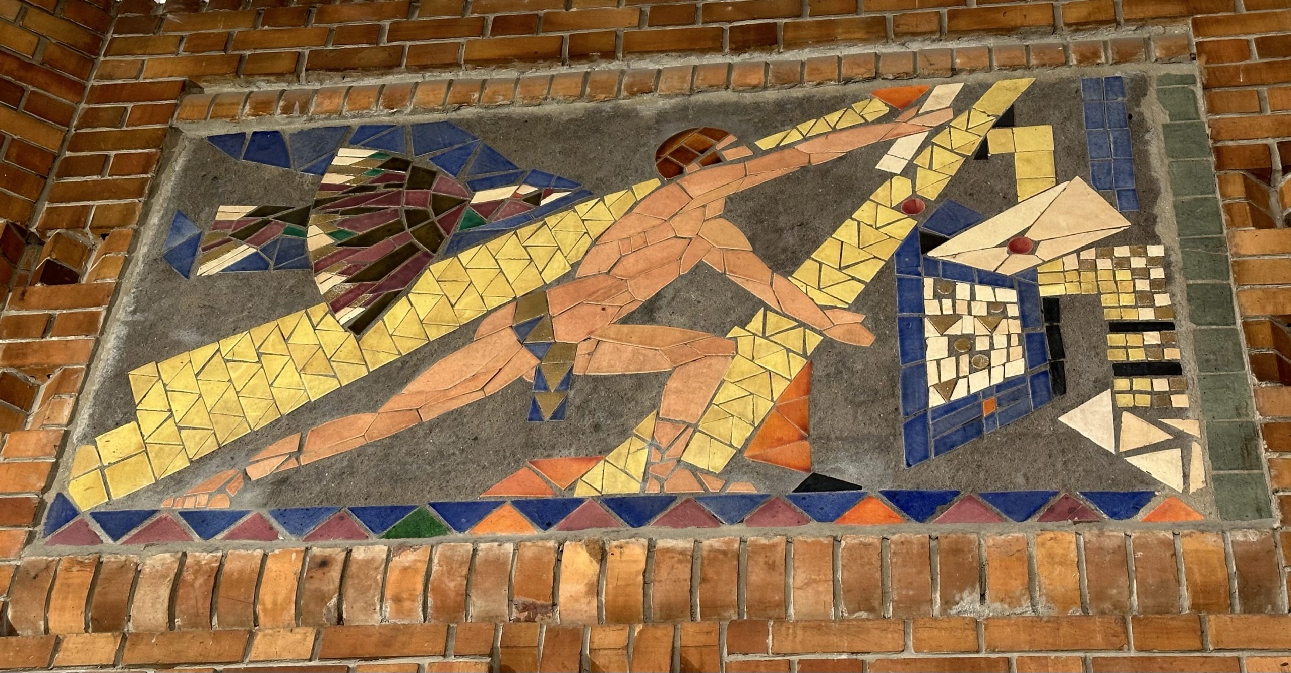
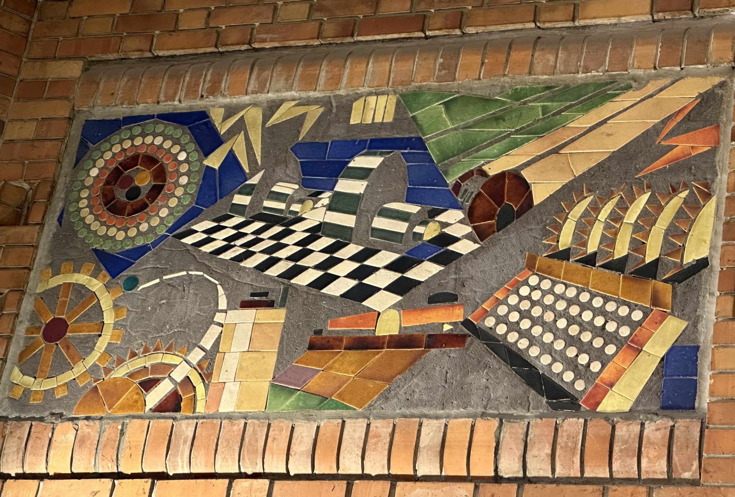
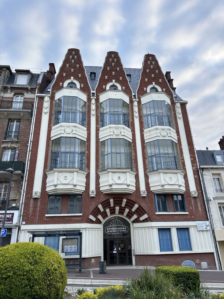
Inside La Poste: carrier pigeon to letter post, modern machinery, modern transportation Conservatoire de Musique et TheatreThe Basilica labyrinth
A 1960’s Mobylette moped manufactured in Saint-Quentin
Our breakfast at the gîte in Trefcon was basic: bread and jam and hot chocolate. Chatting with the owner, we learned that Picard is a language on its own (i.e., has a grammar) while Ch’ti is a dialect.
While it didn’t rain today, the weather remains grey and cool and the walk was more of the same – muddy paths across farmland and along an old railway track. Stopping for a break, we broke into our supplies of oatmeal and meusli, soaked with a little hot chocolate! Paul tried out his new Western Europe birdsong app and identified a Skylark, a Great Tit, and a Garden Warbler.
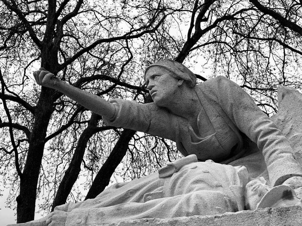
Walking around last evening while waiting for a restaurant to open, we came first upon the 17thC Porte de Bretagne in the old city wall (reconstructed after WWI) and then by a WWI memorial with a dramatic sculpture by Paul Auban, « Picardie maudissant la mort” (Picardy cursing death). Picardy, part of Hauts-de-France, is a historical region of northern France, stretching north from the suburbs of Paris and vineyards of Champagne to the beaches of the Bay of Somme on the English Channel.
The restaurant, Au Gars du Nord, served local fare, one of the dishes being variants of Welsh Rarebit (Les Welsches) said to have been introduced by the British during WWI. Paul’s meal was a Savoyard variation, with Reblochon cheese sauce on Rösti.
La Porte BretagneDrawbridge mechanismRamparts Picardie maudissant la mortLa MairieLa Citadelle“Welsch”
After a quick look at the Citadel this morning, we lined up at a boulangerie for bread for lunch and, as there are no restaurants in Trefcon, went to Carrefour to buy something for dinner. We chose a salmon casserole and two rice puddings (the latter after some discussion, as the glass jars would add further weight to carry!)
The first part of the route was along an old railway track, easy underfoot and pleasant, with the sun shining and plenty of birdsong accompanying us. At the top of a hill in Cartigny, we decided to stop for an early lunch to take advantage of a lone bench in the sun.
After Cartigny, we were back walking along minor roads and muddy tracks. In Vraignes-en-Vermandois we noticed a series of plaques commemorating local writers. The inscriptions were in both French and what we suspect might be Ch’ti, or the language of Picardy.
The rest of the walk, particularly the last few kilometres, were much less enjoyable, as it became windier and began to rain and the muddy tracks made it hard going. When we arrived at our gïte, we discovered that the only cooking facilities are in another apartment, so supper was unheated salmon casserole (and rice pudding :)).
Hot chocolate Local architectural styleAnother walker
We awoke to a cloudless sky, which encouraged Lois (but not Paul – he looks at weather systems), suggesting that the forecast for rain all day beginning at 9:00 might be wrong. But, no, by the time we’d eaten breakfast, the skies were grey once again and the walk was a wet, windy and muddy one.
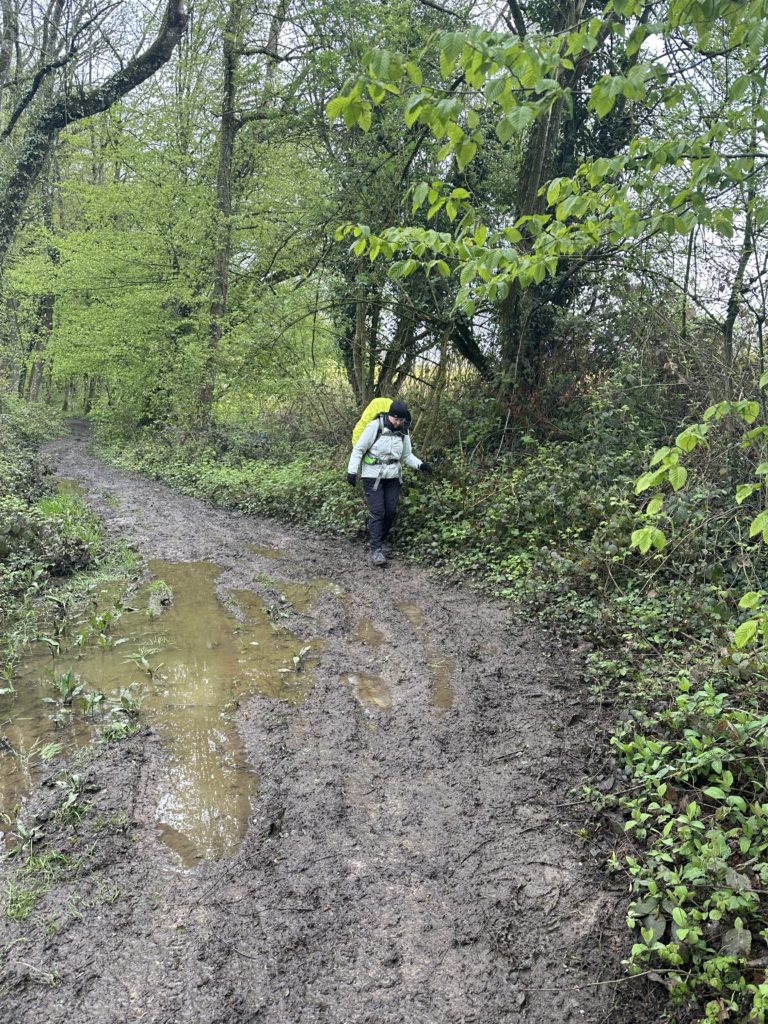
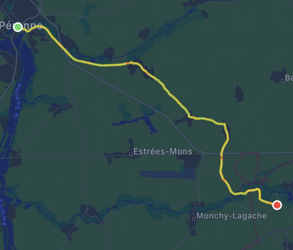
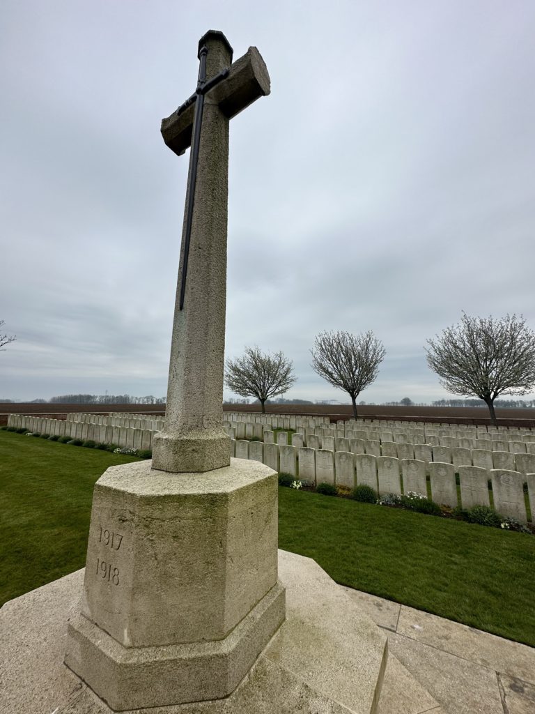
We followed minor roads and tracks through undulating farmland, much of which was planted with fragrant bright yellow canola. We found a bus shelter for our first break in Villers-au-Flos. This town was occupied by the Germans for much of WWI and there were signs to a German military cemetery. Later, we passed another Commonwealth War Graves Commission Cemetry, the Manchester Cemetry. In Rocquigny, we stopped to visit the modern-looking church, where we also got a pilgrim’s stamp. The church had been rebuilt after WWI, but due to “maladie de bêton” had to be demolished and was again rebuilt in 2013. Finding another bus shelter (!), we ate our sandwiches without lingering. It was warmer to keep walking! At Sailly-Saillisel, we ended our walk and waited for a cab to take us in to Péronne.
Villars-au-FlosRocquigny
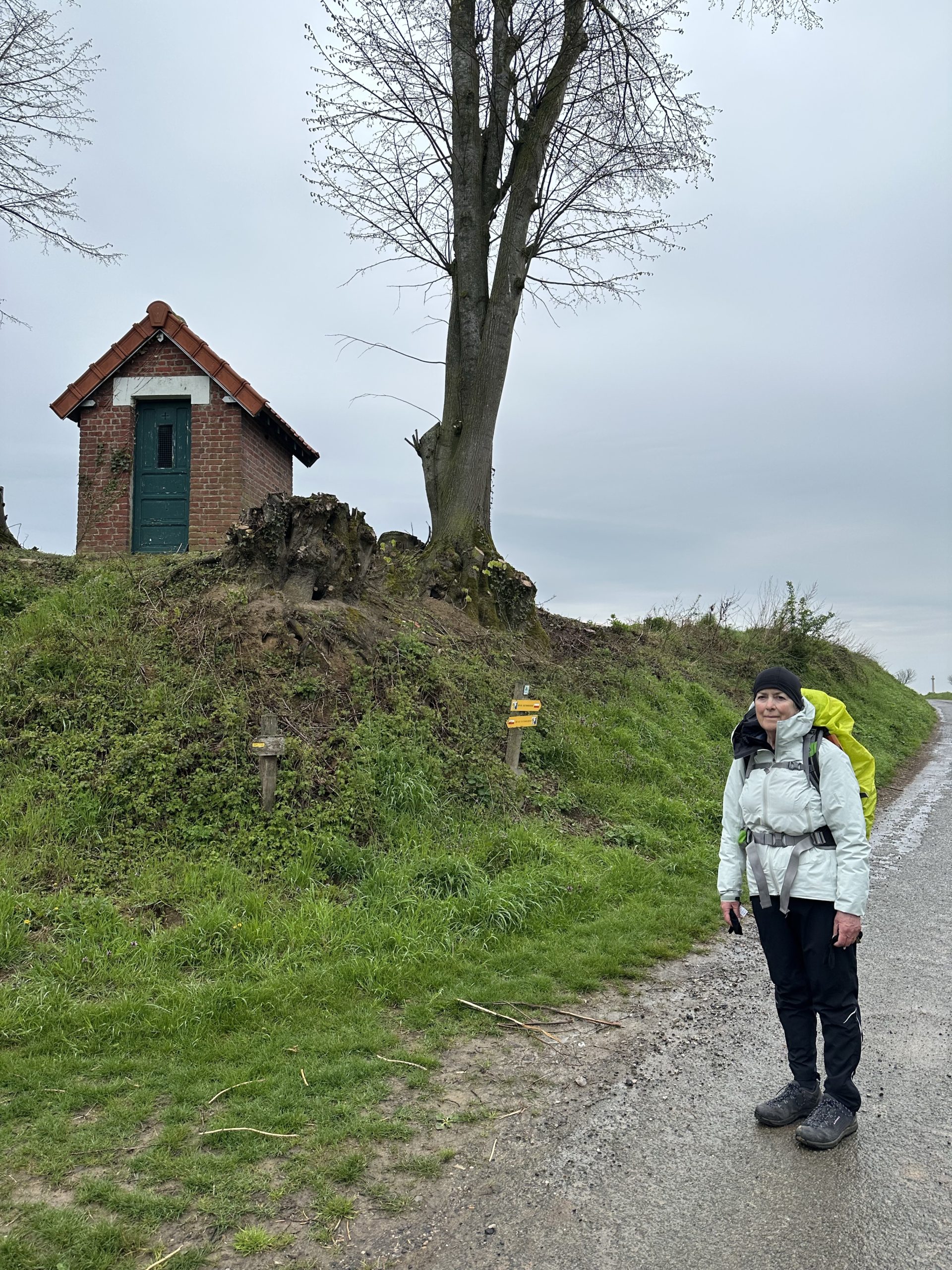
Itinerary note: Up till now we have found the route to be very well signposted but today many turns had no signs or markers at all. Paul had downloaded waypoints for each stage from the VF site and imported them into the Work Outdoors app. This has proved invaluable.
Back on the road again! But, not before stopping at Notting Hill for a departing « noisette » (espresso macchiato) and a hot chocolate for our thermos. On his early morning trip to the boulangerie to buy breakfast croisants, Paul had also picked up a still hot almond croissant and cheese baguettes for lunch, so we were well provided for!
A gentle rain accompanied us as we walked south through the city and out onto rolling farmland, some fields sewn with sugar beet, presumably destined for a large local mill we could see in the distance.
We had a break in Mercatel in a conveniently situated bus shelter next to a chapel. Later, we passed a WWI cemetery of the Commonwealth War Graves Commission, the Sunken Road Cemetry. Just down the hill was a small family chapel with a bench painted with the VF sign and a visitors book. Eventually the rain stopped and we ate our sandwiches sitting on our groundsheet under a tree. Near Hamelincourt, we were a little confused about where the path went, so decided to walk along the road through the town. This was fortuitous in that we came across an automated farm stand where Lois bought a local rhubarb yogurt. Also, the road took us past the site of the Casorti family final resting place. A plaque described this interesting Italian family which had maintained a summer residence in Hamelincourt in the middle of the 19thC (destroyed in 1917). Until the 1830’s, the family travelled throughout Europe as musicians, actors, acrobats or mimes, and were later hired as dance masters, music teachers and composers, or to teach etiquette and posture, mainly in France and Germany. Their compositions were and apparently still are performed the world over.
The farmland closer to Bapaume is dotted with windmills, which we were told have been appearing « like mushrooms ».
As we intended to only walk 15 kms today, we headed to a railway station at Courcelles le-Comte, from where we called a taxi to take us the remaining 10 kms.
Waiting for the bus to Boulogne (from where we could catch a train to Arras), we looked across at the Eglise de Notre Dame de Licques, which is all that remains of an abbey, founded in 1075. The abbey and town suffered attacks from the English and Spanish in the 14thC, and the abbey was furthered damaged during the Revolution. As we waited, three fellow VF walkers approached from the direction of Guînes – a French woman who had started the walk to Rome from Callais (she would have begun from Canterbury, but had no passport), and two men from England who had begun walking from Winchester on Good Friday.
The bus trip to Boulogne, on time and comfortable, cost only 1€ each! Public transport is obviously valued here! Our bus driver even diverted from his usual route to drop us at the Gare SNCF. We then took two slow trains across country (changing at Le Touquet) arriving at Arras late afternoon where we had booked into the Le Dome hotel.
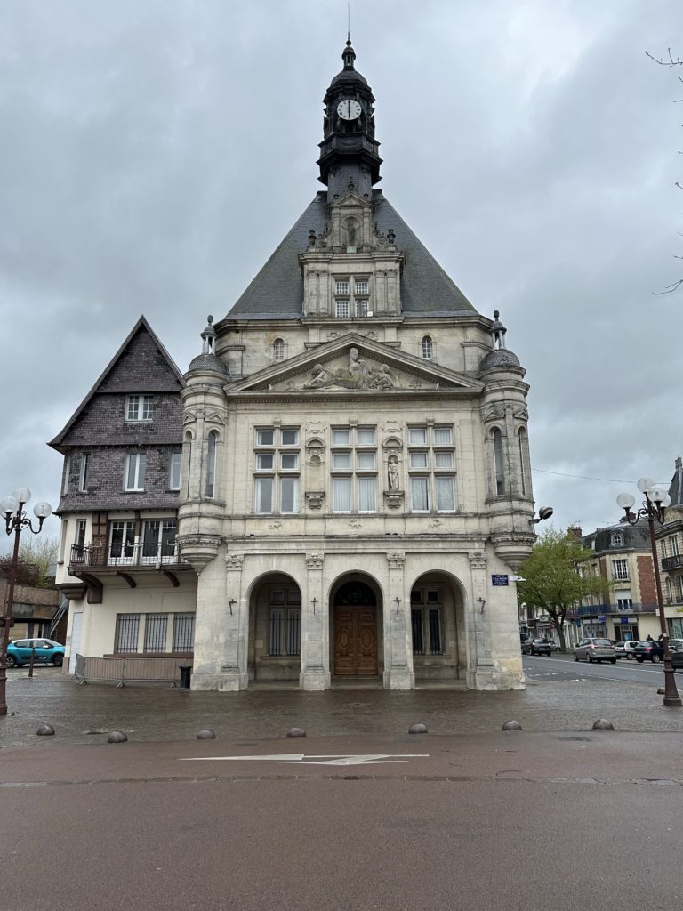
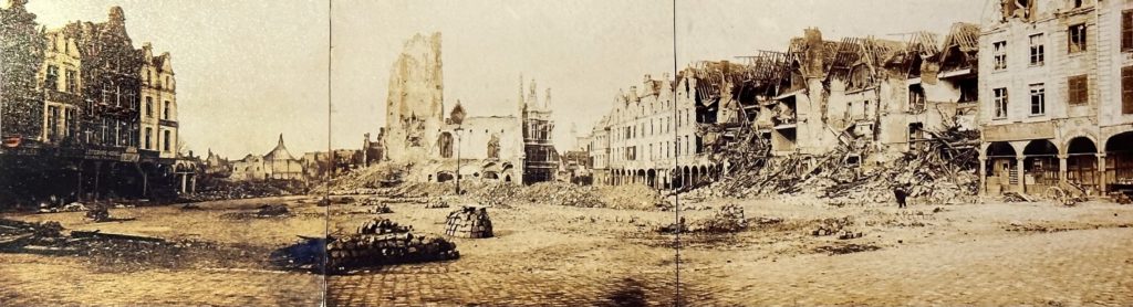
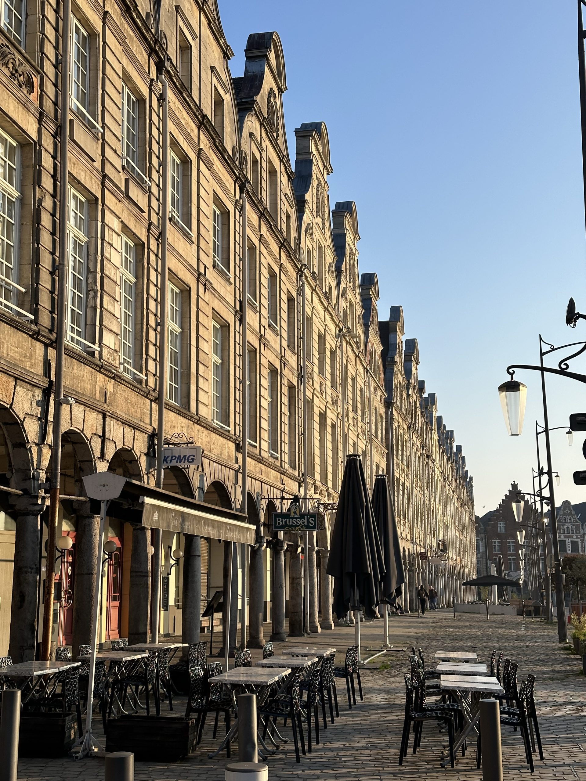
The following morning we checked out of Le Dome and moved into a lovely studio apartment (Les Anges) right off the Place des Héros, one of two grand cobbled squares in the centre of the city surrounded by Flemish Baroque-style townhouses. While the centre retains the appearance of a Baroque town, much of the centre had in fact been destroyed during WWI. Occupying a strategic position on the front line (earning it the name of « La ville martyr »), Arras was at the forefront of major battles during WWI, notably a major offensive action by the Allies during April and May 1917, during which Canadian forces gained Vimy Ridge. The remarkable rebuild was helped by the fact that, between 1556 to 1714, Arras was under Spanish rule and, during that time, Philip II of Spain decreed that all buildings be made of brick and stone and that they should all follow a similar identical style. This attention to detail meant that the town planners were able to rebuild the town in keeping with that style. Some buildings were reconstructed in the art deco style of the time. The Cathédrale Notre-Dame de L’Assomptiom (original cathedral destroyed during the Revolution) was also rebuilt after WWI.
Feeling in need of solace, our first visit was to the Musée de Beaux Arts. The gallery is housed in what was the Saint-Vaast Abbey (dating back to 7thC, it was burned down by the Normans in 783, later reconstructed according to plans designed by the great Parisian architect Labbé, attacked by the Vikings in the 9thC, survived the French Revolution, destroyed during WWI, then reconstructed in identical style!) We happily spent a few hours looking at Flemish and Dutch painting, e.g., Rubens’ Saint Francis receiving the Stigmata (1615), masters of the Arras school (19thC), including Désiré Dubois, Xavier Doulens and Charles Desavary, and a particularly fascinating contemporary exhibition of photos by Michel Gantner.
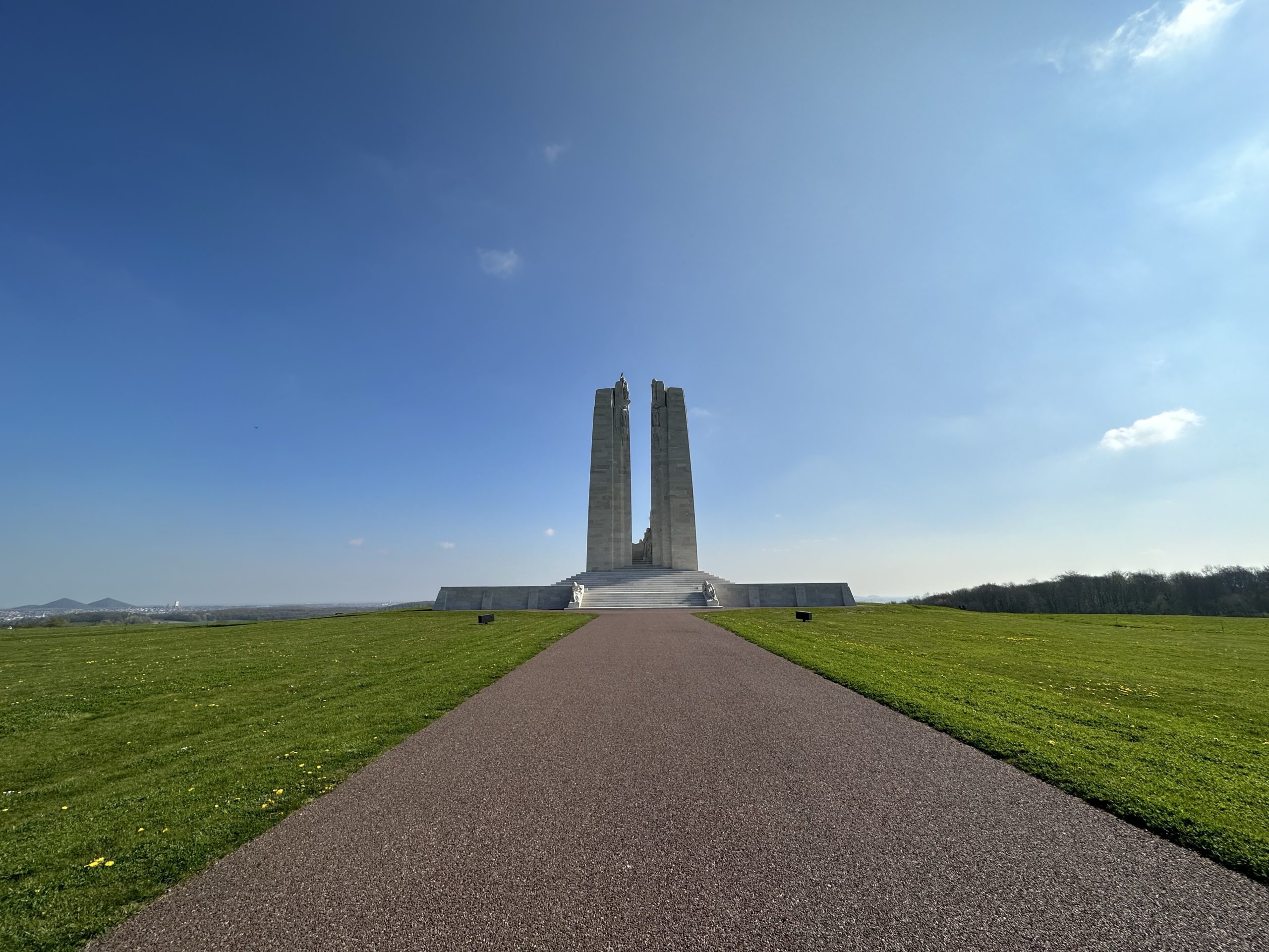
The next day, we took a taxi out to the Canadian National Vimy Memorial at the site of Canada’s victory during the Battle of Vimy Ridge in WWI. The soaring monument, designed by Canadian sculptor Walter Seymour Allwood, sits on the top of the highest point of the ridge, overlooking the Douai Plain. Erected between 1925 and 1936, the monument honours all Canadians who served in WWI. It is carved entirely from Croatian limestone, transported from an ancient Roman quarry in Seget, Croatia. The battle-damaged landscape around the sides and back of the monument were left untouched.
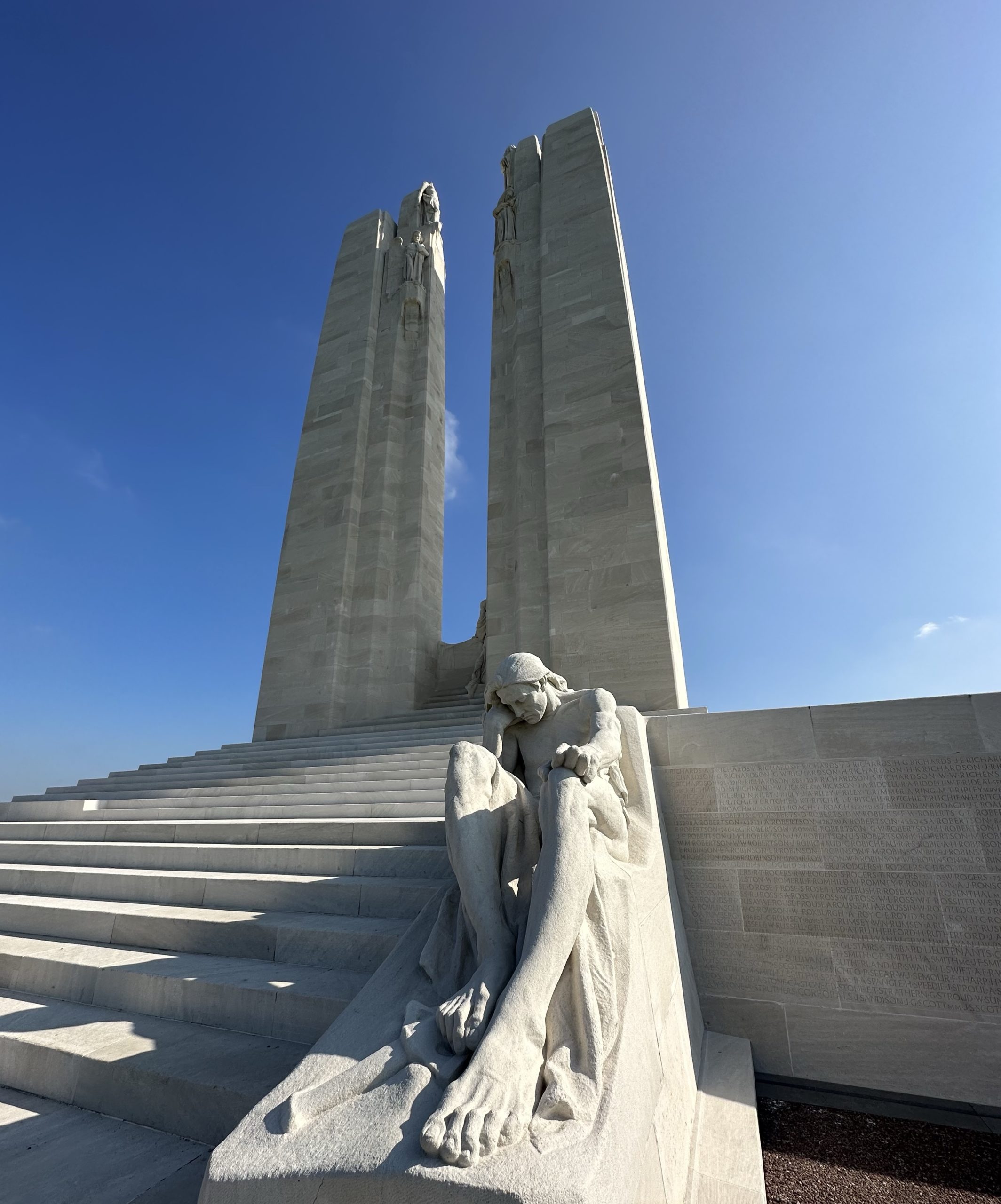
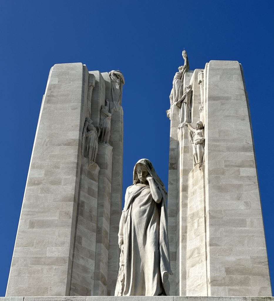
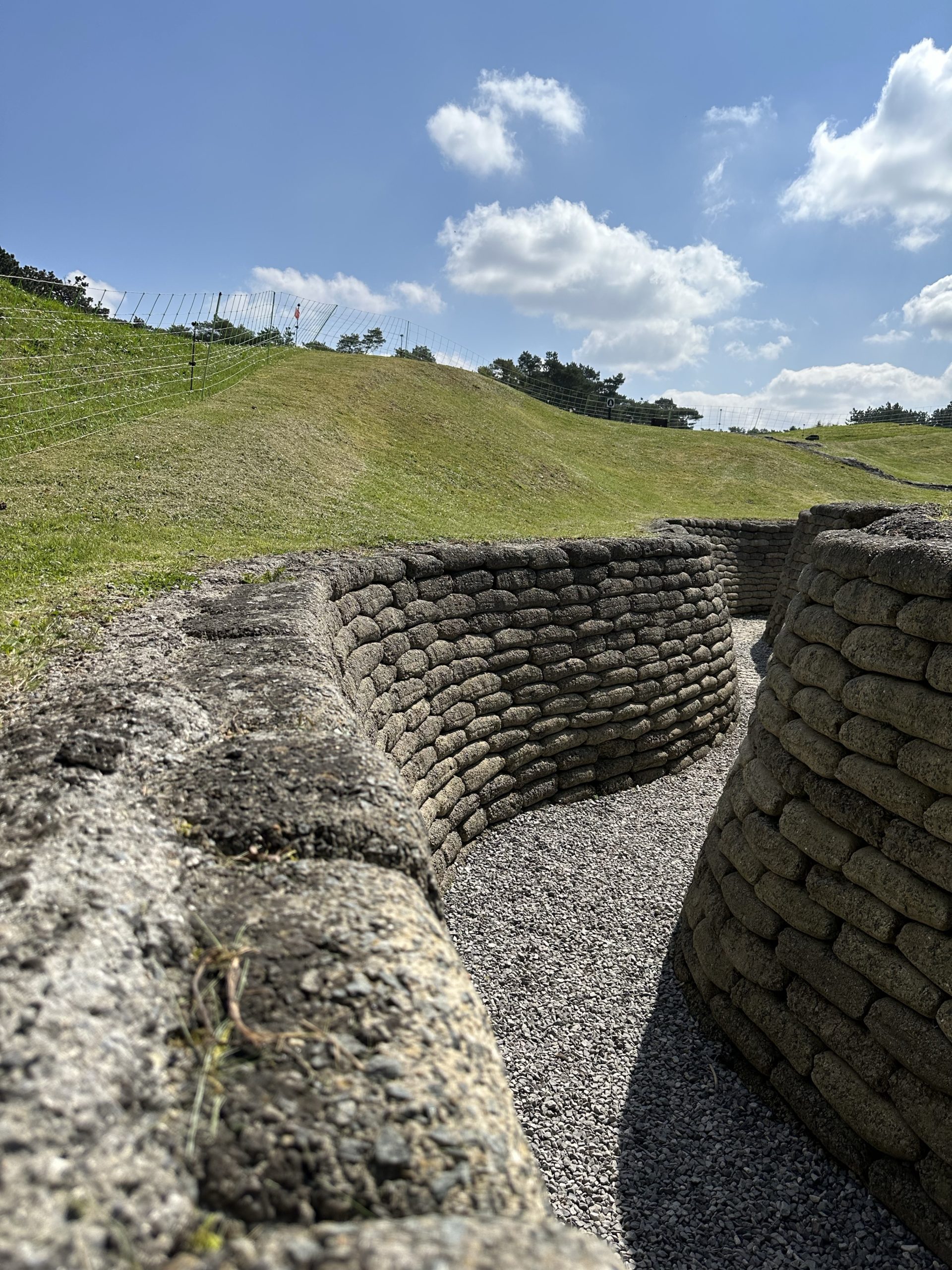
Two pylons representing Canada and France, bearing a Maple Leaf and a Fleur de Lys to honour the sacrifices made by both nations, rise 27 metres above the base. The monument includes 20 human figures representing such values as honour, justice, peace, truth, knowledge, gallantry and sympathy. The topmost figure is that of peace. An allegoric sculptural group marks each corner; Breaking of the Sword on the south corner, Sympathy of the Canadians for the Helpless on the north. Two reclining figures on the southern (reverse) side of the memorial, located either side of the steps, represent the mourning mothers and fathers of Canada’s war dead. The largest figure, known as “Canada Mourning her Fallen Sons” or “Canada Bereft”, stands alone, head bent in sorrow, looking out over the slopes of the ridge. Inscribed on the outside wall of the monument are the names of the 11,285 Canadians who died in France with no known grave. A departure from earlier practices, the monument was erected as a memorial rather than a victory monument, focussing on the loss of life and sacrifice for one’s country, rather than military accomplishments. The memorial, cemeteries, trenches, tunnels, craters and visitor’s centre are on Canadian soil, a gift from France, and managed by Veterans affairs. The tour guides are Canadian students here for 3 months at a time. From Vimy Ridge looking north one can see the slag heaps from the once important coal mining industry of the area. The old mines and associated human made topography are a UNESCO heritage site.
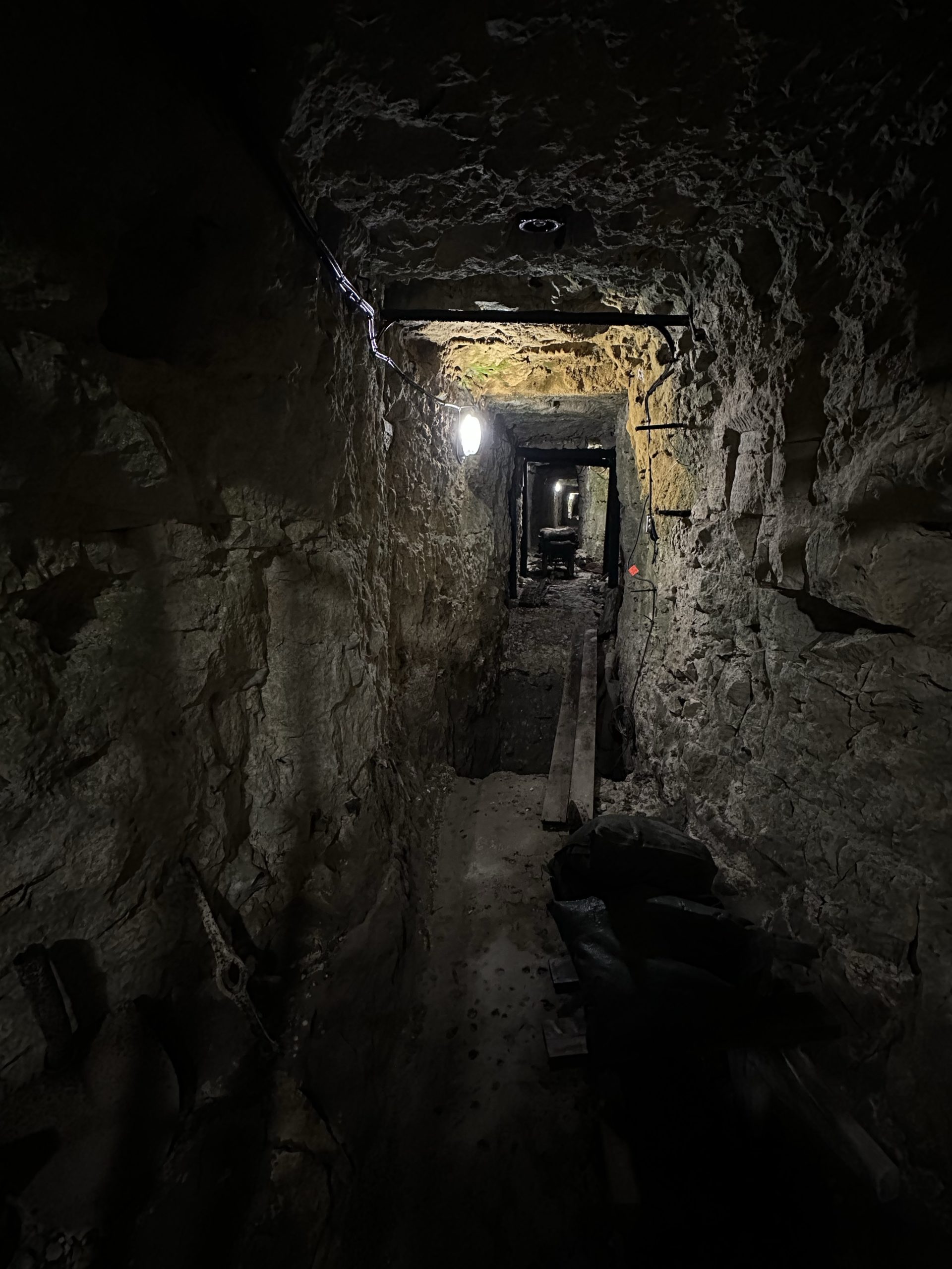
The rest of our time in Arras we spent resting, eating, reading and walking – a self-guided walking tour identified more ancient churches, the 19thC Fontaine du Pont-de-Cité (a fountain of Neptune, not impressive in itself, but notable as it was installed by the water authority to provide potable water to avoid cholera), Le Beffroi (Belfry) we couldn’t go up, as the elevator was not working) and the Citadelle d’Arras (which we travelled to on the Citadine, a free electric mini-bus). We declined to tour the “Boves” (a 20 km maze 10 m beneath the city), underground quarries dug out from the ninth century onwards, to extract material for the construction of the city’s religious buildings and the first rampart, later used as merchants’ storage cellars, and, finally, used by Commonwealth soldiers ahead of the first attack launching the famous Battle of Arras on 9 April 1917.
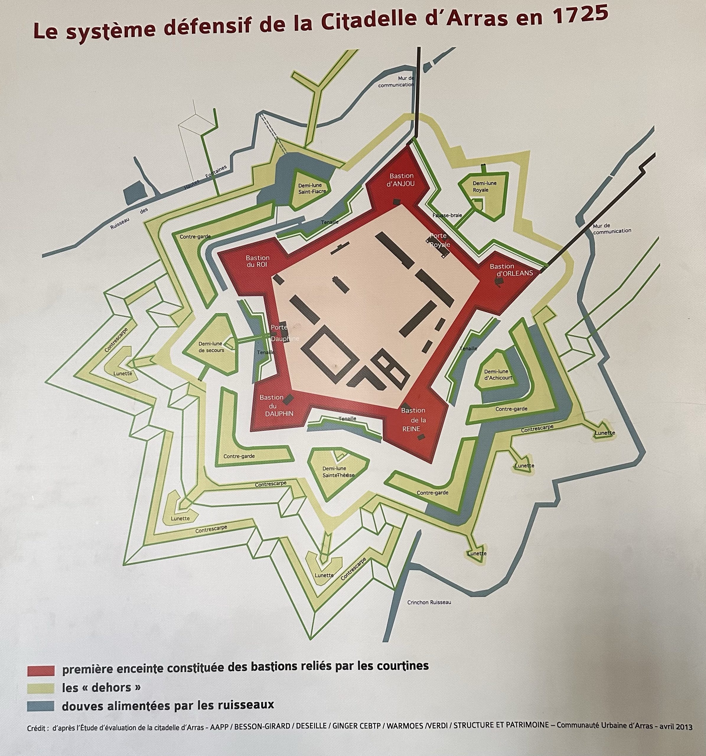
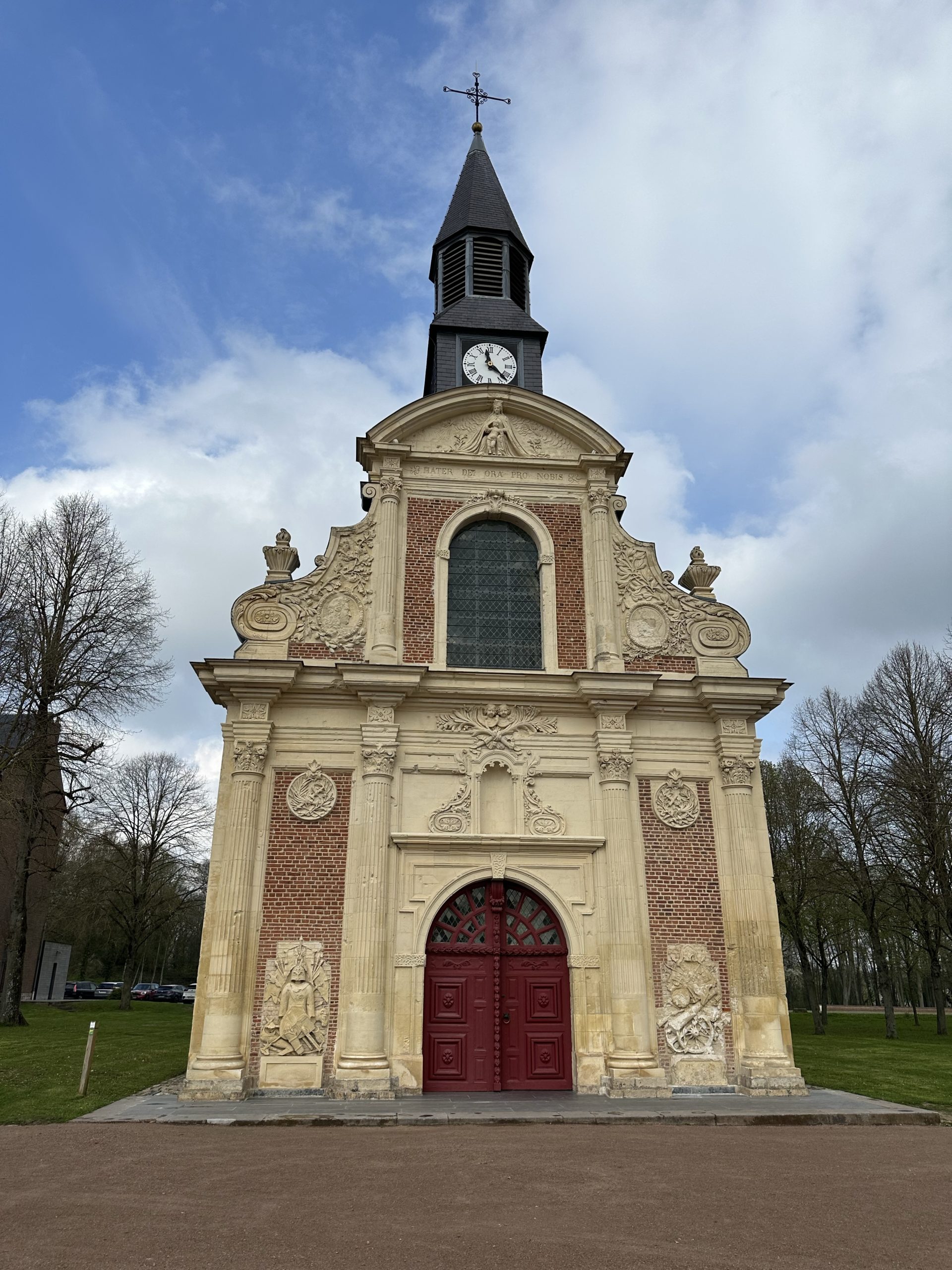
Arras was first fortified in the 13th century with city walls. These defences were improved in the 16th century by the Spanish rulers of the time but the French took the city in 1640, after which Louis XIV commissioned the renowned military strategist, Vauban, to protect Arras and France from attack by the then Spanish Netherlands. The Citadel of Arras, another UNESCO World Heritage site, one of many built by Vauban, mostly in northern France in the late 17thC, was constructed as a pentagonal star. Never beseiged, thus nicknamed « la belle inutile » (useless beauty), the Citadel at times served as a prison and was used by the military up until 2010. During WWII, 218 people (aged between 16 and 69 yrs) suspected by the occupying Germans of being supporters of the Resistance were executed there by the Nazis. The Citadel Chapel of Saint-Louis (1673), still relatively intact, is the oldest church in Arras.
Feeling rested and hopefully recovered from the viruses we will resume walking tomorrow. Given the distance to Bapaume we may to do part of tomorrow’s stage by public transport.
Place des Héroes, Le Bellfroi and Hôtel de Ville 1918 and today
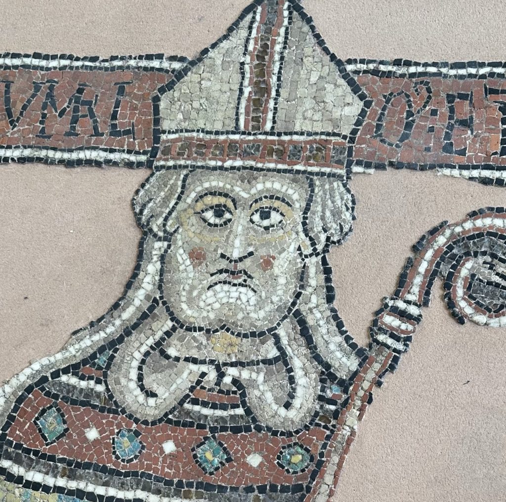
Architecture of ArrasMusée de Beaux Art – Archbishop Frumauld d. 1183
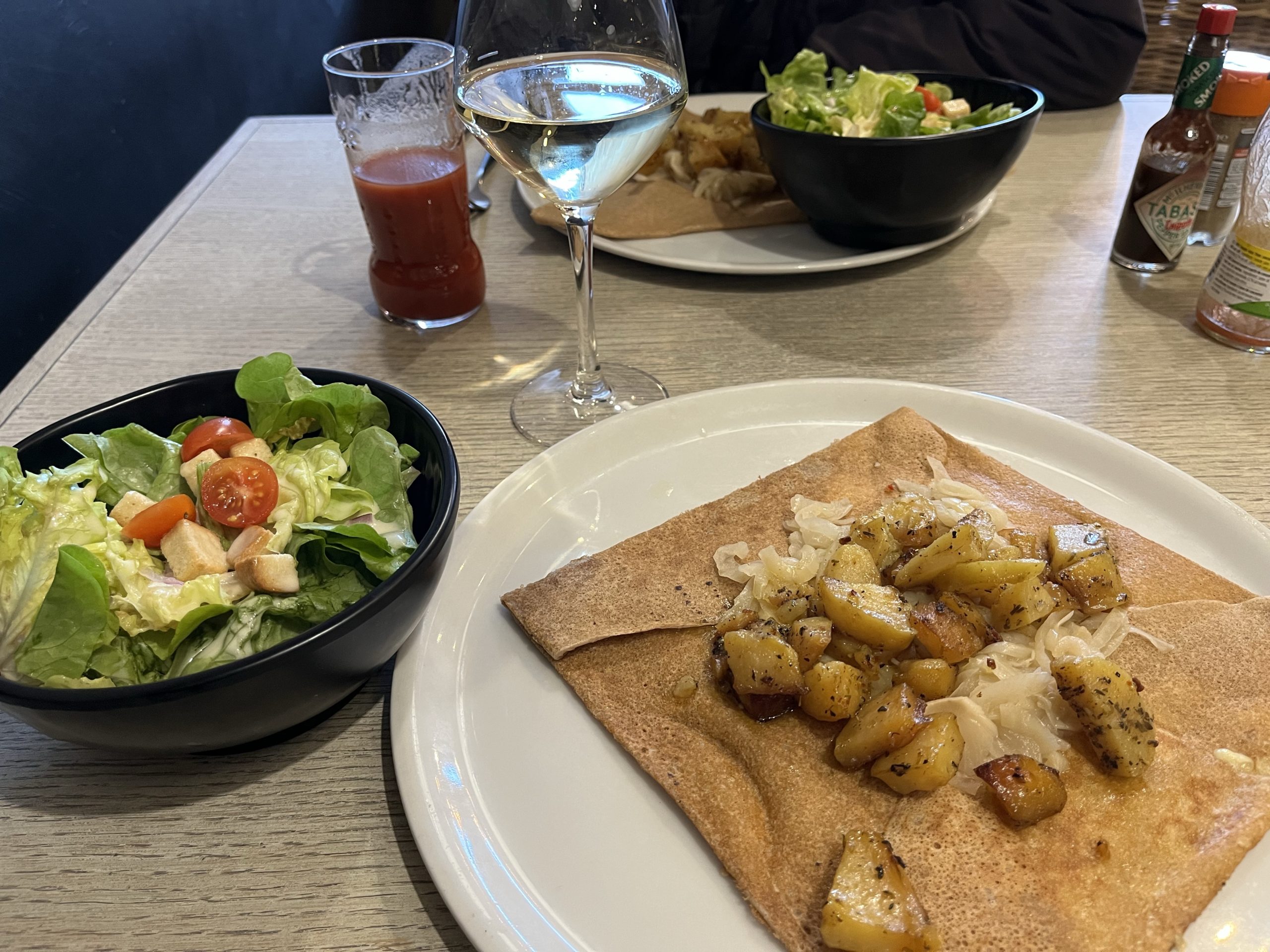
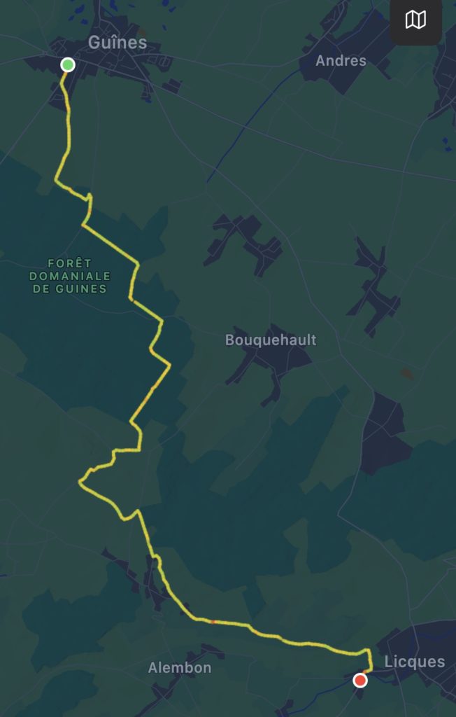
After a huge breakfast at our BnB of local cheeses, fresh bread, pastries, thick yoghurt, juice, fresh fruit and good espresso, we packed leftovers for lunch and set off along GR 145/VF for Licques, soon entering the Forêt Domaniale de Guînes, where we passed the monument commemorating the first crossing of the Channel by balloon in 1785 by Jean-Pierre Blanchard and John Jeffries. We wandered through more forest with swaths of wild flowers and then followed tracks across rolling farmland, wheat fields and pastureland. As we approached Licques, we noticed a savoury sweet scent of fresh leeks arising from a crop ready for spring harvest. Licques is famed for its poultry production and its Fête des Dindes (Festival of the turkey), which traditionally heralded the start of the Christmas season.
For other travellers to note, there were no shops or restaurants open at all on Sunday. Fortunately, we still had brioche and cheese from our generous breakfast, which, together with local pear juice (for sale in our gîte, l’ombre de prunier – we highly recommend it) and tea were the evening’s meal.
While Lois felt well throughout the walk, by the time we reached the gîte, she was very tired and soon developed another fever. We have decided we need to take a longer break to allow her to properly recover, so we will go to Arras to rest for as long as necessary. We will be blogging again in due course.
Thankfully, a couple of days of rest have done the trick and Lois is feeling much better. Deciding that one more day without walking would probably still be wise, we decided to travel to our next stop, Guînes, by taxi (no trains and no buses without going back to Calais).
We booked a taxi for 3:00 and went off in search of lunch. This we found at Restaurant Le Herlen – fresh langostine, cabillaud (cod) in a mustard sauce and tarte á la cassonade, very similar to the sugar pie of Quebec, all delicious.
The 27km ride to Guînes was a pleasant drive through the green rolling countryside of Pas de Calais, even more so as the sun came out! Guînes is best known for the Field of the Cloth of Gold, a summit meeting between Henry VIII and King Francois I of France in 1520, a spectacular event which had little political impact.
We were pleased to be able to meet up with Krishna and David for a drink at their hotel, an enjoyable ending to the day.
Cheese notes: Sable de Wissant – from cows milk with a rind brushed with local “white” beer!
Tarte á la cassonade (and tea…)Gûines 18thC clock tower built on a Viking mound
We had already decided to have a day off after the battle with the wind on Wednesday, which was just as well, as Lois developed a fever and cold symptoms during the night. Despite the best efforts of Dr. Paul and a bag of cold medications from the local pharmacy, Lois’ fever persisted throughout Friday and we remain in Wissant (although moved to the more comfortable Hotel de la Baie, with a view of the beach.)
Paul has spent his time searching for food (take out not really a thing in France!), doing washing, getting our pilgrim passports stamped, reading, and looking around the town.
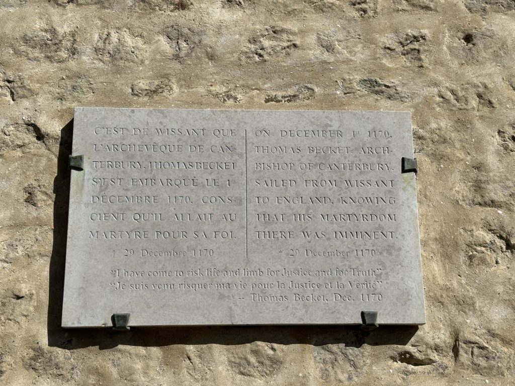
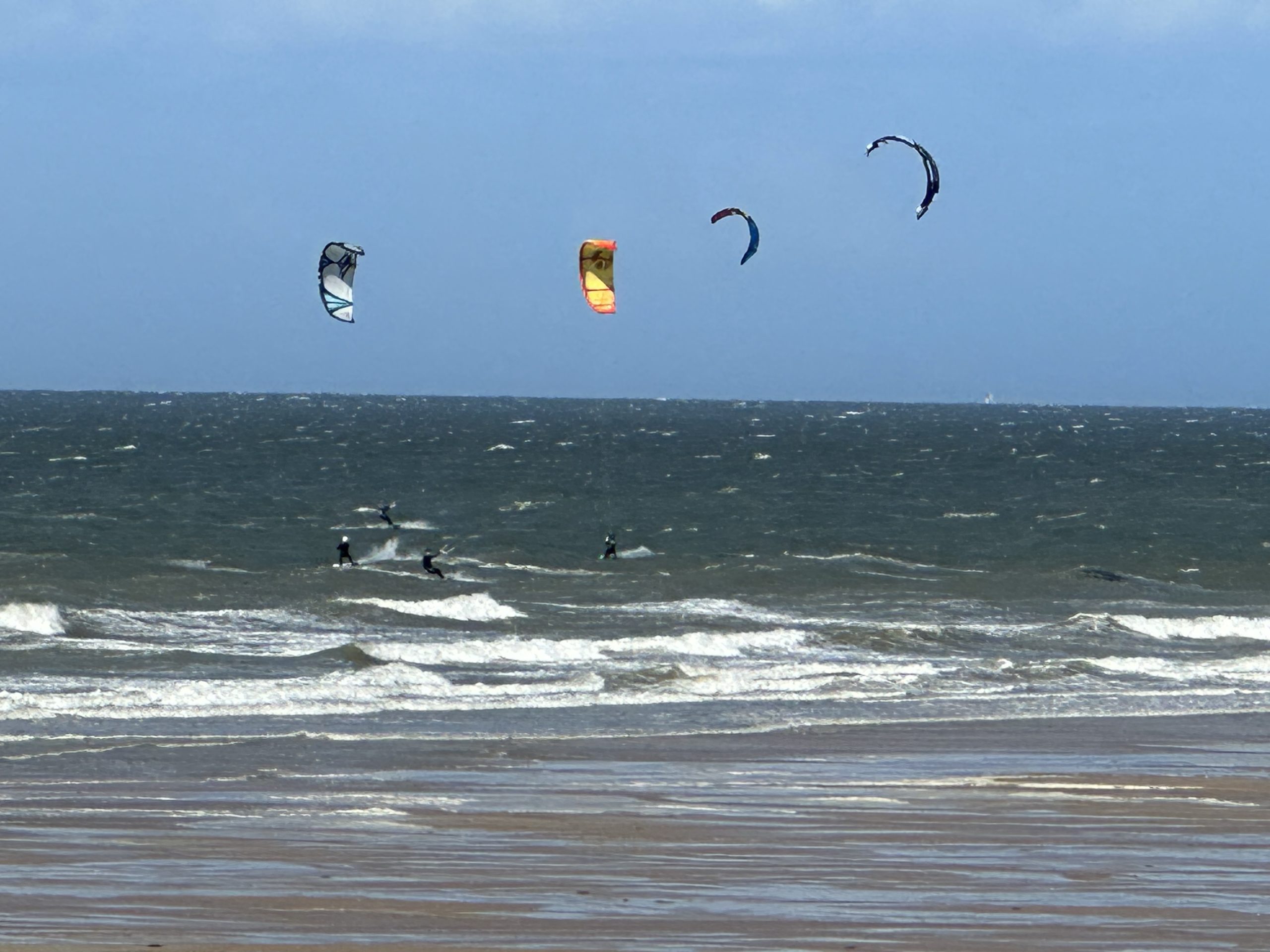
Wissant (white sand) was an important port when Sigeric the Serious ended his pilgrimage by crossing the channel from here in the 10thC. It is thought that in 55BC Julius Caesar left from Wissant to invade Britain. It was also the point of departure for Thomas Beckett when he returned to England in 1170 knowing his life was at risk as a result of his disagreements with Henry II. (The site of his assassination in Canterbury Cathedral is marked with four swords.) Shifting coastal sands eventually silted up the harbour and its importance became eclipsed by Calais. The town is now a seaside destination. Even in these cooler April days, there are people on the beach and numerous kite boarders riding the surf. Today, we could see the white cliffs of Dover.
We will either stay here another day or take a taxi to Gûines tomorrow. Hopefully, we will be back on the path on Sunday. As Lois says, “Viruses be damned, I have a right to be a pilgrim!” (the latter phrase quoting John Bunyan, as beautifully sung by Maddy Prior and the Carnival Band.
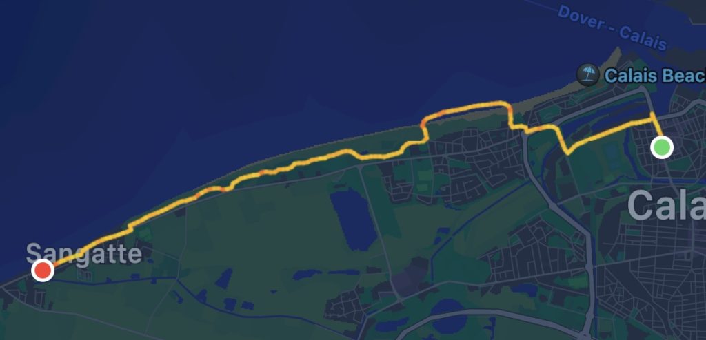
We looked out on a misty English Channel (La Manche from the French side) from a mostly empty lounge on the P&O ferry to Calais, as we dined on yesterday’s sourdough baguette (surprisingly still ok!) and cheddar cheese. Arriving on time, we didn’t disembark for another 1 1/2 hrs, due to a docking issue. It was windy and pouring with rain and we shared a taxi into the city with another couple.
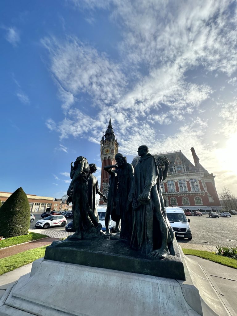
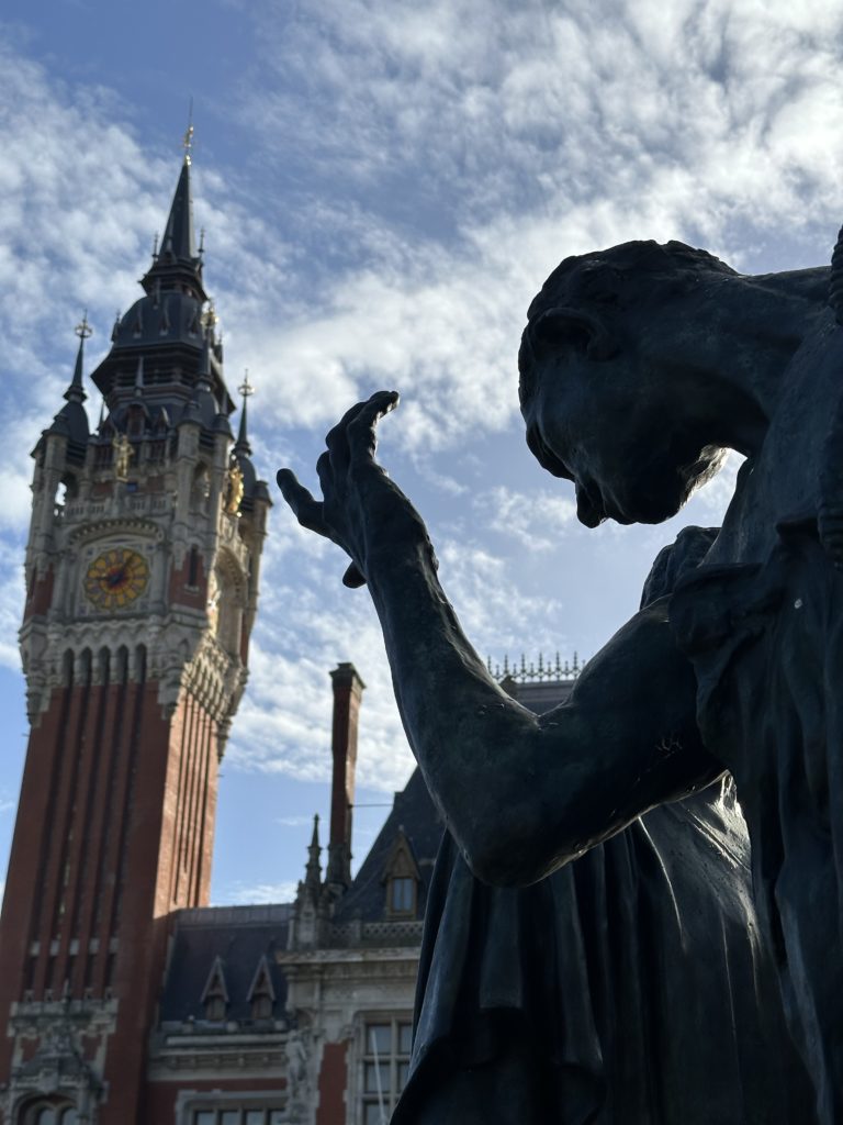
Awaking to leaden skies and a cool 5C, we headed downstairs for a reliable Hotel Ibis breakfast before walking to the town centre to view the Flemish Renaissance style town hall and UNESCO heritage early 20thC bell tower and “Les Bourgeois de Calais” ,one of 12 casts of Rodin’s beautiful sombre sculpture. We had seen another cast of this sculpture in the Musée de Rodin in Paris and were keen to see it again.
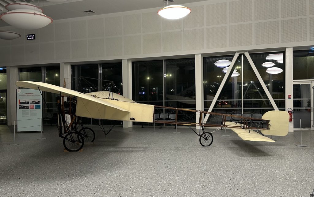
Back to collect our packs, we set off towards Wissant, immediately encountering a diversion on the route, which meant that we missed Bleriot Beach, the departure site of the first airplane crossing of the English Channel in 1909. We had seen an original of one of Louis Bleriot’s planes in the ferry terminal in Calais last night.
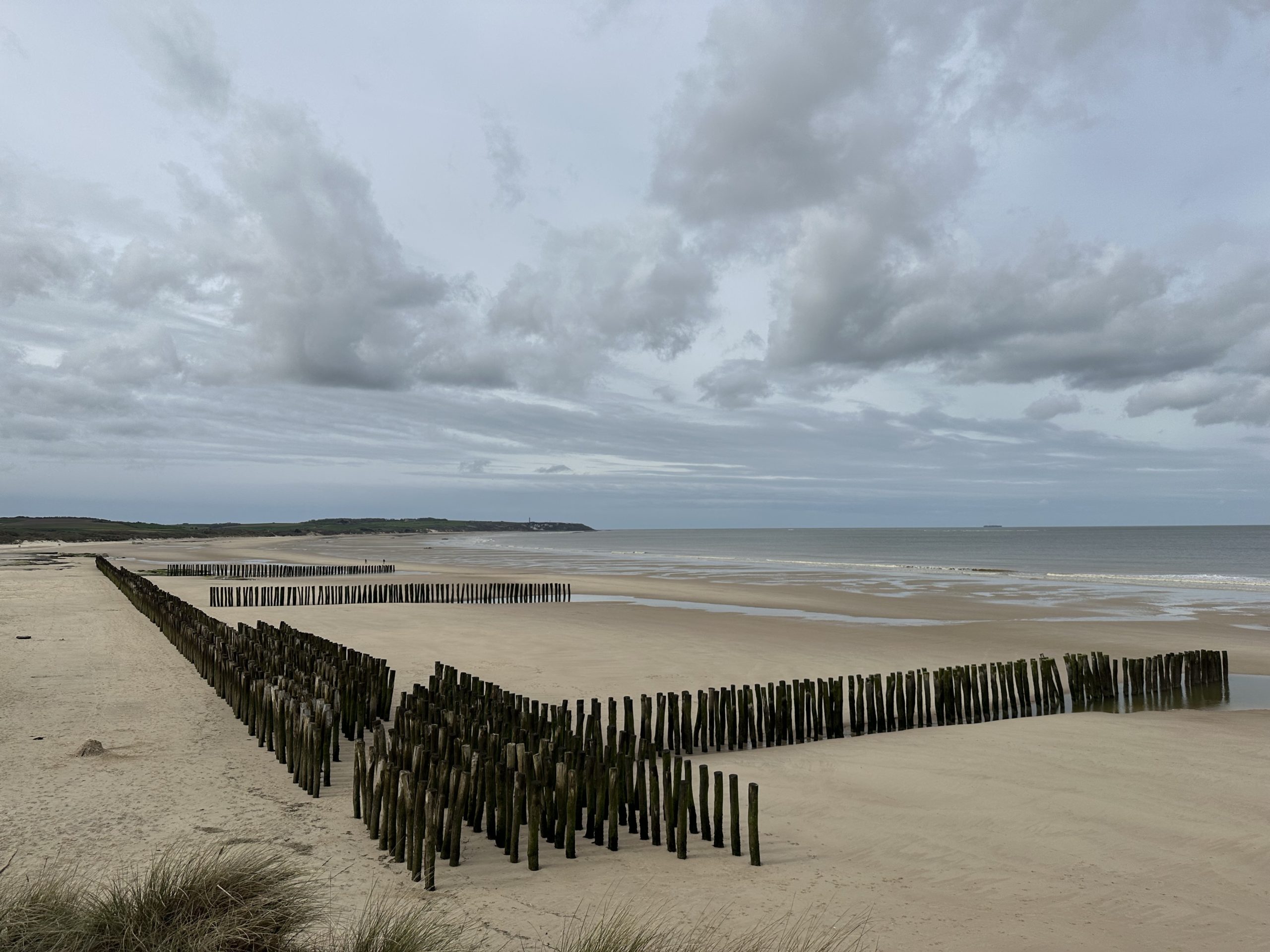
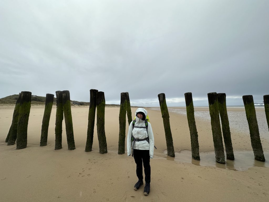
By the time we rejoined the route along the sea shore, the rain was pelting down. The dilapidated German WWII embattlements along the way were reminders of the brutal past of this region of France. Leaving the beach, we followed a long sandy trail behind the sand dunes, the wind driving the cold rain into our faces. As Lois’ hiking pants became increasingly soaked, she regretted not having put on her rain pants! By the time we approached Sangatte, we were in need of warmth, despite the now clearing skies. We walked almost the entire length of the town (a war memorial included a Canadian flag), before finding a restaurant, Le Blanc Nez, with an impressive menu of local seafood. We enjoyed delicious soupe de poisson, salade de chèvre chaud and coffees, while our gloves and tube scarves dried on a nearby radiator.
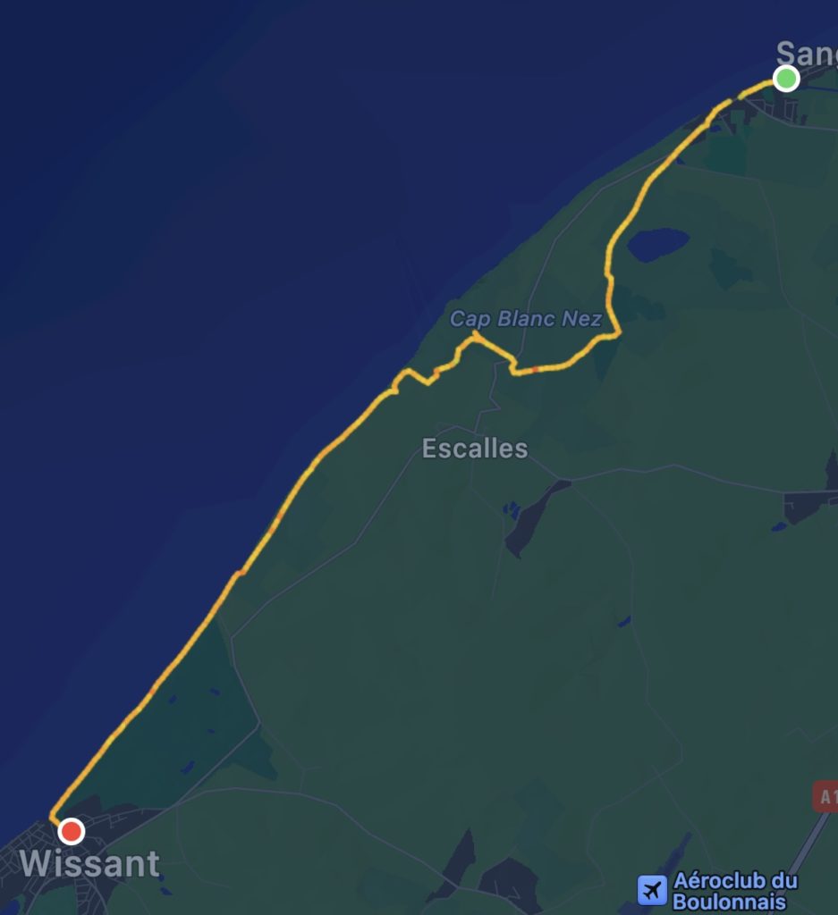
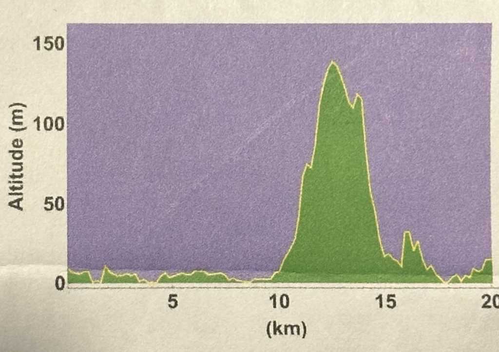
Feeling well refreshed, we started the climb towards Le Cap Blanc Nez. It became stormier, now with a headwind of over 60km/h, which continued to batter us all the way to Wissant. At one point, Paul had to chase his hat over a fence and across a field. Just as he climbed back over the fence, Lois’ backpack rain-cover went flying. Luckily, it was quickly retrieved by a passerby, who Paul then helped back over the fence. Near the Dover Patrol Monument we were very nearly blown over! Stopping for a quick look at the Lindemann Batterie Lourde, a German gun battery which could fire across the Channel, we quickly made our way back down the hill, hoping in vain for some respite from the headwind. By the time we were trudging along the final stretch of beach, heads bent against the wind and blowing sand, we were exhausted and sadly not able to fully appreciate the stunning vistas for which this area is known. We finally stumbled into our hotel around 6 pm. As our room was up 3 flights of stairs, which Lois was reluctant to descend in order to find a meal, Paul gallantly went off in search of pizza pour emporter and a glass of wine for Lois.
A Bleriot XILes Bourgeois de CalaisCap Blanc-Nez in the distanceTowards Wissant
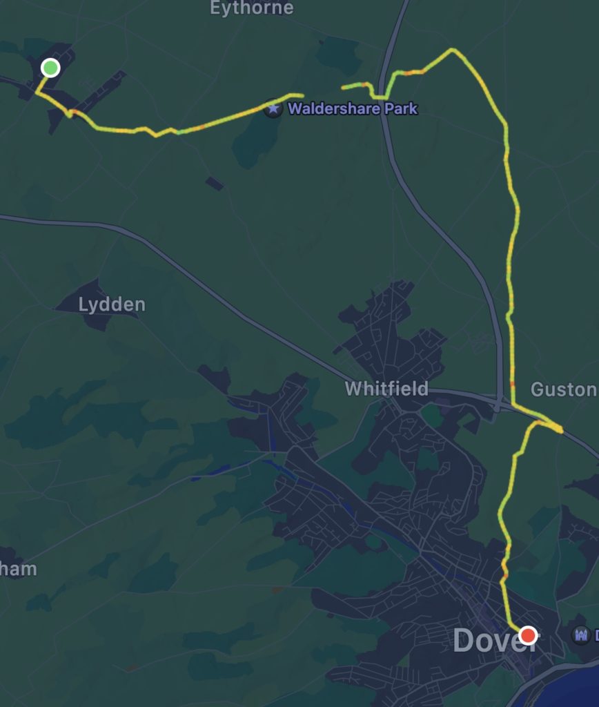
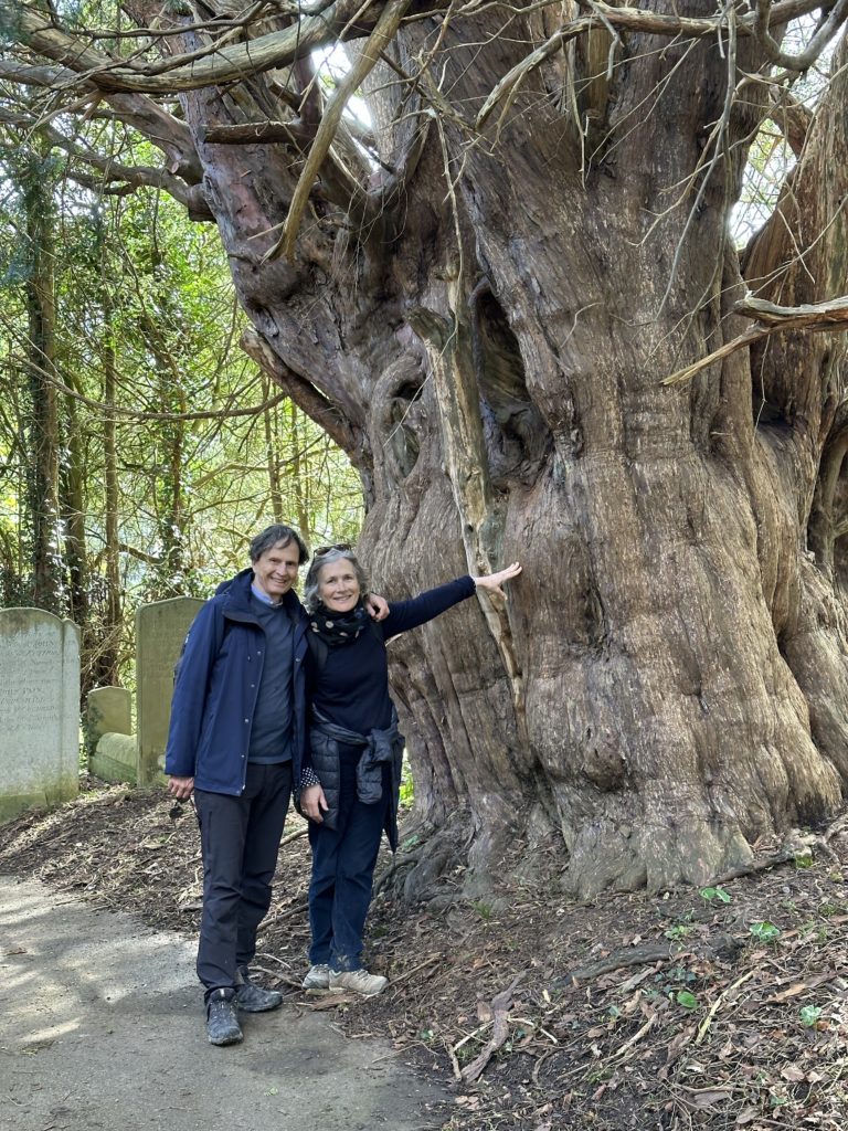
It was hard to pull away from the interesting conversation over breakfast this morning, with old friends and new – Krishna and David were also staying at Susanna’s. But, with blue skies beckoning, we set off with David and Anne for St. Andrew’s Church, for our pilgrim stamp and a search for the “green man” stone carving. We think we may have identified it…! Passing the Celtic cross war memorial, we made our way across fields and coppices on the North Downs Way, stopping to view a 17thC Palladian folly (a belvedere, unfinished) and associated modern sculpture, through Waldershare Park and past its stately home. At Ashley Sutton, while siting on a grassy bank, enjoying a break and Anne’s delicious nut cake, another walker approached, Kevin McCallister from Massachusetts (yes, “Home Alone” references were made!) on his way to Dover to complete another section of the VF (mid—France to Rome completed last year). Krishna and David soon joined us. Late morning, the clouds began to roll in and we donned our rain gear, although the rain held off until later. Just after crossing the A2, we encountered a temporary construction fence, which required a slight detour. Unfortunately, Krishna and David ended up having to climb the fence to get back on track! We then joined an old Roman road, which eventually brought us to the outskirts of Dover. We had our pilgrim passports stamped at St. Paul’s church, thanks to Krishna who went next door to get the custodian, and ended our walk together with a good lunch and well-needed coffees at Cafe Melange, a great find (thanks, Anne!). Krishna and David were spending the night in Dover, but we expect to meet up again along the way. David and Anne headed back to London. We so appreciated their company on the first two days of our walk. We hopped in a cab, stopping at Dover Castle for a quick photo, and then to the ferry dock, to board the 5:25 P&O ferry to Calais. With our passports stamped, the 90 day Schengen countdown begins!
It was a blustery wet day of walking, with the winds whipping across the North Downs and muddy tracks traversing fields – an appropriate initiation into the Via Francigena!
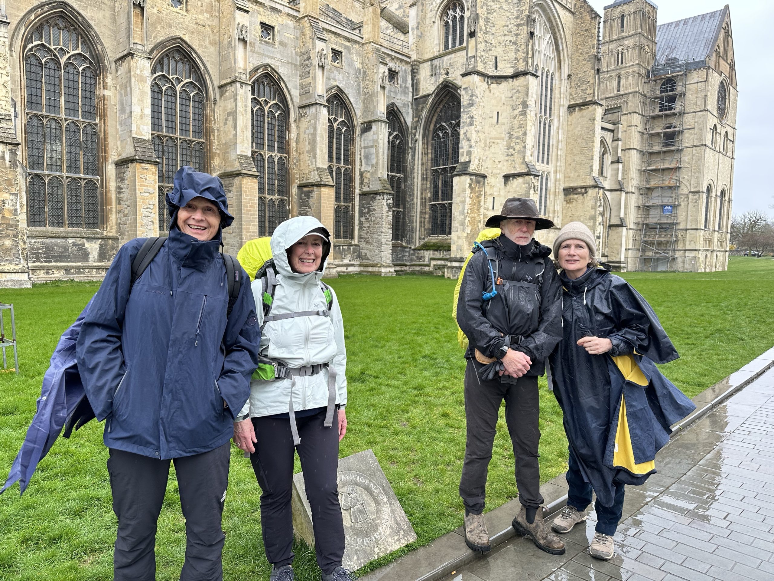
After a hearty breakfast at the House of Agnes (including Hot Cross Buns), the four of us headed off to find lunch items before stopping at the Cathedral to take photos. There we met another couple, Krishna and David, who were also just beginning the walk, having travelled here from Perth, Australia, and their friend, John, accompanying them as far as Shepherdswell.
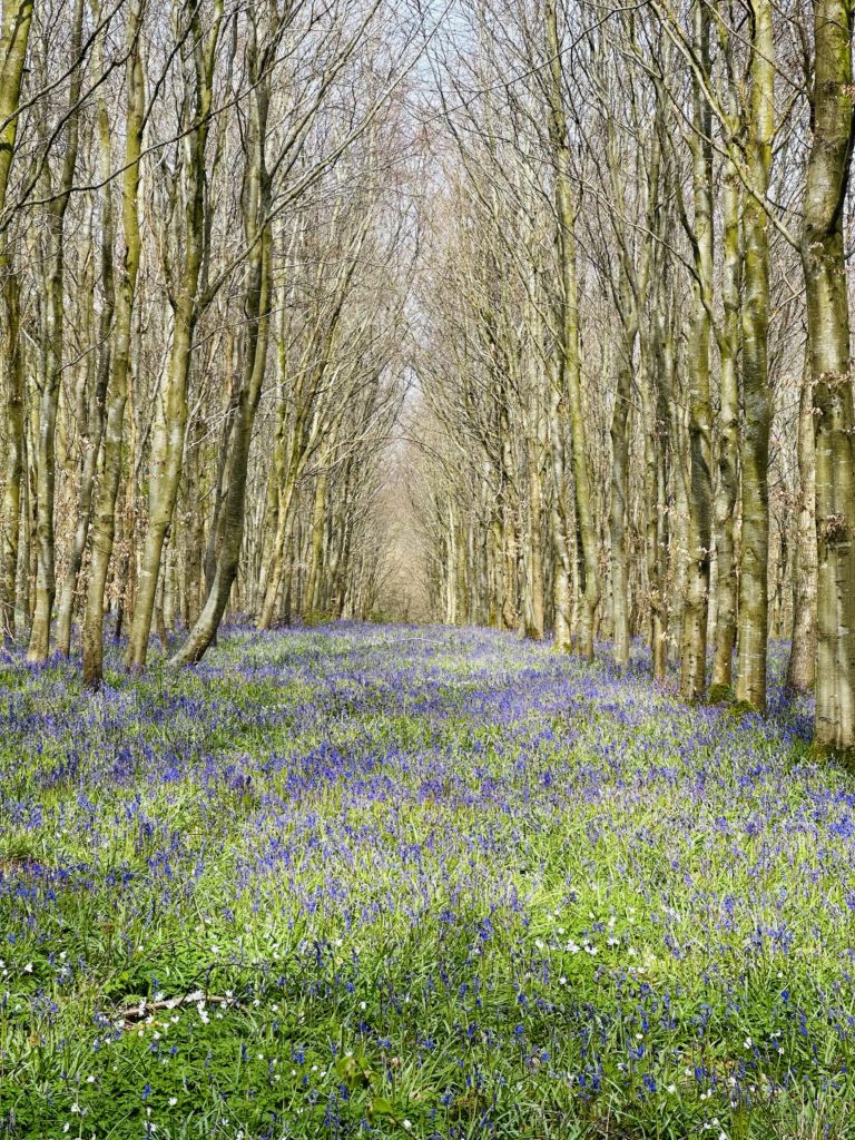
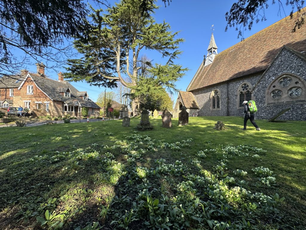
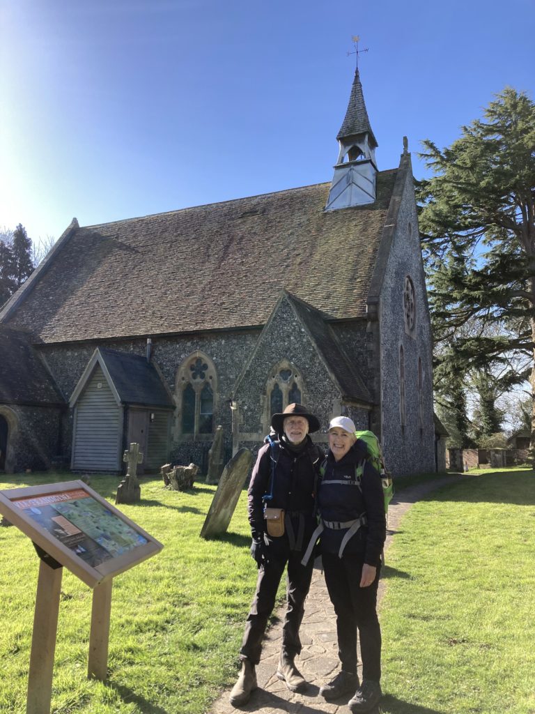
We walked as a group for much of the route, which helped distract us from any fears or misgivings we might be feeling setting out on this journey. The route was well signposted for both the North Downs Way and the Via Francigena and on top of the Downs we found a relief map in wood of the entire route to Rome. We passed St. Augustine’s Abbey and stopped to walk around St. Martin’s Church, dating from Saxon times. At St Mary’s, a Norman Church in Patrixbourne, we found a stamp for our pilgim passport inside and enjoyed a few moments out of the rain. Paul was pleased to see some Oast houses (converted to residences) that are emblematic of Kent. On arriving in Shepherdswell, we had a very welcome cup of tea at the cafe of the East Kent Railway Trust, an old colliery train line. We were both feeling a little stiff after our first day’s walk, but Lois is very relieved that her hip has not given her any grief so far!
We repaired to local pub with Anne and David for dinner.
On our arrival at Heathrow early Monday morning, we headed off by train to Moreton-in-Marsh, a pretty Cotswold town where friends and family had kindly agreed to travel to meet up with us. Our journey to Moreton took much longer than expected due to a damaged viaduct on the main line to Oxford – a consequence of a very wet English March – however, once there, we had a most enjoyable week. The train disruption did mean that we were unable to travel down to London to meet up with Lene and Freddy, old friends from Denmark who were visiting their daughter and family.
We visited Batsford Arboretum with Martin (friend of Paul’s from medical school) and Grace, Paul’s sister Liz, our niece Catherine and grand-nephew Nathaniel. Over lunch with Chris (another medic colleague of Paul’s) and Sally, we heard about their Eco-housing venture as well as rural pursuits such as hedge laying and pollarding, later visiting the grounds of Sizencote House. With Martin, Grace and Liz, we picnicked in the rain (!) before touring Chastleton House – another National Trust gem. We caught up with some of Lois’ International Studies classmates – Angela and Jane joined us for brunch at No. 1 Cotswolds in Moreton and we met Sarah and Jenny for brunch at Artist Residence in London. We really appreciated the distance that everyone came to see us. Martin and Grace journeyed from Dundee in Scotland!
Sizencote House
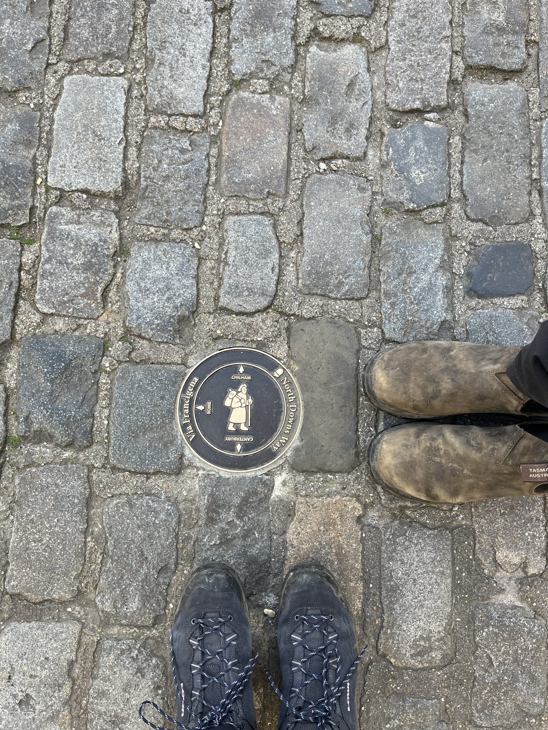
Arriving in Canterbury yesterday, after checking into the House of Agnes (the Wickfield family residence in David Copperfield) we wandered down to the Cathedral precinct and found the stone marking the start of the Via Francigena. Further exploration resumed today after espresso, including the Roman wall, Norman castle and the spectacular Canterbury Cathedral.
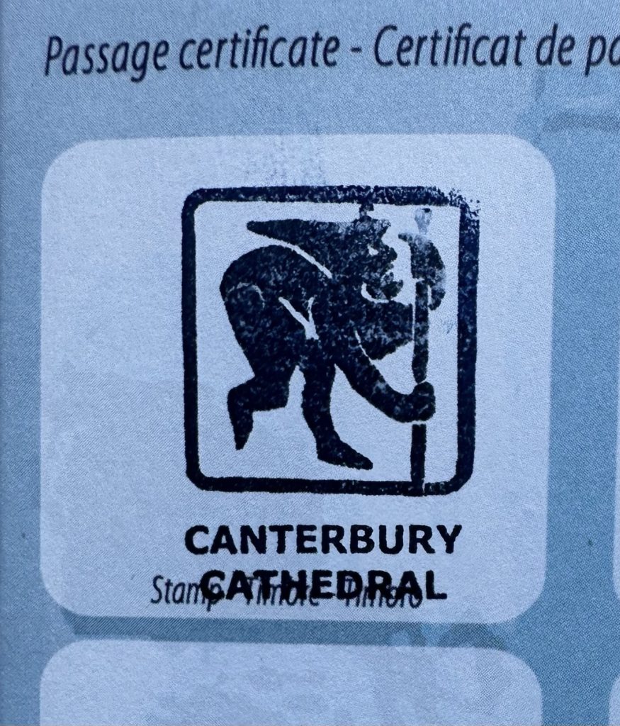
We bought our Via Francigena Pilgrim Passport and have received our first stamp! Our friends, David and Anne, who will walk with us to Dover will arrive soon and we will all attend Easter Choral Evensong at Canterbury Cathedral this evening.
We are currently in Ottawa airport, on our way to London, via Toronto. After a farewell dinner at 10 Acres in Sidney on Tuesday with Mish, Steve, Jade, Rhys and Emme, we flew to Ottawa early Wednesday morning, for a brief visit with Chris, Shinyoung, Alice and Eliot. While the minus temperatures were a bit of a shock after the cherry blossoms in Victoria, we have had a lovely time playing and reading with Alice and Eliot, eating delicious meals, walking in the snow, visiting a sugar bush and attending gymnastics and soccer practices.
We are looking forward to another week of visiting with friends and family in England, before beginning our walk on Easter Monday. Although we have not been able to do the training that we had planned (and begun, but abandoned due to Lois’ hip muscle strain), we are hoping that the exercises and some rest will have helped.
Just 4 weeks before we leave for Ottawa, en route to England to begin our trek! We have had to modify our training program, as Lois had a flareup of hip tendinitis (?) following a 20 km walk. She was hoping her GP would give her a steroid injection, as this has worked in the past, but the presence of sciatic nerve involvement has the doctor concerned that the cause may be degenerative disc disease. As an X-ray was inconclusive, Lois is relying on a combination of physiotherapy, massage therapy, accupuncture and a regime of strengthening and stretching exercises to get her “hike ready”. Deciding that part of the problem might have been that we increased the distance on our long walk too quickly, we started over, now walking longer distances several times a week, increasing the distance by a kilometre each longer walk. Tomorrow, we will do 13 km. It is frustrating that we were not able to train in the way we had planned, but we are hopeful that by the time we leave, we will have had enough kms under our belts that we can begin the trek with some level of endurance and fitness (and no pain!)
We are now into week 5 of our training. As a treat to ourselves on our long walks on Sundays, we have been exploring different brunch venues in Victoria. So far, we have walked to Jam Cafe, Blue Fox and Fuego, all excellent and highly recommended (and worth the lineup)! This week, our 20 km walk will be celebrated with brunch at Bear and Joey with friends Helen, Wayne, David and Kate.
Apart from the long walk, our training is not exactly rigorous. We are walking with an empty pack a couple of times a week and searching out hills to include in our routes. We are both doing our daily (more or less for Lois, always for Paul!) stretches and strengthening exercises and Lois continues to practice yoga twice a week.
Footwear has been the subject of further discussion and debate. Lois ordered a new pair of Lowa Explorer II hiking shoes, when she discovered she may not be able to get her old ones reheeled in time (there appears to be a shortage of shoe-repair services in Victoria). After ordering the boots, we discovered that Oak Bay Cobbler was able to repair her old ones quickly, after all. Now, it’s a matter of deciding whether it is advisable to use the new boots, which are a half-size larger than her normal size (as recommended on hiking blogs), or her old ones, which are already broken in…
Paul’s concern has been the development of a pain in his heel after a long walk in his Lowa’s. He has now purchased a new pair of Blundstones, with a hiking sole, which appears to be solving the problem.